
User's Manual


29
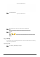
Linkage Figure 4-12
Click Choose to import a map. Step 2
.png, .jpg, and .bmp format are supported.
Import a map Figure 4-13
Crop the map according to the detection range of the radar. Drag the box to select the Step 3
range, and then click Cut Map.
Click Confirm Screen to get the map with the range you need. Step 4
Click Cancel Screenshot to cancel the cropping.
Calculate the map size. Step 5
Measure a distance in the actual detection area. 1)
On the web client, click Draw Line to draw the measured distance on the image. 2)