
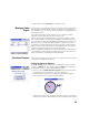
User guide


Index
Numerics
2D Survey 37, 40, 42
3D position solution
33
A
Accept Anyway 55
Acceptance criteria (GNSS)
52
Activate
24
Active map
8
Add Receiver
27
Add to Home
6
Adjusting a close level loop
74
Alignments
19
All
46
Allow in PPK Survey
53
Angle only
40
Angle Right
44
Angle right
79
Antenna type
51
Attributes
93
Automatically accept when criteria is
met
55
Autonomous rover mode
58
Average for
53, 54
Average of
46
Azimuth
57
Azimuth (entering)
2
Azimuth/Distance
82
B
Backsight 41, 43
Base (change)
64
Base (Start Base)
48
Base brand
51
Base capability
30
Base location
63
Basemap files
8
Battery level
5
Battery status
87
Bearing
57
Bearing (entering)
2
Benchmark
67
Bluetooth
27
Broadcast RTCM
14, 49, 50
BS
2
BS Azimuth
36, 37
BS Point
37
By Angle
38
By Distance
38
By managed points
76
By Point
38
By points
76
C
CAD 8
Calibration (Introduction to)
59
Calibration (one-point)
63
Calibration (procedure)
60
Calibration (solve)
63
Calibration requirements
52
Check
38
Check box
7
Circle
88
Circle Zero
78
Close loop on existing point
72
Collecting data out of a survey
58
Collimation
24, 87
Color code (for constellations)
33
Command bar
4
Compensator
86
Control (data collection)
54
Control benchmark (CBM)
66
Control file
13
Coordinate system (select)
14
Corrections
30
CR5 (file format)
15, 19
Create New Instrument
24
CSV
15, 19
CSV format
19
Curve and Offset
85
Customize (home screen)
5
CUT/FILL
79, 80
D
Data collection 51, 54
Data collection capability
30
Data Link
32
Datum
14
Define a Location
85
Deleted point icon
16
Demo mode
23
Description vs. feature (Toggling
between)
94
Descriptions
17, 92
Design point icon
16
Direct and Reverse
40
Direct only
40
Direction from two Points
57
Display Directions as
82
Dist Interval..
56
Distance and Angle
40
Do Not Store
53
DropBox
21
DXF (file format)
8, 19
E
Earth Curvature & Refraction 36
Earth curvature & refraction
13
Edit (manual shots)
98
Edit points
15
EDM
2, 24, 87, 89
Electronic compass
76, 99
Electronic leveling
34
Elevation Mask
30
E-mail
21
End survey
65
Error ellipse
40
Export data
19
F
FBK format 19
Feature (data collection)
54, 56
Feature vs. description (Toggling
between)
94
Features
17, 93
First point
14
Fixed Target
39
Fixing station setup
42
FLD format
19
Follow-me function
11
Foresight
43, 46
Format
88
FORWARD/BACK
79, 80
G
GDM 15
Geolock
24, 25
Global geodetic
17
GNSS
22, 48, 50
GNSS reception status
32
Go North/Go East
82
Go RIGHT/Go LEFT
79, 80
Google Earth
19
Grid
14, 17
Ground calibration
14, 48, 50
H
HA 46, 88
HD
88
HI
37, 40, 42, 44
Hold Still For
56
Home screen
3
Horizontal distance
44
HR
39, 40, 42, 44, 78, 80, 89
HRMS
53
HTML format
19
I
Icons (for points) 16
Import data
15
In Between
57
In Front
57
Insert Page Before (or After)
6
Instrument icon
4
Instrument Settings
24