Survey Pro Help 5.
Survey Pro Help 5.00 Home Screen The Home Screen allows you to create customized menus with your frequently used functions. You can navigate to the Home Screen from any menu in Survey Pro by tapping on the home icon at the upper left corner of the screen. If you are on the Home Screen you can return to the main menu by tapping the menu icon at the upper left corner of the screen.
Survey Pro Help 5.00 Main Menu The Main Menu is the starting point where all the other screens described in this manual are accessed. The area at the bottom of the screen is called the command bar. The small buttons in the command bar are used as follows: Map View Opens a Map View of the current job can be displayed by tapping the button. Surveying Mode The instrument icon indicates which collection mode the software is running in.
Survey Pro Help 5.00 (Close): Closes the current screen. (Settings): Opens the Settings screen associated with the current screen. (GPS Status): This is used to view the current status and access the settings for a GPS receiver when using the GeoLock feature. It is only available from the Remote Control and Remote Shot screens when using a Trimble or Geodimeter robotic total station.
Survey Pro Help 5.00 File Menu The File Menu contains routines to open or create a new job, import and export different file formats, and transfer files between the Data Collector and another device.
Survey Pro Help 5.00 Export Data Index Export Coordinates Export Coordinates - Select Points Export Survey Pro version 5 (.survey) Coordinates Export Survey Pro version 4 (.JOB) Coordinates Export Survey Pro version 4 .JOB/.RAW File Pair Export Survey Pro version 4 .JOB/.RAW Settings Export .CR5 Coordinates Export .TXT Coordinates Export .TXT Coordinates- Format Export .
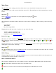
Survey Pro Help 5.00 New Job [File] [Open / New] [New…] The New Job screen is used to create a new job. Create a New Job - File Name Screen Directory: displays the directory where the current job will be stored. Job Name: is where the name of the new job is entered. The default name is the current date. [Browse…]: allows you to select a different directory where to store the new job. Current Settings: displays the last used settings for creating a job.
Survey Pro Help 5.00 Note: To use a scale factor with a job, go to the Scale Settings card to configure the scale factor mode. If you select a mapping plane coordinate system, your scale settings will automatically be configured. [Next >]: opens the Select Control File Screen, where you can select a control file to load into the new job. (Cancel): cancels the creation of a new job and brings you back to the Main Menu.
Survey Pro Help 5.00 Note: You can create a job with no initial point. Point Name: is the name of the initial point. Northing: is the Y-coordinate of the initial point. Easting: is the X-coordinate of the initial point. Elevation: is the elevation of the initial point. Description: is the description of the initial point.
Survey Pro Help 5.00 job and then tap the [Save] button. Note: It is not necessary to include the .survey extension since it will automatically be added for you. Import [File] [Import] The Import screen is used to add the points from another source into the current job or import the data from a LandXML file to the current job. Warning: Coordinate values can change when they are imported! Importing coordinates from any source other than a Survey Pro file (*.survey | *.JOB | *.
Survey Pro Help 5.00 A list of all the .survey files available in the current directory is displayed. Simply tap on the job name that you want to import and then tap the button. The points in the selected job will be added to the points in the current job. Import Survey Pro version 4 (*.JOB) Coordinates When importing coordinates from another *.JOB file, the Import screen is used. A list of all the jobs available in the current directory is displayed.
Survey Pro Help 5.00 Specify Missing Elevation Threshold: if the source file was created from coordinates with no elevations, but the file contains an elevation column with values, such as 0, check this box and indicate the value in the field that will appear to the right. [Preview]: opens the ASCII Import Preview window containing all the point data that will be imported. This is useful to check for errors before actually importing new data. [< Back]: returns to the previous screen.
Survey Pro Help 5.00 Layer: will import all the data on the specified layer. If no coordinate system is configured for the current job, a dialog asks if you want to set the coordinate system for the current job to the coordinate system used in the *.JXL source file. Confirm Point Replace If a point being imported has the same name and the same coordinates as a point that is already in the current job, it is ignored and a message will be displayed after the remaining points are imported indicating this.
Survey Pro Help 5.00 Survey Pro 4.x (.JOB / .RAW) File: when selected, the entire job is exported to a Survey Pro version 4 format .JOB/.RAW file pair. Coordinate (.CR5) File: when selected, the chosen points are exported to a CR5 coordinate file format. Text (.TXT) File: when selected, the chosen points are exported to an ASCII text file. CSV (.CSV) File: when selected, the chosen points are exported to an ASCII text file that is comma delimited and the file is automatically given a *.CSV extension.
Survey Pro Help 5.00 file pair, which you could then import into third party software that uses the old format Survey Pro files. If your job does not have any auto line work feature codes or any feature code attributes, the Save As screen is opened where the file name and location is entered for the .JOB/.RAW file pair. If your job does have auto line work or feature code attributes, you will see the Job Raw Export Settings Screen where you can specify how you want your codes to be converted into the .
Survey Pro Help 5.00 [Next >]: opens the second screen. Export *.TXT Coordinates – Format Select the desired order and format for the resulting TXT file from the list of options. [Finish]: exports the selected points to the TXT file. Export *.CSV Coordinates This routine is identical to the Export *.TXT Coordinates routine, described above with the exception that the formatting for the exported file is automatically set to comma delimited and the extension for the file name will be *.CSV.
Survey Pro Help 5.00 [File] [Backup / Restore] The Backup / Restore wizard consists of a series of screens that are used to backup or restore all the files associated with the current job. The routine also gives you the option of storing a snapshot of a customized map view to the archive. This can then be used to visually identify an archive. Any number of backups can be created for a particular job.
Survey Pro Help 5.00 which will then be included in the archive. [< Back]: returns to the previous screen. [Backup]: opens the next screen. Backup / Restore - Create a Snapshot The Create a Snapshot screen is a map view that is used to configure the map as desired and the resulting image will be saved in the archive as a snapshot along with the job files. (OK): will create the archive along with a snapshot of the map as it is configured on the screen.
Survey Pro Help 5.00 [Enter Server Mode]: places the data collector in server mode where all file transfers are controlled from a PC running either TDS Survey Link or TDS ForeSight. Tapping [Cancel] will disconnect server mode. [Send File…]: will open the Open screen where the file that you want to send can be selected. Once selected, the file is sent from the data collector to the specified device. A progress bar will be displayed that indicates how much of the file has been transferred.
Survey Pro Help 5.
Survey Pro Help 5.
Survey Pro Help 5.
Survey Pro Help 5.00 Note: When running in leveling mode, the [Instrument Settings…] can be selected for Manual Mode to open the Level Method screen. [Instrument Settings]: Opens the next Instrument Settings screen where the settings in the selected instrument profile can be modified. Note: When editing an existing instrument profile, you cannot modify the instrument brand or model.
Survey Pro Help 5.00 Opens the Bluetooth configuration screen that comes with the Bluetooth driver software where you can quickly check or change the virtual COM port and favorites. Note: See the User Manual for more information on configuring Bluetooth with a Recon or Ranger 500X and supported total station. [Defaults]: Set the Serial Port, Baud Rate and Parity to their default values based on the selected total station.
Survey Pro Help 5.00 Receiver Info: Select to launch the Receiver Info dialog. Rename: Select to rename the receiver profile. Delete: Select to delete the selected receiver profile. Receiver Communication This dialog appears in serial mode or Bluetooth mode, depending on the icon you tap in the Add Receiver dialog. Serial mode In serial mode, the Receiver Comms screen includes the following: Port: Select the COM port required to connect to your receiver from the drop-down list.
Survey Pro Help 5.00 [Bluetooth Settings]. [Bluetooth Settings]: Launches the Windows Bluetooth application. Enables you to create a Bluetooth profile for your receiver. If you select Serial, continue as follows: Port: The data collector port used to communicate with the receiver. Baud Rate: The baud rate used by the data collector for receiver communications. Parity: The parity used by the data collector for receiver communication.
Survey Pro Help 5.00 [Configure]: Opens the Modem Serial Comms. screen where you can change the settings for communication between the receiver and the data modem. Modems where you can set the channel and configure radio settings Serial Port fields Baudrate: Displays the baud rate the receiver uses to communicate with the modem. Parity: Displays the parity the receiver uses to communicate with the modem. Serial Port: Displays the serial port the receiver uses to communicate with the modem.
Survey Pro Help 5.00 Serial Port fields Baudrate: Displays the baud rate the receiver uses to communicate with the cellphone. Parity: Displays the parity the receiver uses to communicate with the cellphone. Serial Port: Displays the serial port the receiver uses to communicate with the cellphone. [Configure]: Opens the Modem Serial Comms. screen where you can change the settings for communication between the receiver and the cellphone. Select modem fields Select Modem: Select the required IP modem.
Survey Pro Help 5.00 Channel: Select the channel the radio will use to communicate with the other radio. Sensitivity: Select the sensitivity of the radio. Mode: Select the transmit format used by the base radio. The rover radio must be listening for same format the base is broadcasting. Baud: Displays the baud rate the radio is currently set to. There is no way for the software to change this value, so you must set the receiver to radio communications to match what you see here.
Survey Pro Help 5.00 The General tab enables you to change general settings on the receiver. Every receiver has the option to change the elevation cutoff angle and the option to set the receiver to Off Mode. Models which have special settings available are described below. Elevation cutoff: Keep receiver from using satellites in its position calculation that are below the given angle.
Survey Pro Help 5.00 Glonass tracking: Select On or Off. Settings for Thales (Ashtech) Receivers If the current profile is for a Thales (Ashtech) receiver, the general page also shows the following settings: Canopy: is where you set a parameter to describe the multi-path environment. This command is relevant for ROVER mode or RVP. Choices are: Open Sky (default) Under Canopy (forest, urban canyon) Confidence Level: is where you set the confidence level for ambiguity fixing.
Survey Pro Help 5.00 Note: This setting is only available when your receiver model is Hiper . Network Settings [Job] [Settings] [Networks Card] in the Networks tab. To add a new network to the list, tap the add network icon Name: Enter a unique name for the network server. Address: Enter the IP address for the network server. Port: Enter the IP port for the network server. [Save]: Tap to save the network. To rename a network, tap the gear icon and change the Address and Port if required.
Survey Pro Help 5.00 Post Process Settings [Job] [Settings] [Post Process] The Post Process card is used to configure the settings for logging post processing data, and the collecting and storing of post processing points in the software. RTK Autonomous Points: Specify action to take when accepting autonomous points during RTK data collection. There are three options. Do not store: Select to prohibit acceptance of autonomous points in RTK data collection routines.
Survey Pro Help 5.00 display of all of the coordinates in the control file would be converted from International Feet to US Survey Feet. Units for Angles: Defines the units used for angles as Degrees or Grads (gons). Display Directions as: Display directions as a Bearing or Azimuth. Azimuth type: Defines if you are using a North Azimuth or a South Azimuth. Grid Direction: specifies if your grid coordinates are increasing positive in the North East or the South West direction. Coord.
Survey Pro Help 5.00 Feature Code File: Displays the selected feature code file (*.FXL) to use with the current job. FXL files can be created and customized with the Spectra Precision Feature Definition Manager. [Browse]: Opens a dialog to select a feature code file to use with the current job. Tap the filename and then tap [Open]. [Clear]: Closes the currently selected file so that it is no longer used with the current job.
Survey Pro Help 5.00 routines under the Survey menu. Prompt for Attributes: When checked, a prompt to select feature information will appear before any new point is stored from only the routines under the Survey menu. This also requires that a feature file be selected from the Files Settings card. Prompt for Picture: When checked, a prompt will appear before storing a point where you have the option of taking one or more pictures associated with the current point.
Survey Pro Help 5.00 elevation changes. Use map plane ground coordinates: When selected, you can configure the job to use map plane ground coordinates. Combined Factor: Enter a combined scale factor if already known, otherwise is the combined scale factor computed from the Calculate Scale wizard. Grid Factor: Enter a map plane scale factor if already known, otherwise is the scale factor computed from the Calculate Scale wizard.
Survey Pro Help 5.00 [< Back]: Returns to the previous screen. [Solve >]: Returns to the Scale Settings screen where the combined scale factor will be entered for you. Stakeout Settings The Stakeout Settings card contains the setting that control how stakeout is performed. (The settings available depend on if you are running in conventional or GNSS mode.
Survey Pro Help 5.00 one or more pictures associated with the current point. (Only available when running on a Nomad or Ranger 3 that has a digital camera.) Use Perfect Stationing: When checked, staking locations will be computed at perfect stationing intervals. For example, if your starting station was 0+15 and your station interval was 100, your next stakeout location will occur at 1+00 instead of 1+15.
Survey Pro Help 5.00 Zenith Tolerance: A warning message will be displayed if a vertical angle exceeds the tolerance entered here during a repetition shot. Distance Tolerance: A warning message will be displayed if a distance exceeds the tolerance entered here during a repetition shot. Shoot Distance To Backsight: When checked, a distance will be measured to each shot to the backsight. When unchecked, only the angles are measured.
Survey Pro Help 5.00 Turn On NMEA GPS Receiver: When checked, enables the GPS receiver. Model: Select Shared GPS to use the GPS receiver settings configured in the Windows operating system (see [Shared GPS…] below) or select Generic NMEA and configure the settings from this screen. Serial Port: The serial port on the data collector used to communicate with the GPS receiver.
Survey Pro Help 5.00 File: (available when the output method is ‘To File’) Enter the file name for saving the external data output. To select a different file type, click [Browse]. [Browse]: (available when the output method is ‘To File’) Click to open a file browse dialog where you can select the file name and path for the output file. The default file extension is .XML, but you can use any extension.
Survey Pro Help 5.00 Prompt for Layer: When checked, a prompt to select a layer will appear before any new point is stored from any routine other than those included in the Survey and Stakeout menus. Prompt for Attributes: When checked, a prompt to select feature information will appear before any new point is stored from any routine other than those included in the Survey and Stakeout menus. This also requires that a feature file be selected from the Files Settings card, described earlier.
Survey Pro Help 5.00 Edit Points - (multiple point editing) [Job] [Edit Points] [Edit…] (When more than one point is selected.) This screen is accessed after tapping [Edit…] when more than one point is selected. The change made in this screen will be applied to all the selected points. Description: When checked, allows you to change all the selected point's descriptions to the Description entered in the description edit field.
Survey Pro Help 5.00 Note:; Only user entered points (key in or imported) can be assigned as control points. If the point selected for editing is derived from a measurement, then you will not see the Control layer in the layer edit box. Picture: Displays a list of pictures associated with a point. You can click the drop-down list to see the pictures associated with the job. Use the Power button to view or delete any of the pictures associated with a point.
Survey Pro Help 5.00 [Use for Vertical Calibration]: check this box if the calibration point pair is suitable to use for vertical calibration. Edit Point - Feature [Job] [Edit Points] [Edit…] [Feature] The Feature card is used to modify the feature code and line work control code associated with the point. Any feature codes for the selected point are shown in the list of codes. Each line of the list of codes shows: Code Icon: Icon for the code.
Survey Pro Help 5.00 [Delete…]: Delete the selected polyline. [New…]: Open the Polyline Editor where a new polyline can be created. Import PL5: Import polylines. Available on the Power menu button item. Tap the down arrow to open this menu from the Edit Polylines screen. Export PL5: Export polylines. Available on the Power menu button item. Tap the down arrow to open this menu from the Edit Polylines screen. New Polyline The second screen is used to define all of the points that are used in the polyline.
Survey Pro Help 5.00 tap . Tapping will return to the previous screen without saving the changes. Note: if is selected in the list, the [<-Insert] button will change to an [<-Append] button to indicate that additional points will be appended to the end of the list. Add/Edit Curve The fourth screen is used to modify a selected polyline segment that occurs between two points. A horizontal, vertical, and/or spiral curve can be applied to the polyline segment.
Survey Pro Help 5.00 use existing points to define any particular locations on the alignment, although a point can be used to anchor the starting location, which is the same location for both the horizontal and vertical parts of the alignment. Any location on an alignment where a change occurs is called a node. An alignment can contain straight sections, grades, horizontal, vertical, and spiral curves.
Survey Pro Help 5.00 Edit Alignment Screen – VAL Tab The VAL (Vertical ALignment) tab in the Edit Alignment screen is used to enter or modify only the vertical details of an alignment. Note: The total horizontal length of the VAL must be equal to or greater than the total horizontal length of the HAL when the alignment is used for road layout. [Insert…]: Opens the Edit Segment screen where a new vertical segment can be inserted prior to the selected segment.
Survey Pro Help 5.00 Length: The horizontal length of the line. Make this segment tangent to previous: When checked, the specified line will be tangent to the ending tangent of the previous segment. Note: When making a new horizontal segment tangent to the previous segment, the new segment will appear in the Edit Alignment screen tagged with a (P).
Survey Pro Help 5.00 Dir: Specifies if the curve runs from TS to SC (Tangent to Spiral, to Spiral to Curve) or CS to ST (Curve to Spiral, to Spiral to Tangent). Make this segment tangent to previous: When checked, will automatically turn the spiral so the beginning is tangent to the end of the previous segment. [Azimuth] / [Bearing]: Used to specify a known azimuth or bearing of the start of the spiral. Edit Segment - Vertical Grade Card The Vertical Grade card is used to enter a segment with any grade.
Survey Pro Help 5.00 The raw data is displayed in a tree view, with the root nodes of the tree showing a record of each survey action taken in the current job. You can expand a tree node by tapping on the [+] next to the node or double tapping on the node. This will show you the individual fields of the selected record. You can navigate through the raw data view using the navigation buttons: [Up]: Navigate to the beginning of the records. [Down]: Navigate to the end of the records.
Survey Pro Help 5.00 [Backsight]: Enter the backsight azimuth or backsight point name for this setup. Note: If you wish to change the backsight point, you can only choose a user entered point (key in or imported). If you wish to use a point derived from a survey measurement, you must first go to the Edit Points screen and insert a copy of that point. [Apply PPM]: Check this box if you wish to apply a PPM correction to measured slope distances. Enter the PPM correction factor in the edit box.
Survey Pro Help 5.00 Note: If you selected the target record to edit from the root of the record tree, by default all observations that use that target will be updated with the new target. If you selected the target record to edit from an individual observation, by default only that observation's target will be updated. Raw Data Edit GNSS Base [Job] [View Raw Data] [Edit GNSS Base] The Raw Data Edit GNSS Base screen allows you to edit the GNSS base setup. [Base Point]: Enter the base point for this setup.
Survey Pro Help 5.00 The Raw Data Note screen is used to append a note to an individual raw data record or to the end of the raw data records in the job. The note can consist of any string of text. The buttons in the lower portion of the screen can be tapped to quickly enter any of ten default Foresight linework commands. These buttons can also be customized, or new buttons can be created.
Survey Pro Help 5.00 View DTM [Job] [View DTM] Before viewing a DTM, the Setup DTM 3D screen will open where the DTM layers must be defined. This screen is also used to define other parameters for the DTM. [Layers]: Opens the Layers for Staking DTM screen where the DTM layers are selected. [Boundary]: Opens the Choose Polyline screen where a polyline can be selected that defines the boundary of the DTM. Exclude points…: Move any points that exist outside the selected boundary to the Auxiliary layer.
Survey Pro Help 5.00 All the polylines in the current job are displayed. Select the appropriate polyline and tap . Add/Edit Break-lines [Job] [View DTM] [Breaklines…] The Add/Edit Break-lines screen is used to select, edit, create, or delete the break lines that will be used when computing the DTM. The break lines that will be used when computing the DTM are listed in this screen. [Edit…]: Opens the Edit Polyline screen where the selected polyline can be modified or a new polyline can be created.
Survey Pro Help 5.00 The Points on DTM Layer screen displays all the points on the DTM layer and allows you to add points from another layer or delete (move) points to a different layer. [Delete]: Move the selected point(s) to the Auxiliary layer. If the Auxiliary layer is not specified, you will be prompted to select the layer to move the points to. Note: Points on a boundary or break line cannot be deleted. [GoTo]: Quickly find and select the specified point.
Survey Pro Help 5.00 Hidden-line Removal: When checked, will hide all the lines that occur behind other surfaces in the 3D View. The image shown here is identical to the image shown on except the hidden lines are not removed. Display the Difference: This applies only to DTM stakeout. When checked, the vertical portion (z-axis) of the 3D View screen is computed by the elevation differences between the non-reference DTM surface and the reference DTM surface.
Survey Pro Help 5.00 job file. Filename: Displays the current job file name. Feature Code File: Displays the feature code filename used in the current job. Folder: Displays the directory where the current job file is located. Size: Displays the size of the current job. Created: Displays the date that the current job was created. Points: Displays the first and last point names and if alphanumeric point names are being used. Lines: Displays the number of polylines and alignments that are in the current job.
Survey Pro Help 5.00 -: Subtracts y from x. ×: Multiplies x and y. [Enter]: Moves the active value to Level 1 of the stack, or duplicates Level 1 if there is no active value. Swap: Swaps positions of x and y in the stack. Drop: Drops (removes) x from the stack. Edit: Moves the value in Level 1 to the active area where it can be edited. ±: Changes the sign of x. 1/x: Inverse of x. pi: Enters 3.141592654 to the stack. Clr: Clears the stack. \/¯x: Square root of x. Sin -1 : Arc sine of x.
Survey Pro Help 5.00 e : Raises 2.718281828 to the power of x. 10x : Raises 10 to the power of x. R>°: Converts x, in radians to decimal degrees. R>G: Converts x, in radians to Grads. R>P: Converts the rectangular coordinates (y,x) to polar coordinates. dms +: Adds x in degrees.minutes-seconds and y in degrees.minutes-seconds. Manage Pictures [Job] [Manage Pictures] The Manage Pictures screen is used to manage pictures that are associated with the current job.
Survey Pro Help 5.00 Point Associated with Picture: You can specify an existing point in this field to associate the picture with the specified point. Raw Data Note: Any text entered here will be stored to the job as a note along with the picture details. : can be used to cancel out of the routine without saving the picture. : Saves the picture and closes the routine.
Survey Pro Help 5.00 Survey Menu The Survey Menu contains the routines used for collecting data with a conventional or robotic total station.
Survey Pro Help 5.
Survey Pro Help 5.00 Results Survey Menu Index Main Index Remote Control Index Remote Control Remote Shots Results Card Video Card Video Display Options Video Settings Map Card Aim Card Foresight Card Turn To Sky Plot GeoLock Settings Survey Menu Index Main Index On-board Software Index On-board builds of the Survey Pro software have enhanced features to take advantage of the platform.
Survey Pro Help 5.00 The following screens are used to setup PPM correction parameters for the station setup. Apply PPM [In Instrument] : Use this option if you set the instrument to apply the PPM correction. In this case, the distances returned to Survey Pro by the instrument have already been corrected for PPM. [Record PPM values to file ...]: Opens up the PPM Booking screen where you can record the temperature and pressure values entered into the instrument for book keeping purposes.
Survey Pro Help 5.00 Station Setup Known Point The following screens are used when the setup type is set to Known Point. Station Setup Known Point – Enter Occupy Point + Occupy Point: Select a point to setup on. You can enter a point name, select from a list or from the map. If you enter a new point name here, you will have to enter known coordinates for that point and store it before proceeding with the wizard. 2D Survey: Check this box to conduct a 2D survey.
Survey Pro Help 5.00 Station Setup Known Point – Orient Instrument – BS Point BS Point: Enter the point name to use for the backsight point. BS Azimuth: Displays the grid direction to the backsight point. Fixed Target / Roving Target: Select the target type at the backsight point. Choose fixed target if you will use a dedicated target at the backsight. Choose Roving Target if you will use the same target at the backsight as you will for foresight points. HR: Enter the height of the backsight target.
Survey Pro Help 5.00 Sequence: Select the mode to shoot each set of the resection measurements. You can choose between: Direct and Reverse, or Direct Only. [Check Setup]: This button is only available when there is already a station setup in place. Tap Check Setup to open the Station Check screen. Station Setup Resection – Observations Resect Point: Enter the name of the known point to observe next in the resection. Option: Select the measurement option.
Survey Pro Help 5.00 Fixed Target / Roving Target: Select the target type at the backsight point. Choose fixed target if you will use a dedicated target at the backsight. Choose Roving Target if you will use the same target at the backsight as you will for foresight points. HR: Enter the height of the backsight target. [Send Circle]: Sends the Backsight Circle for this setup to the instrument. [Next >]: Advances to the Check Setup.
Survey Pro Help 5.00 change to the previous foresight point and the backsight point will automatically change to the previous occupy point. Note: Prior to storing a point, you may then be prompted for description, rod height, layer, and/or feature information depending on the selections made in the Surveying Settings screen. [Backsight…]: Opens the Station Setup screen where you can set and check your station occupy point and backsight. : A shortcut to the Surveying Settings screen.
Survey Pro Help 5.00 [Survey] [Traverse / Sideshot] [Traverse] [Traverse Now] This wizard is used to setup the occupy point and backsight after a traverse observation. Note: If you have Prompt for PPM turned on in the Survey Settings, the the Traverse Wizard will start with the PPM Setup screen. HI: Enter the height of the instrument at the new setup point. New Occupy Point: Displays the name of the traverse to point. This would be the name of the point you shot with the Traverse button.
Survey Pro Help 5.00 Remote Shot Screen (Remote Mode) [Survey] [Traverse / Sideshot] [Traverse] or [Side Shot] When running in remote mode, tapping the [Traverse] or [Side Shot] button from the Traverse / Sideshot screen will open the Remote Shot screen. The Remote Shot screen is identical to the Remote Control screen with the addition of a [Take Shot] button that allows you to trigger the total station to take a shot.
Survey Pro Help 5.00 [Toss]: Delete the corresponding set that has the worst residual. Note: A set can only be “tossed” when three or more sets have been collected. [Side Shot]: Use the repetition data gathered to create a new side shot point. The foresight point will automatically advance to the next available point. [Traverse]: Use the repetition data gathered to create a new traverse point.
Survey Pro Help 5.00 from the same occupy point. : Accesses the Surveying Settings screen and Radial Sideshot Settings screen, which is identical to the Repetition Settings screen with the exception of the choices for the Shooting Sequence. Select B>F1>..>Fn^F1>..>Fn>B to shoot all Face 2 side shots in the same order as the Face 1 side shots, or B>F1>..>Fn^Fn>..>F1>B to shoot the Face 2 side shots in reverse order.
Survey Pro Help 5.00 Horizontal Angle Offset [Survey] [Horizontal Angle Offset] The Horizontal Angle Offset screen allows you to compute and store the location of a new point that cannot be occupied, such as at the center of large tree. The routine shoots a prism positioned at the side of the new point and then reads the horizontal angle when aiming toward the center of the new point to compute the new point’s location. Foresight: The point name that will be used when storing the new point.
Survey Pro Help 5.00 [Survey] [Auto Collect] The Auto Collect screen allows users with robotic total stations to automatically collect points either at a specified time interval or after the rod has moved a specified horizontal distance. Note: This routine only works when used with a robotic total station in remote control mode. Foresight: The point name that will be used when storing the first new point. Each successive point name will automatically be incremented by the next available point number.
Survey Pro Help 5.00 Quick Codes [Survey] [Quick Codes] The Quick Codes screen is used to rapidly take shots with different description codes. Foresight: Is where you enter the foresight point name. Note: If you specify an existing point in the Foresight field, you are prompted to overwrite or use the next available point. You will not have the option to store an observation. HR: The height of the rod. : Opens the Smart Target options.
Survey Pro Help 5.00 [Backsight]: Opens the Station Setup screen you can set and check your station occupy point and backsight. Corner & Angle [Survey] [Corner & Angle] The Corner and Angle screen is used to store a point that cannot be shot on a reference line using a reflectorless total station where two other points on the same line can be shot. Foresight: The name of the point that will be stored. Description: The description for the point that will be stored. HR: 0.
Survey Pro Help 5.00 Horiz Offset is always measured from Shot 1. [Backsight]: Opens the Station Setup screen where you can set and check your station occupy point and backsight. Note: After each shot is complete, the computed elevation is displayed for the new point. You can either enter a different elevation or tap to accept the computed elevation.
Survey Pro Help 5.00 Description: The description given to the next stored point. HR: The length of the rod. : Opens the Smart Target options. Number of Sets: The desired number of sets required when shooting each foresight. You must select at least one set. [Traverse]: Prompts you to shoot the Foresight point. After each set is performed, the Move To Other End dialog box will open and prompt you to set up on the new point and enter a new instrument and rod height.
Survey Pro Help 5.00 Known Elevation Is…: Where you specify if the Occupy point or the Foresight point has a known elevation. Elevation: The known elevation for the selected point. Shoot: Defines if you want to perform a Direct shot only, or Direct & Reverse shots to the foresight. HR: The length of the rod. : Opens the Smart Target options. Store Pt: When checked, the elevation of the point specified here will be replaced with the computed elevation.
Survey Pro Help 5.00 : A shortcut to the Date/Time Settings screen. Lat. / Long.: The latitude and longitude of the total station. These values can be scaled from a map, such as a U.S.G.S. 7.5-minute quadrangle sheet or collected with a handheld GPS unit. Aim: Selects the portion of the celestial body that where you intend to aim. You can select Left Edge of Center, Center, or Right Edge of Center.
Survey Pro Help 5.00 [Reset]: Permanently deletes all observations. A warning prompt will appear before the observations are deleted. The Enter Shot Data Screen Horizontal Angle: Displays the horizontal angle measured by the total station. This value is updated with the [Take Shot] button, described below. Current Date / Time: Displays the current date, time, and DUT. These settings can be changed from the Date/Time Settings screen. Date: If incorrect, the current date should be entered here.
Survey Pro Help 5.00 Note: The remote control functions are available only after a supported robotic total station is selected and enabled in the Instrument Settings screen. The Remote Control screen allows you to turn the total station in any direction using the arrow buttons on the keypad and control the tacking functions. The arrow keys are typically used to get the total station to aim in the general vicinity of the prism prior to initiating a search.
Survey Pro Help 5.00 set. GRAY: Off: GeoLock is not enabled. Results Card [Survey] [Remote Control] [Results] The Results card displays live angle data from the total station and live distance data is displayed depending on the current EDM mode. [HD/VD] / [ZA/SD]: Toggles the data displayed from the total station between HA, HD and VD, or HA, ZA and SD.
Survey Pro Help 5.00 [Turn to Angles]: Turns the total station to the specified horizontal and zenith angles. Existing Point: The point from the current job that the total station will turn to. [Turn to Point]: Turns the total station to the specified point. [Turn to Backsight]: Turns the total station to the backsight point. [Flip]: Quickly rotates the total station from face one to face two, or vice versa.
Survey Pro Help 5.00 Note: If any points defining your perimeter already exist, the point names can be entered in these fields without reshooting them. [Shoot 1] , [Shoot 2], [Shoot 3]: Shoots and stores the corresponding point. Horizontal Distance Interval: The horizontal distance between each shot taken during the surface scan. Vertical Distance Interval: The vertical distance between each shot taken during the surface scan.
Survey Pro Help 5.00 [> X,Y View] / [> X,Z View] (Map card): Changes the orientation of the current view. Quick Shot routine Opens when you start the software, or when you press the STAR key from anywhere in the application. This includes the following: No Job mode Job mode Quick Shot Settings Shell to external mode No Job mode On starting Survey Pro On board, the No Job Mode screen appears. You can: Take measurements, but not store points. Change instrument settings. Allow for the setting of circle.
Survey Pro Help 5.00 Job mode Once you have opened a job, you can: Perform station setup. Go to stakeout mode. Store sideshot or traverse shots or angle offset shots. HA: Horizontal angle. ZA: Vertical angle. SD (or HD/VD): Current shot is bold until it is stored as a point. Non-bold values cannot be stored and the user is prompted to take a new shot. Note: SD ( or HD/VD ) from a shot initiated by the MSR2 key is prefaced with “*”.
Survey Pro Help 5.00 To open the dialog, tap the settings icon in the title bar. Display: Options are HA,ZA,SD or HA,HD,VD. Controls the values that appear in the Quick Shot screen. MSR Key: There are two options: Measure Only: When the MSR key is pressed, a measurement is initiated but no shot is stored. Measure and Store: When the MSR key is pressed, a measurement is initiated and a sideshot is stored if a JOB is open. Note: The MSR2 key always operates in Measure and Store mode.
Survey Pro Help 5.00 goes into the third state and shows stakeout information of Come/Go, Left/Right, and Cut/Fill. The icons on the screen are used as follow: Survey: There are two options: Survey: Return to Quick Shot quickly. Check Station: Launches the Check Setup dialog. Turn to: Appears if the instrument supports motorized turning. There are two options: Turn To Line: Turn the instrument to turn point 2D. Turn to: Starts the Turn To dialog. Search: Appears if the instrument supports AutoLock.
Survey Pro Help 5.00 3. Tap the MSR key to measure to the rod: Quick Stake goes into COME/GO, LEFT/RIGHT mode and shows a CUT/FILL. 4. Store the staked point: Tap Enter or the stake icon. You are prompted to store the point as a new point. A description defaults, based on one of the following selections: Design point’s description. PT and the design point name. 5. Stake Next, exit: When you have stored the point, a new design point is already entered into the Design Point field and ready to be staked.
Survey Pro Help 5.
Survey Pro Help 5.00 The items available in the Survey Menu with the GNSS module depend the current state of the setup. There are four states: No RTK survey is setup. Base is set up, but the rest of the RTK survey is not set up. Base and rover are setup, but the required calibration is not yet solved. Setup complete (base, rover, and calibration). The Survey Menu contents are listed below for each of the four states.
Survey Pro Help 5.
Survey Pro Help 5.
Survey Pro Help 5.
Survey Pro Help 5.00 Mode: Displays if the receiver is set to Off, Base, Rover, or Post Processing mode. Memory: Displays the amount of memory remaining in the receiver’s internal storage card. Battery: Displays the remaining battery charge in the receiver. Satellites: Displays the number of satellites: Used: By the receiver for the current GPS solution. Locked: (Tracked) by the receiver. [Reset Ambiguities]: Used to reinitialize the receiver’s RTK engine.
Survey Pro Help 5.00 The Data Link card displays information about the base to rover communications when the modem is a radio. Receiver mode: See the Receiver card. Modem Reception: Displays two values indicating the data modem signal quality. This information is only displayed if the receiver is in rover mode. Signal Latency: Displays the age of the differential correction used in the current GNSS solution. This value should be one second or less for good RTK solutions.
Survey Pro Help 5.00 Status: displays information about the recording. It will be one of four values No Communication: Not receiving a response to commands. No Data: Receiving an unknown or a bad response to commands. Recording: A file on the receiver or in the data collector is open and recording GNSS raw data. If this receiver monitors sessions, this field will display: session in progress when a session is ongoing. Not Recording: No file is open and there is no raw data recording.
Survey Pro Help 5.00 SNR Plot tab: This tab lists all the satellites that are in view and shows a bar graph that indicates the signal-to-noise ratio. A longer bar indicates more noise, and a lower-quality signal. USI: The universal identifier number of the satellite that you wish to disable or re-enable. For GPS satellites, this will be the Pseudo Random Noise (PRN) number and will be between 1 and 37.
Survey Pro Help 5.00 Starting a Survey Start Survey at Base [Survey] [Start Base] When you are starting a survey at your own RTK base, select the Start Base menu item. You will first be prompted to select a receiver with the Connect to Base screen. Connect to Base The Connect to Base screen is used to select a base receiver to connect to, and to pick the format for base corrections. The display of the receivers to select list is identical to the Receiver Settings screen.
Survey Pro Help 5.00 Select Geoid [Start Survey Survey] | Projection Prompt, or [Survey] [Projection] [Select Geoid…] The Select Geoid screen is used to choose a geoid model to use with the default ground calibration coordinate system. [Use a geoid model]: Is where you select if you want to use a geoid. Leave this box unchecked if you want to use ellipsoid heights for the vertical coordinate. [Geoid Model]: Select the geoid model from the list of available geoids.
Survey Pro Help 5.00 Note: When the measure to mark is true vertical; the Radius and Notch fields will not be available. [Set]: Updates the receiver antenna settings with the values selected on this screen. Note: When this screen is used by the RTK rover for updates of antenna height during a survey, the Set button will send the new antenna parameters to the receiver as well as updating the software's settings.
Survey Pro Help 5.00 Connect to Rover The Connect to Rover screen is used to select a rover receiver to connect to. The display of the receivers to select list is identical to the Receiver Settings screen. Below the list of receivers, the modem type and correction format are displayed for radio modems. The Network and server type are displayed for internet modems. [Connect>]: Connects to the selected receiver and advanced to the Set Rover Receiver screen.
Survey Pro Help 5.00 [One Point]: This will solve a valid calibration using the base point as the horizontal and vertical control point, then open the Data Collection screen. Note: The [One Point] button appears in place of the [Start Now>] button when the conditions for One Point setup are met: You must be in Default Ground Calibration projection mode. You have started a new job with only one point, and that point was selected as the base point location.
Survey Pro Help 5.00 You cannot yet have a coordinate system initialized or solved. [
Survey Pro Help 5.00 blunder detection cannot run and you will see the yellow warning for your calibration solution status. You must evaluate the quality of the solution manually if this is the case. Start Survey at Rover [Survey] [Start Survey] When you are starting a survey at the RTK rover, either because the RTK base is already set, or because you are using an NTRIP network for base corrections, select the Start Survey menu item.
Survey Pro Help 5.00 [Next >]: Tap to advance to the Select Base Point at Rover screen. Select Base Point At Rover The Select Base Point at Rover screen is used to choose the point in the job file where the base is located, or to store a new point for the base receiver setup location. This screen is similar to the Select Base Point screen described in the Start Survey at Base section. Base Antenna: Displays information about the base antenna received at the rover from the broadcast stream.
Survey Pro Help 5.00 than a point occupied in static mode. [Feature]: Opens the Feature Collection screen where various automatic and manual data collection options are available. [Offset]: Opens the Offset Shots screen where a point can be collected and stored at a specified offset. [Point]: Opens the Occupy Data Points screen used to occupy and store a new point.
Survey Pro Help 5.00 Offset Shots [Survey] [Data Collection] [Offset] The Offset Shots screen is used to collect a point you cannot physically occupy with GPS. You can occupy a nearby point with the GNSS rover and then measure the offset distance and direction with tape and compass, or take a shoot with a laser range finder. Offset Point: The point name of the offset point to be stored. Description: The description of the offset point to be stored.
Survey Pro Help 5.00 Session Time: Displays the total occupation time so far for this measurement. Count Status: Displays Measuring when you have current coordinates from the receiver and the screen is updating with the latest measurement. If you are using Epoch Averaging, Averaging is displayed after you tap [Topo SS] while the number of epochs is averaged in the software. Suspended is displayed if you are not receiving valid data from the receiver.
Survey Pro Help 5.00 Data Collection [Control] [Check Point] The Check Control Point screen is used to check a control point. This is done when you want to verify the quality of the coordinate system solution. Coordinates: Displays the local coordinates computed using the current measurement and the latest projection solution.
Survey Pro Help 5.00 [Accept]: Adds the measured GNSS coordinates to the point record in the job file, and returns to the Control Points screen. Resume Survey [Survey] [Resume Survey] (Available only when in RTK GNSS mode and a survey is in session.) The Resume Survey routine is used to continue with a survey that has been interrupted. [Resume Survey]: Tap to open the Connect to Rover screen, where you must select your RTK rover to connect to.
Survey Pro Help 5.00 without going into static occupation mode. The point is stored with the description labeled on the button, for example, [Ditch] or [TOPO]. You can also tap [Enter] to store a point with the last used description. Note: Storing points in this routine does not change the last user specified description used in any survey routine. Note: To enter a new description, or edit an existing button description in the Quick Codes screen, tap and hold the button.
Survey Pro Help 5.00 Note: This step is usually not necessary, since the intermediate mapping plane is automatically set up by default using the location of the first GNSS control point collected in this job. However, if the first GNSS control point is far away (more than 10km), or it is considerably higher or lower (+/- 200m) you may wish to enter the parameters of the intermediate mapping plane.
Survey Pro Help 5.00 ground level. [Same as Base]: Updates the values with the coordinate of the GNSS base station. Use Geoid: Choose to use a geoid model with this zone. When this box is checked, you can select a geoid model from the dropdown list to use with the coordinate system. When this box is unchecked, no geoid will be used with the coordinate system. You can pick a geoid model from the database using the drop down box.
Survey Pro Help 5.00 Solve from Control Points Calibration scale [Calculate scale from control points]: Select this option to calculate the best-fit scale parameter from the horizontal control points. This is the default setting [Fix scale to 1.0]: Select this option to calculate a fixed scale calibration, where the rotation and translation are calculated from control points, but the scale is fixed to 1.0. Note: When you are using Default Ground Calibration mode, a scale of 1.
Survey Pro Help 5.00 Separation: Enter the separation between the inclined plane and the local elevation. Origin N / E: Enter the local origin (north,east) of the inclined plane. [Solve >]: Updates the calibration solution using the values entered on the Horizontal and/or Vertical cards. Calibration calculator The Calibration Calculator screen is used to setup a calibration parallel to a selected mapping plane zone, or some arbitrary rotation, from a single control point.
Survey Pro Help 5.00 parameters. Database: Select what type of coordinate system record to choose. You can: Use Database Zone: Displays controls to pick a map projection from the regions and zones in the database. Use Database Site: Displays controls to pick a localized zone based site from the Site region in the database. Region: Select the region of the map projection zone. Zone: Select the specific map projection zone. Datum: View or select the horizontal datum for this zone.
Survey Pro Help 5.00 Custom Molodensky: Choose this option to use a custom 3-parameter datum transformation, with either a custom ellipsoid or a data base ellipsoid. Custom Similarity: Choose this option to use a 7-parameter datum transformation, with either a custom ellipsoid or a data base ellipsoid. Grid and Azimuth Parameters: is where you select the grid azimuth and the positive coordinate direction. The options are: North Azimuth: Set a north azimuth for your new zone.
Survey Pro Help 5.00 Values: Enter the values for the custom ellipse if you are not using Ellipse from List: Ellipse a: Enter the semi major axis of the new ellipsoid. Other Parameter: Select the other ellipse parameter to enter. You can use one of: Semi minor axis; Flattening; Reciprocal flattening; First eccentricity; First eccentricity squared; Second eccentricity; Second eccentricity squared.
Survey Pro Help 5.00 Ground Coordinates - Setup The Ground Coordinates Setup screen is used to toggle between grid and ground coordinates, and to select how to define the origin of the ground coordinate system. Projection Definition: Choose how to represent the mapping plane coordinates. There are two options: Use Grid Coordinates: WGS84 geodetic coordinates will be transformed into mapping plane zone coordinates. Horizontal distances on the ground are usually scaled to the grid.
Survey Pro Help 5.00 The Ground Coordinates Location screen is used to define the local ground coordinate of the origin point. This coordinate will be used to calculate an offset from the mapping plane grid coordinates so that you can separate the grid and ground coordinates to make them recognizable. This screen is used when you select either Key in coordinates to define origin or Pick point to define origin on the first page.
Survey Pro Help 5.00 remote benchmark. The New Elevation field of the Remote Elevation screen will then display the calculated elevation for the base point to be set on tapping [Accept]. Import GNSS Control [Survey] [Import GNSS Control] The Import GNSS Control wizard is used to merge an accurate NEE location (control point source) with a GNSS collected point in the job file. This point will then be designated as a GNSS control point and can be used to solve a calibration adjustment.
Survey Pro Help 5.00 Enter Control Coordinate – Key In The purpose of this screen is to manually input the control point coordinates. This is the second screen that appears when Key In Coordinate was selected in the first screen. Point (n / x): Displays the name of the selected job point that the control point source will be merged into. A counter is included where n is the number of points set so far, including the one you are working on, and x is the number of total points to set in this sequence.
Survey Pro Help 5.00 [Show Details]: Shows the same details for the selected point as the Single Point Results screen shows, described above. [Re-Enter]: Clears the control point source for the selected point in the list box and returns to the previous screen. [< Back]: Returns to the selection screen. [Finish]: See Finish, below. Finish The finish behavior will be one of three cases: 1.
Survey Pro Help 5.00 Projection Calculator – Rotation Convergence: Displays the computed rotation from grid north to geodetic north. Rotation: Displays the computed rotation from geodetic north to grid north. [< Back]: Returns you to the first Projection Calculator screen. [Accept]: Copies the two computed values to past results and returns you to the first Projection Calculator screen.
Survey Pro Help 5.00 Files can be selected from this list to delete or copy/move to the data collector. Connected To: The drop-down list shows the current connection mode. The states are Receiver and SD Card: If you change from SD Card to Receiver, the system attempts to connect to the active receiver. If this fails, or if the active receiver is not a Trimble receiver or the Spectra Precision Epoch 25 receiver, a message appears, and the setting reverts to SD Card.
Survey Pro Help 5.00 and stay stationary on points of interest for periods of time during the survey. Once the file is begun, the Stop and Go Receiver Session screen opens. Note: The location of the file is usually on the receiver’s built in memory. However, some models support collection of post processing data to a file on the data collector. For those receivers that support it, the location of the log file is specified on the Receiver General Settings screen.
Survey Pro Help 5.00 Point : Enter the station name for the stop and go point. Description: Enter the description for the stop and go point. Session Duration: Allows you to specify how long you want each static occupation during the stop and go file to last. Log Until Stop: Check this control to have the static occupation continue until you tap [Stop]. If this is unchecked, the static occupation will last as many minutes and seconds that you have set in the duration edit fields.
Survey Pro Help 5.00 Stakeout Menu The Stakeout Menu contains a variety of stakeout routines, including offset staking.
Survey Pro Help 5.
Survey Pro Help 5.
Survey Pro Help 5.
Survey Pro Help 5.00 [Solve >]: takes you to the second Stake Points screen where the distance and direction to the design point is displayed, see below. : opens the Stakeout Settings screen. Stake Points - Screen 2 Design point: displays the name of the design point that was entered in the first screen. Description: displays the description assigned to the design point. Angle Right: is the horizontal angle to turn to face the design point. Horz.
Survey Pro Help 5.00 CUT/FILL: displays the required amount of cut or fill to bring the stake point to the design point’s elevation. Rod Elev: displays the elevation at the rod’s location computed from the last shot. [Change…]: is used to modify the current design elevation, which will also modify the associated CUT/FILL value for the current station being staked. [Shot]: takes a shot to the prism and computes come/go, cut/fill information. Shot data: displays the measurements from the last shot.
Survey Pro Help 5.00 Performing stake out in remote mode is different from running in a non-remote mode because the feedback is continuous and provided in the rod’s point of view instead of the total station’s point of view. When staking in remote mode, the first four shots taken in a row where no distance is returned will result in a beep to warn that the instrument has possibly lost track of the prism.
Survey Pro Help 5.00 [Stakeout] [Stake List of Points] Edit List The Edit Point List screen is used to modify the existing point list. [Remove]: removes the selected point from the point list. [Clear All]: removes all the points from the point list. [To Closest]: is available only when the screen is accessed with the [Change Design Point…] button.
Survey Pro Help 5.00 HR: is the rod length. EDM: This button can be toggled to shoot in various EDM modes. The options available depend on the total station being used. Consult the total station’s documentation for more information on the EDM modes that it supports. BACK / FORWARD: is the distance that the rod must travel BACK (away from the total station) or FORWARD (toward the total station) in order to occupy the specified line.
Survey Pro Help 5.00 [Tap Line…]: displays a map of all the polylines and alignments in the current job. Simply tap the line that you want to offset stake and then tap . [To/From…]: opens a window where a range of points can be defined. The points within the specified range will define the centerline of the road to be offset staked. Begin Station: is the station assigned to the first point of the selected polyline or point range. [Backsight…]: opens the Station Setup screen.
Survey Pro Help 5.00 Station to Stake: is the station to be staked. Station Interval: specifies how far to advance from the current station to the next station. [Next Sta]: advances the current station by the Station Interval. Note: When advancing, if you want to also stake the locations where the alignment of the road changes, be sure to check the Stake “Corners”, Not Just Even Intervals option in the Stakeout Settings card. Tapping the button will access the Stakeout Settings.
Survey Pro Help 5.00 1. A new backsight circle value is computed, sent to the instrument and stored in the raw data 2. The Angle Right value is changed to zero to reflect the change. The instrument now needs to be turned horizontally to zero to face the current target location. 3. To prevent errors if this button is used, the backsight set up is invalidated when exiting the Stakeout dialog. A circle zeroed on a design point is meaningless once the design point has been staked.
Survey Pro Help 5.00 Offset Staking – Screen 6 This screen is used to describe the stake point before it is stored and select if the Results screen should be displayed. Point: is the point name for the stake point being stored. Description: is the description for the stake point being stored. The default description is the station, side, and distance from the centerline for the design point. Show Results on OK: When this checkbox is checked, a Results screen will open after tapping from this screen.
Survey Pro Help 5.00 X-Slope: is the cross slope of the Left and Right sides of the road, respectively. The slope is computed from (rise/run)x100. (A negative slope will cause water to run from the centerline toward the edge.) Stake Curb / Ditch: When checked, this allows you to include a curb or ditch in the road profile. Height: defines the height of the curb, or depth of the ditch. (A negative value would be used to define the depth of a ditch.
Survey Pro Help 5.00 Cut / Fill: is the cut or fill required for the current rod location to be positioned on the design slope. Toward CL / Away CL: is the computed horizontal distance that the rod must move either toward the centerline or away from it, respectively, before it is positioned at the catch point. Note: The computed horizontal distance is based on the observed terrain computed from the last two shots.
Survey Pro Help 5.00 [Force CUT Slope]: forces all computations to be based on a cut slope. [Force FILL Slope]: forces all computations to be based on a fill slope. [Topo SS…]: will store the last shot taken as a side shot. HR: is the rod height. [< Back]: returns to the previous screen. [Store >]: opens the next screen. Slope Staking – Screen 5 The fifth screen is used to store a point for the last shot taken from the previous screen, which should be located at the catch point.
Survey Pro Help 5.00 [Circle Zero]: is used to modify the circle on the total station so that the angle right reading will be zero when it is facing the current target, which can sometimes be easier than turning to an obscure angle value. When this button is tapped, the following actions will occur: 1. A new backsight circle value is computed, sent to the instrument and stored in the raw data 2. The Angle Right value is changed to zero to reflect the change.
Survey Pro Help 5.00 Des. Slope: is the design cut or fill slope. Obs. Slope: is the computed (observed) cut or fill slope based on the last shot and the corresponding hinge point. HD to HP: is the horizontal distance from the rod to the hinge point. Cut to HP / Fill to HP: is the cut or fill required to bring the current rod location level with the hinge point. To Slope Offset: is the perpendicular offset between the rod location and the horizontal line from the hinge point to the catch point.
Survey Pro Help 5.00 HR: is the rod height. [Topo SS…]: will store the last shot taken as a side shot. [Shot]: takes a shot. [< Back]: returns to the previous screen. [Store >]: opens the next screen. Point Slope Staking – Screen 3 The third Point Slope Staking screen is identical to the fifth Slope Staking screen. Stake Line and Offset [Stakeout] [Line and Offset] The Stake Line and Offset screen is used to stake stations on a line, or at an offset to it, at fixed intervals.
Survey Pro Help 5.00 Height of rod: is the length of the rod. [Backsight…]: opens the Station Setup screen. [< Back]: returns to the previous screen. [Solve>]: opens the third Stake Line and Offset screen, described next. Note: A motorized total station will automatically turn toward the design point after pressing [Solve>] depending on the configuration of the Stakeout Settings screen. Stake Line and Offset – Screen 3 Station: displays the current station that is being staked. H.
Survey Pro Help 5.00 Screen 4 is used to stake the current station. Stake Curve and Offset [Stakeout] [Curve and offset] The Stake Curve and Offset screen is used to stake stations on a curve or at an offset to it at fixed station intervals. PC Point: is the starting point of the curve (point of curvature). [PC Tangent Azm] / [PC Tangent Brg]: defines the azimuth or bearing, respectively, of the tangent at the PC Point.
Survey Pro Help 5.00 Note: A motorized total station will automatically turn toward the design point after tapping [Solve>], depending on the configuration of the Stakeout Settings screen. Curve and Offset – Screen 3 Station: displays the current station that is being staked. H. Offset: displays the offset distance of the curve being staked from the specified curve and if it is on the Right or Left side of the specified curve.
Survey Pro Help 5.00 The Stake Out Point (Store/Tape) screen allows you to store a point at a specified offset from the stake point, resulting in a point that is either closer to, or further away from the total station. Point: is the name assigned to the new offset point. Description: is the description assigned to the new offset point. Tape Out/Tape In: is the specified offset from the stake point. A positive value will result in a new point that is further away from the total station.
Survey Pro Help 5.00 the cut / fill values accordingly. Design elevations will be lower when is selected, and higher when U is selected. [Grade]: specifies a slope from the spiral curve to the curve that is being staked. When this is a non-zero value, the elevation for the staked points will increasingly differ from the corresponding design elevations on the spiral curve as the Offset value increases. Height of rod: is the length of the rod. [Backsight…]: opens the Station Setup screen.
Survey Pro Help 5.00 station associated with the Start Point. Screen 2 is used to define the offset distance and location, the station to be staked and the station interval. Screen 3 provides the distance and direction information to the current station to be staked from the occupy point. Screen 4 is used to stake the current station.
Survey Pro Help 5.00 Store Offset Points [Stakeout] [Store Offset Points] The Store Offset Points screen is used to store points in the current job at a specified offset from an existing polyline or alignment at a specified interval. [Tap Line…]: allows you to tap an existing polyline or alignment that the station and offset will be computed from. [To/From…]: allows you to enter a range of points that define the line where the station and offset will be computed from.
Survey Pro Help 5.00 Station Interval: is the distance between the stations where offset points are stored. Note: If the Stake Corners option is selected in the Stakeout Settings screen, offset points will also be stored where ever the horizontal or vertical section of the road changes. Start Point: is the point number that will be assigned to the first offset point that is stored. Each stored point that follows will be assigned the next available point number.
Survey Pro Help 5.00 dealing with State Plane or UTM mapping plane coordinates, which are often very large in magnitude, the difference can be considerable if the coordinates are converted from one format to the other. If importing coordinates from a source where you are not sure if the units are in International Feet or US Survey Feet into a job that is set to International Feet or US Survey Feet, you will usually just want to import them without any conversion being performed.
Survey Pro Help 5.00 the reference DTM surface and its corners. Once a shot is taken, the rod location and the occupied TIN triangle are displayed. Data: shows the angle and distance information from the previous shot. Result: shows the current northing, easting, and elevation of the rod as well as the computed elevation of the reference DTM at the current location and the cut or fill necessary to bring the elevation at the current location to the elevation of the reference DTM at the current location.
Survey Pro Help 5.00 right shows the vertical view. [Set Center Line…]: allows you to select any polyline or alignment in the current job to use as a centerline. This will replace any centerline loaded from the LandXML file. [View Cross-Sections…]: opens the Cross-Section View screen, described below, where you can view the station, surface, and offset details of the loaded LandXML file. [Load From LandXML…]: opens the Open screen where you can select which LandXML file to load.
Survey Pro Help 5.00 Height of Rod: is the rod height. [Backsight…]: opens the Station Setup screen where you can set your backsight. [< Back]: returns to the previous screen. [Solve >]: opens the next Station Staking screen. Station Staking – Screen 3 [Stakeout] [Station Staking] [Next >] [Solve >] The third Station Staking screen shows the direction and distance information from the instrument to the selected stake point.
Survey Pro Help 5.00 +/- Angle: is the angle to be added to the specified azimuth or bearing, thus modifying the direction to the new point. Note: To subtract an angle from the specified azimuth or bearing, enter a negative +/- Angle value. Horiz. Dist: is the horizontal distance from the reference point to the new point. Vert. Dist: is the vertical distance from the reference point to the new point. Store point: When this is checked, the computed point will be stored with the name specified here.
Survey Pro Help 5.00 Current Rod Pt: is the current rod point. Next FS Point: is the point that the rod person wants to locate. Increment: is added to the Next FS Point value after pressing the [Next Point >] button. (A negative integer can be entered to have point numbers advance in descending order.) [Next Point >]: advances the Next FS Point value by the specified Increment, replaces the current rod point by the previous FS point, and accesses Screen 2.
Survey Pro Help 5.00 When stationary, your position is marked with a flashing green circle. When moving, a green triangle is displayed that represents your current position and direction of travel and a blue arrow indicates your velocity. When navigating, a red arrow points from your current position to the target. Zoom Extents Button: will change the scale of the screen so that all the points in the current job will fit on the screen. Zoom In Button: will zoom the current screen in by approximately 25%.
Survey Pro Help 5.00 Control column of the point list. If you toggle the best fit point assignments, you can then tap the [Resolve with Existing Points] button to update the best fit solution.
Survey Pro Help 5.
Survey Pro Help 5.00 precision computed by the receiver. When this area of the screen is tapped, the epoch count stops and the GNSS Status screen opens. Go SOUTH / NORTH: displays the distance the rover must move in a south or north direction to reach the design point. Go EAST / WEST: displays the distance the rover must move in an east or west direction to reach the design point.
Survey Pro Help 5.00 Note: Tap the graphic portion of the screen for an expanded view. GNSS Status: displays the current solution type, the number of satellites used, and the horizontal and vertical precision computed by the receiver. If this area of the screen is tapped, the epoch count stops and the GNSS Status screen opens. Go SOUTH / NORTH: displays the distance the rover must move in a south or north direction to reach the closest point on the line.
Survey Pro Help 5.00 Although the graphic portion of the screen is continuously updated, the numeric values are not updated until the [Shot] button is tapped. The correct procedure for slope staking in GNSS mode is to use the graphic portion of the screen to locate the catch point as closely as possible and press [Shot]. Once the position is satisfactory, you can determine if the rover needs to be moved again.
Survey Pro Help 5.00 HD to HP: is the horizontal distance from the rod to the hinge point. VD to HP: is the vertical distance from the rod to the hinge point. HD to CL: is the horizontal distance from the rod to the centerline. VD to CL: is the vertical distance from the rod to the centerline.
Survey Pro Help 5.00 Show Station – Screen 2 Once the line is selected, the second screen is opened where information is displayed about the rod position and the selected line. GNSS Status: displays the current solution type, the number of satellites used, and the horizontal and vertical precision computed by the receiver. Tap on this button to open the detailed GNSS Status screen. [>OCCUPYING] / [>ROVING]: switches from ROVING to OCCUPYING mode.
Survey Pro Help 5.00 The DTM GPS Shot screen displays all relevant information on the current rover position and a graphic that shows the rover location, the occupied TIN triangle, and the rectangular DTM corners of the DTM boundary. Note: the DTM boundary corners and TIN triangle may not be visible depending on the current scale of the screen. [>OCCUPYING] / [>ROVING]: switches from ROVING to OCCUPYING mode.
Survey Pro Help 5.00 Inverse Menu The Inverse Menu contains routines that compute the direction and distance between two objects. The following screens are available from the Inverse Menu: Inverse Inverse Inverse Inverse Inverse Point to Point Point to Line Point to Polyline Point to Multiple Points Point to Location / Point Main Index Inverse Point to Point [Inverse] [Point to Point] The Inverse Point to Point screen will calculate the distance and direction between two existing points.
Survey Pro Help 5.00 The Inverse Point to Line screen computes the perpendicular offset distance and direction from a known point to a continuous line defined by two points or one point and a direction. Inverse Point: is the known point that the offset information to a specified line is computed. Begin Station: is the beginning station value that corresponds with the Start of Line, which is used to compute the inverse station in the results.
Survey Pro Help 5.00 point names. [Solve]: will compute the distance and direction of the offset from the known point perpendicular to the polyline. Note: There is no solution if a perpendicular offset does not occur within the extents of any selected polyline segments. Results Station: is the station along the polyline where the offset occurs, starting from the Begin station. Offset: is the horizontal distance of the offset.
Survey Pro Help 5.00 Inverse Point to Location / Point [Inverse] [Location / Point] The Inverse Point to Location / Point screen will calculate the distance and direction from any point or location to another point or location. Begin: is the reference point or location used to compute the distance and direction to another point or location. End: is the other point or location whose correlation to the Begin point or location is computed.
Survey Pro Help 5.00 Cogo Menu The Cogo Menu contains all of the coordinate geometry routines used to perform computations from the existing job data.
Survey Pro Help 5.00 Horiz. Dist: is the horizontal distance from the reference point to the new point. Vert. Dist: is the vertical distance from the reference point to the new point. Store point: When this is checked, the computed point will be stored with the name specified here. [Solve]: will compute the location for, and optionally store the new point.
Survey Pro Help 5.00 they will be treated as straight sections in the offset alignment that is created. The Offset Staking or Offset Points routine should be used to stake offsets from a spiral curve. Store Pts: When checked, is the first point name that will be used when storing the computed offset points.
Survey Pro Help 5.00 polyline, or alignment. Start Station: is the station for the first node of the selected line. Station: is the station on the line where you want to compute an offset point from. Offset: is the offset distance that is to the left (when line. L is selected) or right (when R is selected) from the selected Store Pts: When checked, will store the computed offset point with the name specified in the corresponding field.
Survey Pro Help 5.00 The Compute Area routine computes the area of a flat horizontal plane encompassed by a selected boundary. [Tap Line…]: allows you to tap an existing polyline defining a boundary from a map view. [To/From…]: provides selection of individual points to define a boundary. [Solve]: will compute the details for the horizontal area of the selected boundary and display them in the Results screen. Results Area: is the area that the boundary encloses.
Survey Pro Help 5.00 Triangle Solutions [Cogo] [Triangle Solutions] The Triangle Solutions screen will solve for the unknown parts of a triangle after providing three known parts. Triangle Solution: is where you select the parts of the triangle that are known. You can select any of the following from the dropdown list: Side-Side-Side: The lengths of all three sides are known. Angle-Side-Angle: Two angles and the side between them are known.
Survey Pro Help 5.00 Perimeter: is the length of the boundary from the first point to the last point, plus any additional length between the last point and the first point. Error dist.: is the distance between the last point and the first point. Error azm: is the direction from the last point to the first point. Precision: is the ratio between the Error distance and Perimeter.
Survey Pro Help 5.00 Add to Map [Cogo] [Map Check] [Add to Map…] The Add to Map screen is used to add the existing line and curve data to the current job as a polyline. Description: is the name that will be assigned to the new polyline that will be added to the project. [Location]: can be used to manually enter the coordinates for the first point of the polyline. [Point]: can be used to define the starting location of the first point of the polyline by an existing point.
Survey Pro Help 5.00 [Azimuth] / [Bearing]: defines the direction of the boundary sides with lengths that are not yet known. Results Point 1 / 2: Displays the coordinate of the end points of the computed boundary line. Total Area: is the total area of the boundary. Plot Area: is the area enclosed by the pre-defined fixed boundary lines. Difference: is the difference between the Total Area and the Plot Area.
Survey Pro Help 5.00 [Earth Curvature and Refraction]: Set the earth curvature and refraction correction coefficient. Select [None] to turn earth curvature and refraction correction off for all observations from this station setup. AU Conversion [Cogo] [AU Conversion] The AU Conversion (Architectural Units Conversion) screen will convert distances with fractional inches to decimal distances.
Survey Pro Help 5.00 excludes that point. Result: Displays the average coordinates of all the selected points. These coordinates are automatically updated when changes are made in the lower portion of the screen (without the need to tap [Solve]). Use Elevation from Point: When checked, and if storing the point, the elevation for the computed point will be the elevation of the point selected here.
Survey Pro Help 5.00 Curve Menu The Curve Menu contains routines that will compute all aspects of a horizontal curve and assist in curve layout.
Survey Pro Help 5.00 Chord: is the chord length. Deg. Arc: is the deflection angle that results in a 100-ft. arc length. Deg. Chord: is the deflection angle that results in a 100-ft. chord length. Delta: is the deflection angle. Tangent: is the distance from the PC or PT to the PI. External: is the minimum distance between the PI and the curve. Mid Ord.: is the distance between the curve and the chord at the center of the curve's length.
Survey Pro Help 5.00 Tangent: is the distance from the PC or PT to the PI. Three Point Curve [Curve] [3 Point Curve] The Three Point Curve screen will compute the details of a curve when three points of the curve are specified; the PC, PT and any other point on the curve; or the PC, PT and radius point. First point: is the first point from the current job that defines the curve. The specified point can be either the PC or the Radius Point by selecting the appropriate radio button.
Survey Pro Help 5.00 Fillet: is the area between the arc length and the tangents. Compute Radius Point [Curve] [Radius Point] The Compute Radius Point screen is used to compute and optionally store the radius point for a curve when certain parts of the curve are known. PC Point: is the point that defines the beginning of the curve (Point of Curvature). PT Point: is the point that defines the end of the curve (Point of Tangency).
Survey Pro Help 5.00 Sector: is the area between the arc length and the two edge radii. Fillet: is the area between the arc length and the tangents. Line Tangent to Circles [Curve] [Tangent to Circle] Will compute the location of a line that is tangent to the specified sides of two specified circles. Tangent Line: determines which sides of the circles the computed line will be tangent to as you occupy the 1st Radius Point and face the 2nd Radius Point.
Survey Pro Help 5.00 Deflection: is the angle to turn to the current station. PI to Station: is the distance from the PI to the current station. Tangent Offset: provides perpendicular offset information from the tangent (the line from the PC to the PI) for each station on the curve. The results are given in the following format: Station: is the current station on the curve Tan dist (TD): is the distance on the tangent, from the PC to the PI, or the PI to the PT, where the perpendicular offset occurs.
Survey Pro Help 5.00 Results Radius: is the distance from the radius point to the curve. Length: is the arc length. Chord: is the chord length. Delta: is the deflection angle. Tangent: is the distance from the PC or PT to the PI. Mid Ord.: is the distance between the curve and the chord at the center of the curve's length. External: is the minimum distance between the PI and the curve. Deg. Arc: is the deflection angle that results in a 100-ft. arc length. Deg.
Survey Pro Help 5.00 Store PT: When checked, will store the computed PT point with the specified point name. [Store RP]: When checked, the computed radius point will be stored with the name specified here. [Solve]: will compute and store the PT, and if desired, the radius point. Results Radius: is the distance from the radius point to the curve. Length: is the arc length. Chord: is the chord length. Delta: is the deflection angle. Tangent: is the distance from the PC or PT to the PI. Mid Ord.
Survey Pro Help 5.00 PVC / PVI Station: is the station for the specified point. PVC / PVI Elevation: is the elevation for the specified point. Begin Grade: is the grade at the tangent of the PVC. End Grade: is the grade at the tangent of the PVT. Curve length: is the length of the vertical curve (the horizontal distance between the PVC and PVT). Hi/Lo Elevation: is the elevation of the curve at the location where the tangent is zero (the crest of the curve).
Survey Pro Help 5.00 buttons and then re-computed with the Layout button. Current station: is the station that will be solved for with the Layout button. Elevation: is the known elevation for the location(s) on the parabolic curve where you want to compute the station(s). [Solve]: computes the details of the vertical curve. [Sta -]: decreases the Current station by the Interval. [Sta +]: increases the Current station by the Interval.
Survey Pro Help 5.00 Elevation: is the elevation for the current station. Spiral [Curve] [Spiral] The Spiral screen will compute the details of a spiral curve, given the spiral length and radius. Spiral length: is the length of the spiral curve. Radius: is the circular curve radius. [Solve]: computes the details of the spiral curve. [Layout…]: opens the Spiral Layout screen where the location of stations on the spiral curve can be computed. [Traverse…]: opens the Traverse on Spiral screen.
Survey Pro Help 5.00 [Layout]: computes the location of the Current Station. Results Station: is the current station. Deflection: is the horizontal angle to the current station as if occupying the TS and backsighting the Spiral PI. Long crd.: is the chord length from the TS to the current station. Short crd.: is the chord length from the previous station to the current station.
Survey Pro Help 5.00 Roads Menu The Roads Menu contains the routines used to perform road layout.
Survey Pro Help 5.00 Roads Menu Index Main Index Road Slope Staking Index Road Slope Staking Road Slope Staking - Screen 2 Roads Menu Index Main Index Show Station Index Road Station and Offset Road Station and Offset - Screen 2 Roads Menu Index Main Index Add/Edit Templates [Roads] [Edit Templates] The Add/Edit Templates screen is used to edit an existing template or create a new template. Templates describe the cross-sectional profile of a roadway.
Survey Pro Help 5.00 Edit Template [Roads] [Edit Templates] [Edit…] or [Roads] [Edit Templates] [New…] The Edit Template screen is identical to the New Template screen and is used to create a new template or edit an existing one. All of the segments of the current template are listed in the screen. The list shows the name of each segment, the horizontal and vertical offsets (lengths), and the slope. Note: The length of the first segment must be greater than zero.
Survey Pro Help 5.00 Slope / V Offset: is the slope of the segment, or the vertical length, respectively. When defining a vertical offset, select the D if the segment travels downward, or select U if the segment travels upward from the point of view of the centerline. Note: A segment with a negative slope will result in water that flows from the centerline toward the road edge.
Survey Pro Help 5.00 Note: There are some limitations on the Land XML road elements that are supported in Survey Pro. Only one CrossSectSurf element is allowed to be defined at each template. Only clothoid spirals are supported Curve-Spiral-Curve is support for road alignments only, other alignments will turn the spiral into a straight line segment. Only PVI, ParaCurve, and UnsymParaCurve elements are supported along the vertical alignment definition.
Survey Pro Help 5.00 [View Profiles]: opens the Road Profiles screen where you can see information about the cross-sectional profile of the road at any station. [Set POB…]: opens the Road Alignment Properties screen where information about the current alignment can be changed. Roads Report Screen [Roads] [Edit Roads] ([New…] or [Edit…]) [Road] [Check…] The Roads Report screen displays a list of any errors after performing the following tests: Confirm that the alignment contains both a HAL and a VAL.
Survey Pro Help 5.00 [Seg…]: opens the Details screen and lists information related to the selected segment at the current station. Road Alignment Properties Screen [Roads] [Edit Roads] ([New…] or [Edit…]) [Road] [Set POB…] The Road Alignment Properties screen is used to change information about the current alignment. Description: is the name of the current alignment. A new name can be assigned to the alignment from this field.
Survey Pro Help 5.00 be created. [Edit…]: opens the Edit Template screen where the selected template can be modified, although accessing the templates editor from here will not allow inserting or removing of segments. The Widenings Card [Roads] [Edit Roads] ([New…] or [Edit…]) [Widenings] The Widenings card of the New Road screen is used to add or edit widenings. A widening is a section of a road that changes in width, but does not necessarily require any new templates.
Survey Pro Help 5.00 [Check…]: opens the Roads Report screen and displays any errors. [New…]: opens the New Widening screen, which is identical to the Edit Widening screen, where a new widening can be created. [Edit…]: opens the Edit Widening Screen screen where the selected widening can be modified. Mirror to Right / Left: duplicates the widening to the other side of the road when checked.
Survey Pro Help 5.00 elevation is entered to change the slope back again. For example, a curve will typically require two super elevations for each side of the road: one at the beginning of the curve and one at the end. Slope 1 / 2: is the starting and ending slopes of the road, respectively. The starting slope must match the current slope of the road at that station. Parabolic Transition 1 / 2: is the length of the vertical curve that will lead in and out of the super elevation, respectively.
Survey Pro Help 5.00 Station Interval: is the value that is added to the Station to Stake after the [Next Station] button is pressed. [Next Station]: advances the Station to Stake by the Station Interval. Note: If the Stake Corners option is selected in the Stakeout Settings screen, the [Next Station] button will also stop at any horizontal or vertical alignment node, and the beginning and end of any widening and super elevation that falls within the interval.
Survey Pro Help 5.00 button is tapped, the following actions will occur: 1. A new backsight circle value is computed, sent to the instrument and stored in the raw data 2. The Angle Right value is changed to zero to reflect the change. The instrument now needs to be turned horizontally to zero to face the design point. 3. To prevent errors, the backsight set up is invalidated when exiting the Stakeout dialog if this button has been used.
Survey Pro Help 5.00 [Next Station]: advances the current station by the Station Interval. Note: If the Stake Corners option is selected in the Stakeout Settings screen, the [Next Station] button will also stop at any horizontal or vertical alignment node, and the beginning and end of any widening and super elevation that falls within the interval. [Backsight…]: Opens the Station Setup screen.. [< Back]: returns to the previous screen. H. Map Card The H.
Survey Pro Help 5.00 data from a grade sheet. [Tap Road…]: opens the Tap on a Road screen where you can tap on any road in the job to select it. Name: displays the name of the selected road. Begin Station: displays the station assigned to the beginning of the road. End Station: displays the final station in the road. Use Station Equation: When checked, the current station equation will be applied to the road.
Survey Pro Help 5.00 Cut / Fill: is the necessary cut or fill that will bring the rod position even with the road's surface. Cut / Fill to CL: is the necessary cut or fill that will bring the rod position to the same elevation as the centerline at the current station. Cut / Fill to Edge: is the necessary cut or fill that will bring the rod position to the same elevation as the outer edge of the last segment at the current station.
Survey Pro Help 5.00 Adjust Menu The Adjust Menu contains routines to perform a variety of adjustments. Scale Translate Rotate Traverse Adjust Index Main Index Traverse Adjust Index Traverse Adjust Traverse Adjust- Angle Adjustment Traverse Adjust- Compass Rule Traverse Adjust- Results Adjust Menu Index Main Index Scale [Adjust] [Scale] The Scale screen will scale the distances of a range of points relative to a specified base point.
Survey Pro Help 5.00 [Tap Points…]: allows you to select points by tapping them from a map view. [To/From…]: allows you to select points by typing in a point range. Translate by Coordinates: When checked, all of the selected points will be adjusted in the same direction and distance as between a specified From point or location and a To point or location. When unchecked, the selected points will be adjusted by the specified direction and distance.
Survey Pro Help 5.00 rotated. [New Azimuth] / [New Bearing]: is the direction between the same two points specified above after the rotation. [Solve]: will perform the rotation on the selected points and change the coordinates accordingly. Traverse Adjust [Adjust] [Traverse Adjust] The Traverse Adjust wizard is a series of screens that allow you to adjust a closed traverse for angular error and/or perform a compass rule adjustment on a closed or open traverse.
Survey Pro Help 5.00 Closed Traverse: select this option if you are adjusting a closed traverse. Close to Known Location: select this option if you are adjusting an open traverse and closing to a known point or location. Note: if a closing location is not specified, it is automatically assumed that the first point of the traverse will be the closing location. [Location]: allows you to enter coordinates to define the closing location. North: is the Y-coordinate for the closing location.
Survey Pro Help 5.00 Miscellaneous Screens Menu The following screens are only available via a Quick Pick or a power button. They are not available directly from any menu item.
Survey Pro Help 5.00 Start Location: is the location for the first point, which is the reference location used to compute the locations of the remaining points. The default location is the POB defined from the Edit Alignment screen. Edit Description List (From any Description field), Edit Description List... The Edit Description List screen is used to modify the contents of the drop-down description list, which is optionally displayed next to any Description field. You can also save the list to a file.
Survey Pro Help 5.00 Quick Pick Editor , Edit Quick Pick (located at bottom of list) The Quick Pick Editor is used to customize the list of routines available from the Quick Pick button. Menu Items: Is a dropdown list containing the menu items you would normally see in the Main Menu. Selecting a menu item from this list will display all of the routines from that menu item that can be included in the Quick Pick list. Routines listed in bold are already in the Quick Pick list.
Survey Pro Help 5.00 7 ( 100, L, L ) 9 The third example describes a curve with a radius of 100, using the same units as the job, that begins at Point 7, turning to the Left (from the point of view of the radius point), creating a Large arc (> 180°), and ending at Point 9. Map Display Options From the Map View, tap The Map Display Options screen is used to configure the information that is displayed in the Map View. Show Points: will show a dot for each point in view.
Survey Pro Help 5.00 Zoom Window Button: allows you to drag a box across the screen. When your finger or stylus leaves the screen, the map will zoom to the box that was drawn. Zoom To Point Button: prompts you for a point name and then the map view will be centered to the specified point with the point label displayed in red. Turn To Point Button: Tap this button and then tap a point in the map view to automatically turn the total station to the selected point.
Survey Pro Help 5.00 Stake to Point: Opens up the Stake Point screen (conventional mode), the Remote Staking screen (robotic mode), or the GNSS Stake Point screen (GNSS mode) where the selected point can be staked. Stake to Line: (when a point is selected) Select a second point to define the line, then opens the Stake to Line Conventional screen (conventional mode), or the Stake to Line GNSS screen (GNSS mode).
Survey Pro Help 5.00 From the Map View, tap The Manage Basemaps screen is used to select the basemaps to display in the map view for the current job. The main portion of the screen lists the names of all the basemaps that have been added to the current job. The other columns display if each basemap is visible and the number of elements in a vector basemaps. Note: You can toggle the visibility of a basemap by tapping on the Visible column of the basemap list.
Survey Pro Help 5.00 Show All: Sets the Visibility state of all layers to shown. Selectable All: Sets the Visibility state of all layers to selectable. General Card (DXF basemaps only) The General card is used to set the units of the DXF basemap. Distance Units: Set the distance units of the DXF basemap. The map will be converted from these units to job units for display and object selection.
Survey Pro Help 5.00 Manage Smart Targets , Manage Smart Targets The Manage Smart Targets screen is used to edit existing custom targets or configure a new custom target type. The upper portion of the screen lists all the custom targets that are currently available. To select a target, tap it from this list. The selected target can then be edited, deleted, or activated. [Add]: Opens the Edit Smart Target screen where a new custom target can be created.
Survey Pro Help 5.00 Note: In order to perform automatic repetitions when using active prisms, active prisms must be set up over both the backsight and foresight.
Survey Pro Help 5.
Survey Pro Help 5.
Survey Pro Help 5.00 NC = North Central SC = South Central M = Mainland I = Island O = Offshore State Zone Central Zone Meridian Constant Arkansas N 92 00 0.581899 S 92 00 0.559691 1 122 00 0.653884 2 122 00 0.630468 3 120 30 0.612232 4 119 00 0.596587 5 118 00 0.570012 6 116 15 0.549518 7 118 20 0.561243 N 105 30 0.646133 C 105 30 0.630690 S 105 30 0.613378 Florida N 84 30 0.502526 Iowa N 93 30 0.677745 S 93 30 0.658701 N 98 00 0.632715 S 98 30 0.
Survey Pro Help 5.00 S 109 30 0.714901 N 100 00 0.673451 S 99 30 0.656076 New York (Long Island) 74 00 0.654082 North Carolina 79 00 0.577171 North Dakota N 100 30 0.744133 S 100 30 0.729383 N 82 30 0.656950 S 82 30 0.634520 N 98 00 0.590147 S 98 00 0.567617 N 120 30 0.709186 S 120 30 0.684147 Pennsylvania N 77 45 0.661540 S 77 45 0.648793 N 81 00 0.564497 S 8100 0.544652 South Dakota N 100 00 0.707738 S 100 20 0.689852 86 00 0.585440 N 101 30 0.
Survey Pro Help 5.