
Reference Manual


Table Of Contents
- Table of Contents
- Welcome
- Main Menu
- File Menu
- Job Menu
- Job Menu – GPS
- Job Menu – Basic GPS
- Survey Menu
- Backsight Setup
- Traverse / Sideshot
- Repetition Shots
- Multiple Sideshots
- Radial Sideshots
- Distance Offset Shot
- Horizontal Angle Offset
- Vertical Angle Offset
- Auto Collect
- Corner & 2 Lines
- Corner & Angle
- Corner & Offset
- Corner & Plane
- Surface Scan
- Video Scan
- Shoot From Two Ends
- Record Mode
- Resection
- Remote Elevation
- Check Point
- Solar Observation
- Remote Control
- Survey Menu – GPS
- Survey Menu – Basic GPS
- Leveling Menu
- Stakeout Menu
- Stakeout Menu – GPS and Basic GPS
- Inverse Menu
- Cogo Menu
- Curve Menu
- Roads Menu
- Adjust Menu
- Miscelaneous Screens
- Appendix A
- Index
Survey Pro Reference Manual
R-86
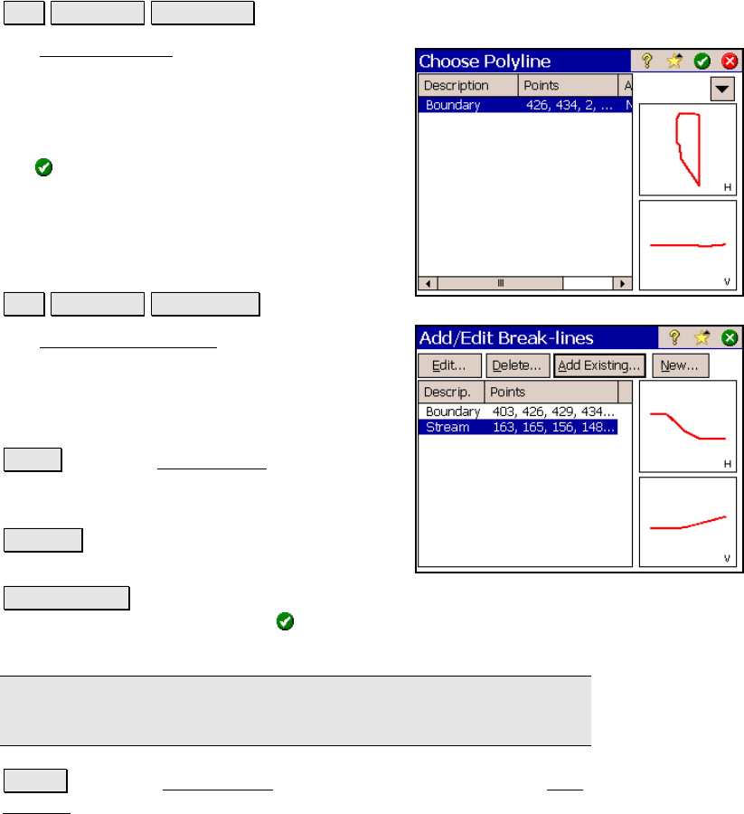
Choose Polyline
Job View DTM Boundary….
The Choose Polyline screen is used to select an
existing polyline that defines a boundary for
your non-reference DTM surface.
All the polylines in the current job are
displayed. Select the appropriate polyline and
tap
.
Add/Edit Break-lines
Job View DTM Breaklines….
The Add/Edit Break-lines screen is used to
select, edit, create, or delete the break-lines
that will be used when computing the DTM.
The break-lines that will be used when
computing the DTM are listed in this screen.
Edit… : opens the Edit Polyline screen where
the selected polyline can be modified or a new
polyline can be created.
Delete… : will move the selected polyline to
the Auxiliary layer.
Add Existing… : will display all the polylines in the current job.
Selecting a polyline and tapping will move the selected polyline to
the DTM layer.
Note: If a boundary is defined, only polylines that fall within the
boundary can be added.
New… : opens the New Polyline screen, which is identical to the Edit
Polyline screen and is used to create a new polyline.