
Reference Manual


Table Of Contents
- Table of Contents
- Welcome
- Main Menu
- File Menu
- Job Menu
- Job Menu – GPS
- Job Menu – Basic GPS
- Survey Menu
- Backsight Setup
- Traverse / Sideshot
- Repetition Shots
- Multiple Sideshots
- Radial Sideshots
- Distance Offset Shot
- Horizontal Angle Offset
- Vertical Angle Offset
- Auto Collect
- Corner & 2 Lines
- Corner & Angle
- Corner & Offset
- Corner & Plane
- Surface Scan
- Video Scan
- Shoot From Two Ends
- Record Mode
- Resection
- Remote Elevation
- Check Point
- Solar Observation
- Remote Control
- Survey Menu – GPS
- Survey Menu – Basic GPS
- Leveling Menu
- Stakeout Menu
- Stakeout Menu – GPS and Basic GPS
- Inverse Menu
- Cogo Menu
- Curve Menu
- Roads Menu
- Adjust Menu
- Miscelaneous Screens
- Appendix A
- Index
Job Menu
R-73
Start Station: is the station on the alignment that corresponds with
the starting location or point.
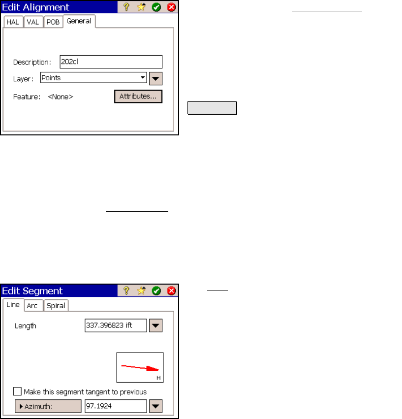
Edit Alignment Screen – General Tab
The General tab in the Edit Alignment screen
is used to describe the alignment and select the
layer where it is located.
Description: is the description of the
alignment.
Layer: is the layer where the alignment will be
located.
Attributes : opens the Point Feature Attributes
screen (Page R-63) where the feature attributes
for the alignment can be selected.
Edit Segment
The Edit Segment screen is accessed anytime an existing horizontal
or vertical segment is added or edited. A variety of segment editing
screens are possible depending on the type of segment being edited or
created. Each segment editor is discussed below.
Edit Segment – Line Card
The Line card is used to add a straight
horizontal line segment in the alignment.
Length: is the horizontal length of the line.
; Make this segment tangent to previous:
When checked, the specified line will be
tangent to the ending tangent of the previous
segment.