
Reference Manual


Table Of Contents
- Table of Contents
- Welcome
- Main Menu
- File Menu
- Job Menu
- Job Menu – GPS
- Job Menu – Basic GPS
- Survey Menu
- Backsight Setup
- Traverse / Sideshot
- Repetition Shots
- Multiple Sideshots
- Radial Sideshots
- Distance Offset Shot
- Horizontal Angle Offset
- Vertical Angle Offset
- Auto Collect
- Corner & 2 Lines
- Corner & Angle
- Corner & Offset
- Corner & Plane
- Surface Scan
- Video Scan
- Shoot From Two Ends
- Record Mode
- Resection
- Remote Elevation
- Check Point
- Solar Observation
- Remote Control
- Survey Menu – GPS
- Survey Menu – Basic GPS
- Leveling Menu
- Stakeout Menu
- Stakeout Menu – GPS and Basic GPS
- Inverse Menu
- Cogo Menu
- Curve Menu
- Roads Menu
- Adjust Menu
- Miscelaneous Screens
- Appendix A
- Index
Job Menu
R-41
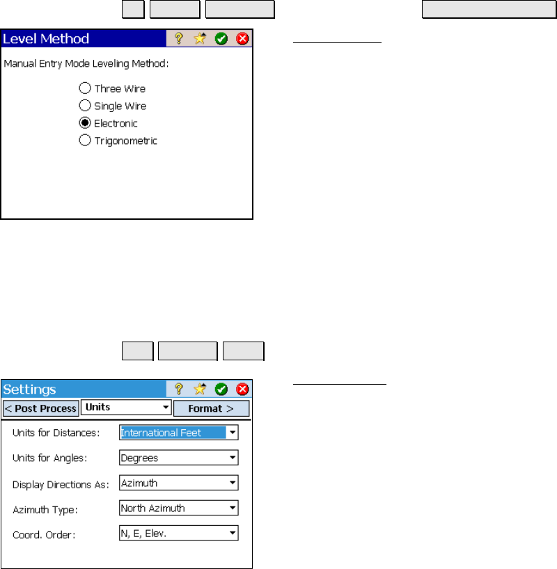
Level Method
Job Settings Instrument (select Manual Mode) Instrument Settings…
The Level Method screen is used to select the
leveling method you want to use while running
in leveling mode and while using Manual Mode.
This will affect the type of data you are
prompted for when taking shots.
Three Wire: Prompts for shot data will require
upper, center, and lower wire readings.
Single Wire: Prompts for shot data will require
center wire readings only.
Electronic: Prompts for shot data will require a
vertical and horizontal distance.
Trigonometric: Prompts for shot data will require a zenith angle and
horizontal distance.
Units Settings
Job Settings Units.
The Units Settings card defines the units that
are used within the software, sent from the
total station, entered from the keypad and
displayed on the screen.
Units for Distances: defines the units used for
length as Meters, International Feet, or US
Survey Feet.