
Reference Manual


Table Of Contents
- Table of Contents
- Welcome
- Main Menu
- File Menu
- Job Menu
- Job Menu – GPS
- Job Menu – Basic GPS
- Survey Menu
- Backsight Setup
- Traverse / Sideshot
- Repetition Shots
- Multiple Sideshots
- Radial Sideshots
- Distance Offset Shot
- Horizontal Angle Offset
- Vertical Angle Offset
- Auto Collect
- Corner & 2 Lines
- Corner & Angle
- Corner & Offset
- Corner & Plane
- Surface Scan
- Video Scan
- Shoot From Two Ends
- Record Mode
- Resection
- Remote Elevation
- Check Point
- Solar Observation
- Remote Control
- Survey Menu – GPS
- Survey Menu – Basic GPS
- Leveling Menu
- Stakeout Menu
- Stakeout Menu – GPS and Basic GPS
- Inverse Menu
- Cogo Menu
- Curve Menu
- Roads Menu
- Adjust Menu
- Miscelaneous Screens
- Appendix A
- Index
Survey Pro Reference Manual
R-414
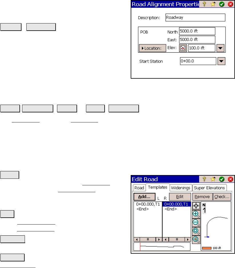
Description: is the name of the current
alignment. A new name can be assigned to the
alignment from this field.
Point / Location : depending how this
button is toggled, you can change the POB of
the alignment by entering a new point number
or new coordinates.
Start Station: replaces the existing starting
station of the alignment with the starting
station entered here.
The Templates Card
Roads Edit Roads ( New… or Edit… ) Templates.
The Templates card of the New Road screen is used to add existing
templates to the road.
The screen displays a list of left and right templates that are
currently assigned to the road. When a particular template is
selected, a cross-sectional profile view of the selected template is
displayed and an overhead view shows where the selected template
occurs on the alignment.
Add… : when a template or <End> is selected
from the L or R columns in the Templates card,
this button opens the Add Template
screen,
which allows you to add a new template to the
same side of the road that was selected.
Edit : allows you to edit the selected template
in the Edit Template screen, which is identical
to the Add Template
screen.
Remove : removes the selected template from
the list.
Check… : checks the road for errors and displays the results in the
Roads Report screen, described above.