
Reference Manual


Table Of Contents
- Table of Contents
- Welcome
- Main Menu
- File Menu
- Job Menu
- Job Menu – GPS
- Job Menu – Basic GPS
- Survey Menu
- Backsight Setup
- Traverse / Sideshot
- Repetition Shots
- Multiple Sideshots
- Radial Sideshots
- Distance Offset Shot
- Horizontal Angle Offset
- Vertical Angle Offset
- Auto Collect
- Corner & 2 Lines
- Corner & Angle
- Corner & Offset
- Corner & Plane
- Surface Scan
- Video Scan
- Shoot From Two Ends
- Record Mode
- Resection
- Remote Elevation
- Check Point
- Solar Observation
- Remote Control
- Survey Menu – GPS
- Survey Menu – Basic GPS
- Leveling Menu
- Stakeout Menu
- Stakeout Menu – GPS and Basic GPS
- Inverse Menu
- Cogo Menu
- Curve Menu
- Roads Menu
- Adjust Menu
- Miscelaneous Screens
- Appendix A
- Index
Survey Pro Reference Manual
R-372
Error dist.: is the distance between the last point and the first point.
Error azm: is the direction from the last point to the first point
Precision: is the ratio between the Error distance and Perimeter.
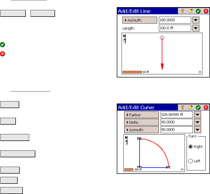
Add / Edit Line
The Add / Edit Line screen is used to enter a new line to the list prior
to the selected line segment.
Azimuth / Bearing : is the direction of the
line.
Length: is the length of the line, in feet or
meters.
: enters the line to the list.
: closes the screen without entering any new
line data.
Add / Edit Curve
The Add / Edit Curve screen is used to enter a new curve to the list
prior to the selected line segment.
Radius : The distance from the radius point to
the curve
Delta : The internal angle from center to
tangent points
Degree Arc : The internal angle equivalent to
a 100-ft arc length
Degree Chord : The internal angle equivalent
to a 100-ft chord length
Length : The arc length
Chord : The chord length
Tangent : The distance from the PC or PT to the PI