
Reference Manual


Table Of Contents
- Table of Contents
- Welcome
- Main Menu
- File Menu
- Job Menu
- Job Menu – GPS
- Job Menu – Basic GPS
- Survey Menu
- Backsight Setup
- Traverse / Sideshot
- Repetition Shots
- Multiple Sideshots
- Radial Sideshots
- Distance Offset Shot
- Horizontal Angle Offset
- Vertical Angle Offset
- Auto Collect
- Corner & 2 Lines
- Corner & Angle
- Corner & Offset
- Corner & Plane
- Surface Scan
- Video Scan
- Shoot From Two Ends
- Record Mode
- Resection
- Remote Elevation
- Check Point
- Solar Observation
- Remote Control
- Survey Menu – GPS
- Survey Menu – Basic GPS
- Leveling Menu
- Stakeout Menu
- Stakeout Menu – GPS and Basic GPS
- Inverse Menu
- Cogo Menu
- Curve Menu
- Roads Menu
- Adjust Menu
- Miscelaneous Screens
- Appendix A
- Index
Stakeout Menu – GPS & Basic GPS Module
R-351
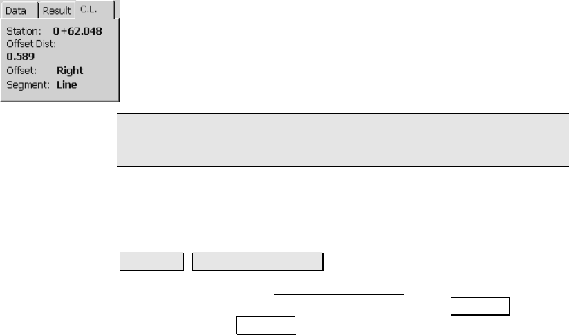
C.L.: shows the current station and offset information for the rover
location relative to the selected centerline. The type of line segment
in the polyline at the current station is also displayed. (This card is
only available if the With C.L. checkbox was checked in the previous
screen.)
Note: Tapping anywhere within the map view will open a larger map
view, which provides zoom controls.
Where is Next Point
Stakeout Where is Next Point.
The instructions for the Where is Next Point routine for GPS are
similar to the conventional method, except that the Backsight button
is replaced with a Setup HR button to configure rover antenna and
the backsight information is replaced with rover antenna height
information. See Page R-334 for details.