
Reference Manual


Table Of Contents
- Table of Contents
- Welcome
- Main Menu
- File Menu
- Job Menu
- Job Menu – GPS
- Job Menu – Basic GPS
- Survey Menu
- Backsight Setup
- Traverse / Sideshot
- Repetition Shots
- Multiple Sideshots
- Radial Sideshots
- Distance Offset Shot
- Horizontal Angle Offset
- Vertical Angle Offset
- Auto Collect
- Corner & 2 Lines
- Corner & Angle
- Corner & Offset
- Corner & Plane
- Surface Scan
- Video Scan
- Shoot From Two Ends
- Record Mode
- Resection
- Remote Elevation
- Check Point
- Solar Observation
- Remote Control
- Survey Menu – GPS
- Survey Menu – Basic GPS
- Leveling Menu
- Stakeout Menu
- Stakeout Menu – GPS and Basic GPS
- Inverse Menu
- Cogo Menu
- Curve Menu
- Roads Menu
- Adjust Menu
- Miscelaneous Screens
- Appendix A
- Index
Stakeout Menu – GPS & Basic GPS Module
R-347
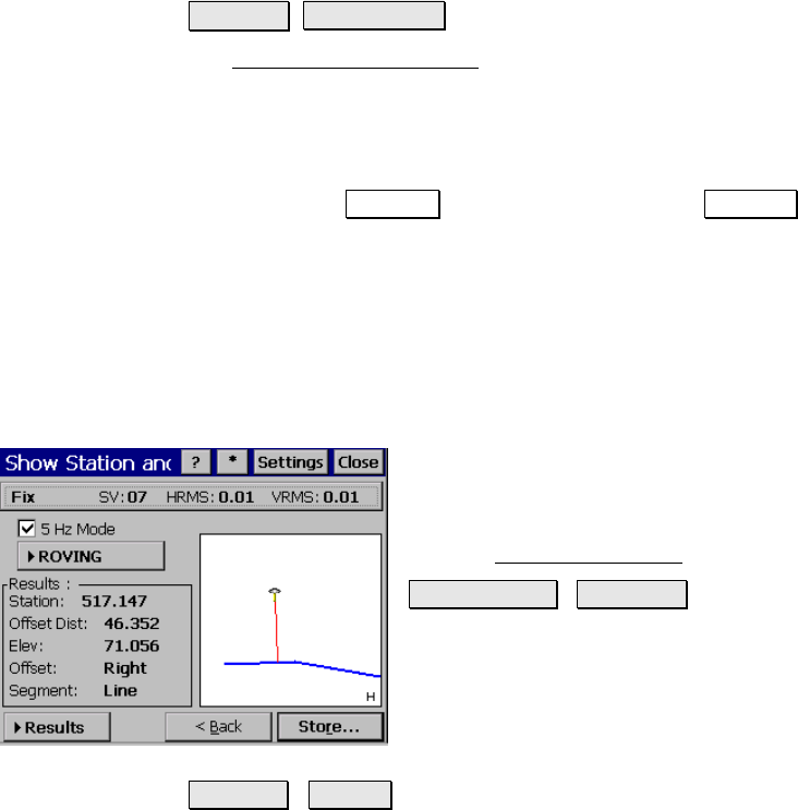
Show Station and Offset
Stakeout Show Station.
The Show Station and Offset routine allows you to position the rover
anywhere near a polyline, a range of points that define a line, or an
alignment to see where the rod is located in relation to the selected
line.
The first screen of this routine is similar to the conventional method,
except that the Backsight button is replaced with a Setup HR button
to configure rover antenna and the backsight information is replaced
with rover antenna height information. See Page R-318 for details.
Show Station – Screen Two
Once the line is selected, the second screen is opened where
information is displayed about the rod position and the selected line.
GPS Status: displays the current solution type,
the number of satellites used, and the
horizontal and vertical precision computed by
the receiver. Tap on this button to open the
detailed GPS Status screen
(Page R-176).
OCCUPYING / ROVING : switches from
ROVING to OCCUPYING mode. When
ROVING, the receiver is in dynamic mode and
will calculate your position as you move to the
point. When OCCUPYING, the receiver is
switched to static mode and will calculate the
most precise position for the staked point.
Results / N,E,Z : displays either the results, or plane coordinates
in the lower corner of the screen.
Station: is the station at the current rod position.
Offset Dist: is the perpendicular distance from the line to the rod.
Elev: is the elevation at the rod position.