
Reference Manual


Table Of Contents
- Table of Contents
- Welcome
- Main Menu
- File Menu
- Job Menu
- Job Menu – GPS
- Job Menu – Basic GPS
- Survey Menu
- Backsight Setup
- Traverse / Sideshot
- Repetition Shots
- Multiple Sideshots
- Radial Sideshots
- Distance Offset Shot
- Horizontal Angle Offset
- Vertical Angle Offset
- Auto Collect
- Corner & 2 Lines
- Corner & Angle
- Corner & Offset
- Corner & Plane
- Surface Scan
- Video Scan
- Shoot From Two Ends
- Record Mode
- Resection
- Remote Elevation
- Check Point
- Solar Observation
- Remote Control
- Survey Menu – GPS
- Survey Menu – Basic GPS
- Leveling Menu
- Stakeout Menu
- Stakeout Menu – GPS and Basic GPS
- Inverse Menu
- Cogo Menu
- Curve Menu
- Roads Menu
- Adjust Menu
- Miscelaneous Screens
- Appendix A
- Index
Survey Pro Reference Manual
R-332
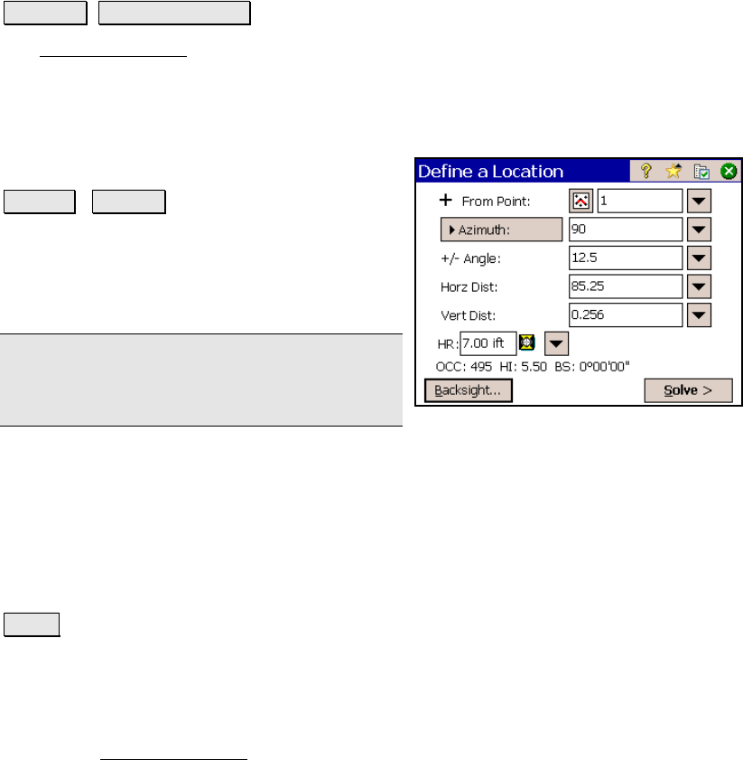
Define a Location
Stakeout Define a Location.
The Define a Location screen is used to manually enter the distance
and direction to a new point from any existing reference point and
then stakeout the new point.
From Point: is the reference point that the specified angle and
distance information is applied to for locating
the new point.
Azimuth / Bearing : is the direction from the
reference point to the new point.
+/- Angle: is the angle to be added to the
specified azimuth or bearing, thus modifying
the direction to the new point.
Note: To subtract an angle from the specified
azimuth or bearing, enter a negative +/- Angle
value.
Horiz. Dist: is the horizontal distance from the reference point to the
new point.
Vert. Dist: is the vertical distance from the reference point to the new
point.
Store point: When this is checked, the computed point will be stored
with the name specified here.
Solve : will compute the location for the new point and access the
next screen.
Define a Location – Screen Two
The second Define a Location screen displays the direction and
distance information from the occupy point to the new point.