
Reference Manual


Table Of Contents
- Table of Contents
- Welcome
- Main Menu
- File Menu
- Job Menu
- Job Menu – GPS
- Job Menu – Basic GPS
- Survey Menu
- Backsight Setup
- Traverse / Sideshot
- Repetition Shots
- Multiple Sideshots
- Radial Sideshots
- Distance Offset Shot
- Horizontal Angle Offset
- Vertical Angle Offset
- Auto Collect
- Corner & 2 Lines
- Corner & Angle
- Corner & Offset
- Corner & Plane
- Surface Scan
- Video Scan
- Shoot From Two Ends
- Record Mode
- Resection
- Remote Elevation
- Check Point
- Solar Observation
- Remote Control
- Survey Menu – GPS
- Survey Menu – Basic GPS
- Leveling Menu
- Stakeout Menu
- Stakeout Menu – GPS and Basic GPS
- Inverse Menu
- Cogo Menu
- Curve Menu
- Roads Menu
- Adjust Menu
- Miscelaneous Screens
- Appendix A
- Index
Stakeout Menu
R-323
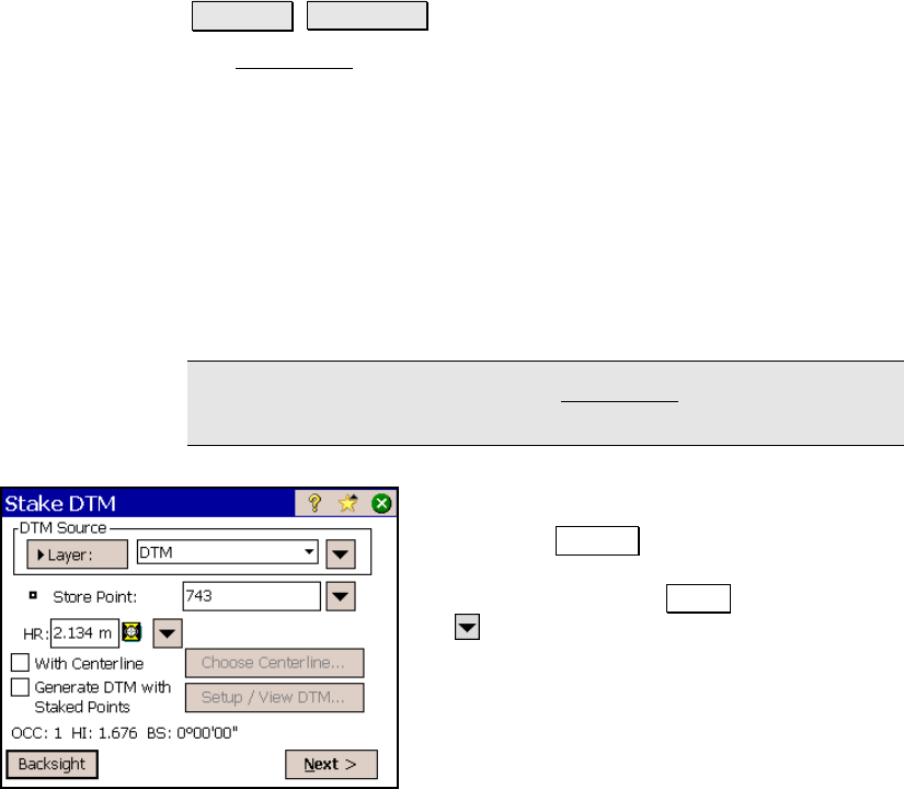
Stake DTM
Stakeout Stake DTM.
The Stake DTM routine allows you to stake an area and get cut/fill
information between the point being staked and a reference DTM
surface at the same horizontal coordinates. You can also obtain
volume information between the surface being staked and a specified
reference elevation or the reference DTM surface.
The reference DTM surface can be defined by a layer in the current
job or a file loaded on the data collector. Either a DXF file containing
a triangulated irregular network (TIN) or a digital terrain model
(DTM) file can be used.
Consult the User’s manual for more information.
Note: The speed performance of the Stake DTM routine is enhanced
when using a DTM file as opposed to a DXF file.
DTM Source: is where you select your
reference DTM surface. If using a layer, toggle
the button to Layer and then select the layer
from the dropdown list. If using a DTM or DXF
file, toggle the button to File and then tap
the power button and Browse then select the
appropriate file.