
Reference Manual


Table Of Contents
- Table of Contents
- Welcome
- Main Menu
- File Menu
- Job Menu
- Job Menu – GPS
- Job Menu – Basic GPS
- Survey Menu
- Backsight Setup
- Traverse / Sideshot
- Repetition Shots
- Multiple Sideshots
- Radial Sideshots
- Distance Offset Shot
- Horizontal Angle Offset
- Vertical Angle Offset
- Auto Collect
- Corner & 2 Lines
- Corner & Angle
- Corner & Offset
- Corner & Plane
- Surface Scan
- Video Scan
- Shoot From Two Ends
- Record Mode
- Resection
- Remote Elevation
- Check Point
- Solar Observation
- Remote Control
- Survey Menu – GPS
- Survey Menu – Basic GPS
- Leveling Menu
- Stakeout Menu
- Stakeout Menu – GPS and Basic GPS
- Inverse Menu
- Cogo Menu
- Curve Menu
- Roads Menu
- Adjust Menu
- Miscelaneous Screens
- Appendix A
- Index
Stakeout Menu
R-305
EDM: This button can be toggled to shoot in
various EDM modes. The options available
depend on the total station being used.
Consult the total station’s documentation for
more information on the EDM modes that it
supports.
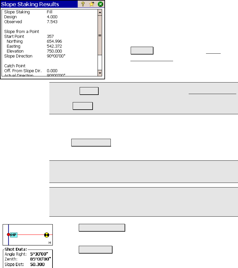
• Results : This will open the Slope
Staking Results screen, listing detailed
information for the current setup and
last shot.
Note: The Results button is only available from the Store Catch Point
screen when using GPS or Remote mode, which is accessed after
tapping Store >.
The button described below selects which information is displayed in
the screen from the following options:
• Vertical Map : displays a cross-sectional view at the current
station.
Note: When you tap a map view, an expanded view of the same map
will fill the screen.
Note: The Vertical Map will show an X at the location of each
previous shot. This can be useful in determining if the current
terrain will never intersect the slope (no catch point).
• Horizontal Map : displays an overhead view of the job.
• Shot Data : displays the shot data for the last shot.
The button described below selects the type of slope that will be
used from hinge point to the catch point from the following options: