
Reference Manual


Table Of Contents
- Table of Contents
- Welcome
- Main Menu
- File Menu
- Job Menu
- Job Menu – GPS
- Job Menu – Basic GPS
- Survey Menu
- Backsight Setup
- Traverse / Sideshot
- Repetition Shots
- Multiple Sideshots
- Radial Sideshots
- Distance Offset Shot
- Horizontal Angle Offset
- Vertical Angle Offset
- Auto Collect
- Corner & 2 Lines
- Corner & Angle
- Corner & Offset
- Corner & Plane
- Surface Scan
- Video Scan
- Shoot From Two Ends
- Record Mode
- Resection
- Remote Elevation
- Check Point
- Solar Observation
- Remote Control
- Survey Menu – GPS
- Survey Menu – Basic GPS
- Leveling Menu
- Stakeout Menu
- Stakeout Menu – GPS and Basic GPS
- Inverse Menu
- Cogo Menu
- Curve Menu
- Roads Menu
- Adjust Menu
- Miscelaneous Screens
- Appendix A
- Index
Survey Pro Reference Manual
R-296
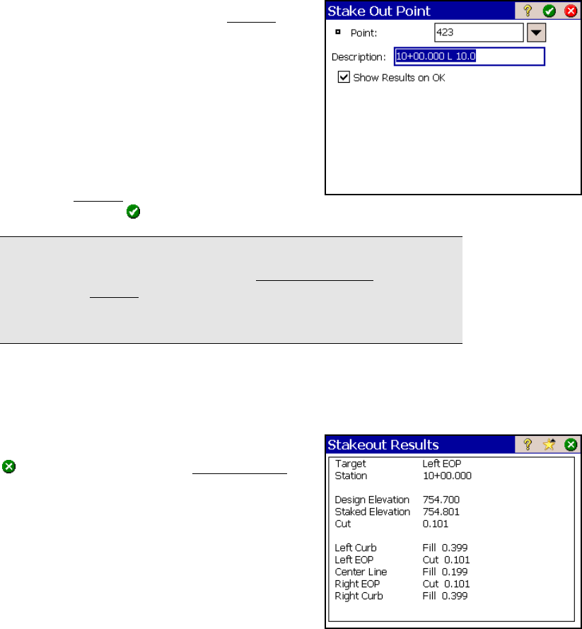
Offset Staking – Screen Six
This screen is used to describe the stake point
before it is stored and select if the Results
screen should be displayed (described next).
Point: is the point name for the stake point
being stored.
Description: is the description for the stake
point being stored. The default description is
the station, side, and distance from the
centerline for the design point.
Show Results on OK: When this checkbox is
checked, a Results
screen (described next) will
open after tapping
from this screen.
Note: This screen will not appear if the Write Cut Sheet Data Only (No
Store Point) checkbox is checked in the Stakeout Settings screen,
although the Results screen will still appear if the Show Results on OK
checkbox was never unchecked from this screen. (It is checked by
default.)
Offset Staking – Stakeout Results
This screen shows detailed cut/fill values, which may be needed when
marking a road or offset stake.
: returns you to the second Offset Staking
screen where the Design point is advanced by
the Increment value.