
Reference Manual


Table Of Contents
- Table of Contents
- Welcome
- Main Menu
- File Menu
- Job Menu
- Job Menu – GPS
- Job Menu – Basic GPS
- Survey Menu
- Backsight Setup
- Traverse / Sideshot
- Repetition Shots
- Multiple Sideshots
- Radial Sideshots
- Distance Offset Shot
- Horizontal Angle Offset
- Vertical Angle Offset
- Auto Collect
- Corner & 2 Lines
- Corner & Angle
- Corner & Offset
- Corner & Plane
- Surface Scan
- Video Scan
- Shoot From Two Ends
- Record Mode
- Resection
- Remote Elevation
- Check Point
- Solar Observation
- Remote Control
- Survey Menu – GPS
- Survey Menu – Basic GPS
- Leveling Menu
- Stakeout Menu
- Stakeout Menu – GPS and Basic GPS
- Inverse Menu
- Cogo Menu
- Curve Menu
- Roads Menu
- Adjust Menu
- Miscelaneous Screens
- Appendix A
- Index
Survey Pro Reference Manual
R-288
Cut / Fill: displays the required amount of cut or fill to bring the stake
point to the elevation of the reference line at the nearest
perpendicular.
Note: If staking beyond the end points of the reference line, or if the
reference line is defined by a 2D point, no vertical data is computed.
Meas : contains the information measured by the total station during
the previous shot.
Shot : takes a shot to the prism.
< Back : returns to Screen One.
Store… : opens the Store Point dialog so you can store the last point
that was shot.
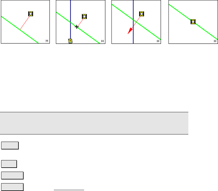
Graphic when prism is
greater than 10-feet
from the line.
Graphic when prism is
between 1-foot and
10-feet from the line.
Graphic when prism is
within 1-foot of the
line
Graphic when prism is
on the line or within the
Horizontal Distance
Tolerance specified in
the Stakeout Settings
screen (Page R-50).