
Reference Manual


Table Of Contents
- Table of Contents
- Welcome
- Main Menu
- File Menu
- Job Menu
- Job Menu – GPS
- Job Menu – Basic GPS
- Survey Menu
- Backsight Setup
- Traverse / Sideshot
- Repetition Shots
- Multiple Sideshots
- Radial Sideshots
- Distance Offset Shot
- Horizontal Angle Offset
- Vertical Angle Offset
- Auto Collect
- Corner & 2 Lines
- Corner & Angle
- Corner & Offset
- Corner & Plane
- Surface Scan
- Video Scan
- Shoot From Two Ends
- Record Mode
- Resection
- Remote Elevation
- Check Point
- Solar Observation
- Remote Control
- Survey Menu – GPS
- Survey Menu – Basic GPS
- Leveling Menu
- Stakeout Menu
- Stakeout Menu – GPS and Basic GPS
- Inverse Menu
- Cogo Menu
- Curve Menu
- Roads Menu
- Adjust Menu
- Miscelaneous Screens
- Appendix A
- Index
Survey Pro Reference Manual
R-250
GPS Status
Survey GPS Status.
The GPS Status screens are described starting on Page 176.
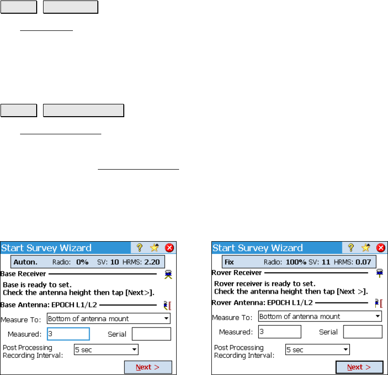
Start GPS Survey
Survey Start GPS Survey.
The Start GPS Survey wizard is used to complete the setup necessary
for any RTK GPS Survey. It is opened from the main menu, or any
time you try to access data collection or stake out functions. The
steps to complete the Start GPS Survey
wizard will depend on what
you have already done in the job.
When connecting to the receivers by serial cable, Survey Pro will
detect if it is a base or rover and start the workflow accordingly.
When connecting to either receiver by Bluetooth, you are prompted
for which receiver you are connected to. Each screen is shown below.
Connected to Base Connected to Rover