
Reference Manual


Table Of Contents
- Table of Contents
- Welcome
- Main Menu
- File Menu
- Job Menu
- Job Menu – GPS
- Job Menu – Basic GPS
- Survey Menu
- Backsight Setup
- Traverse / Sideshot
- Repetition Shots
- Multiple Sideshots
- Radial Sideshots
- Distance Offset Shot
- Horizontal Angle Offset
- Vertical Angle Offset
- Auto Collect
- Corner & 2 Lines
- Corner & Angle
- Corner & Offset
- Corner & Plane
- Surface Scan
- Video Scan
- Shoot From Two Ends
- Record Mode
- Resection
- Remote Elevation
- Check Point
- Solar Observation
- Remote Control
- Survey Menu – GPS
- Survey Menu – Basic GPS
- Leveling Menu
- Stakeout Menu
- Stakeout Menu – GPS and Basic GPS
- Inverse Menu
- Cogo Menu
- Curve Menu
- Roads Menu
- Adjust Menu
- Miscelaneous Screens
- Appendix A
- Index
Survey Pro Reference Manual
R-246
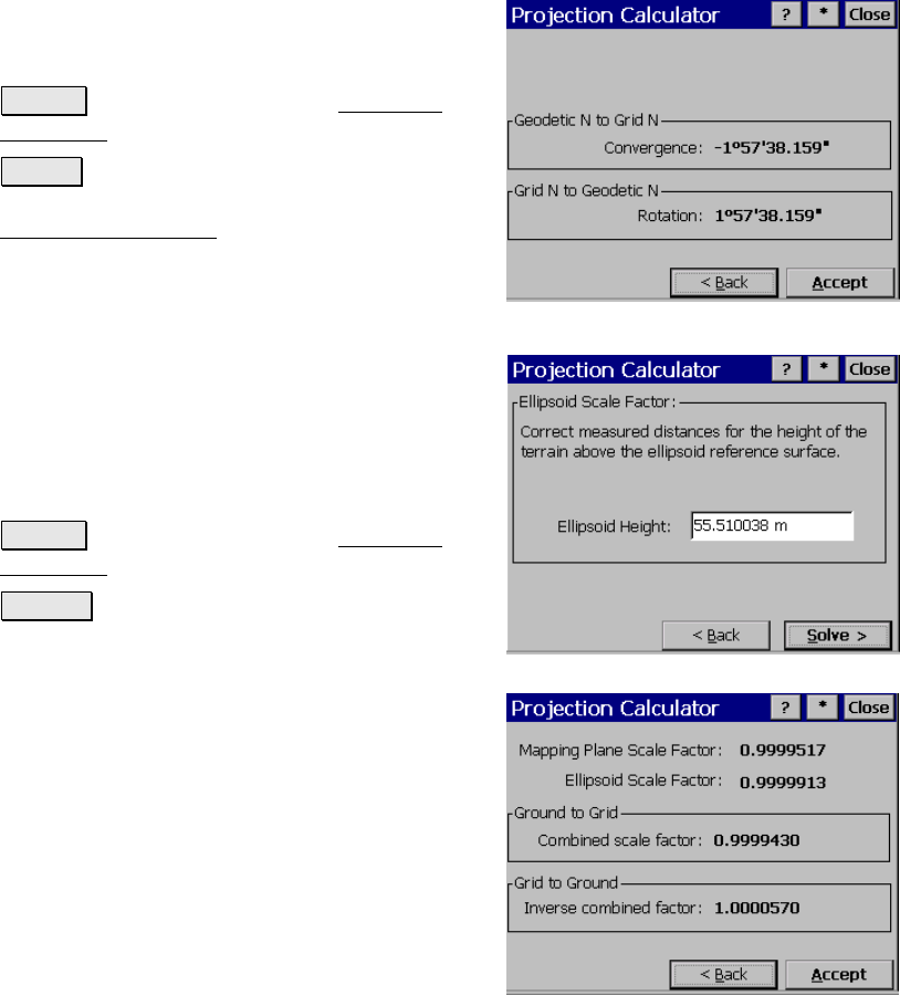
Projection Calculator – Rotation
Convergence: displays the computed rotation from geodetic north to
grid north.
Rotation: displays the computed rotation from
grid north to geodetic north.
< Back : returns you to the first Projection
Calculator screen.
Accept : copies the two computed values to
past results and returns you to the first
Projection Calculator
screen.
Projection Calculator – Scale –
Height Correction
Ellipsoid Height: is where you enter the
WGS84 ellipsoid height for your current
location. This value will be used to calculate
the height above the terrain component of the
scale factor. This is sometimes referred to as
the sea level correction.
< Back : returns you to the first Projection
Calculator screen.
Solve > : takes you to the final screen.
Projection Calculator – Scale
Mapping Plane Scale Factor: displays the
computed mapping plane scale factor on the
selected mapping plane at the reference point.
Ellipsoid Scale Factor: displays the computed
ellipsoid scale factor at the reference point.
Combined Scale Factor: displays the Mapping
Plane Scale Factor multiplied by the Ellipsoid
Scale Factor. This is the ground to grid scale
factor.