
Reference Manual


Table Of Contents
- Table of Contents
- Welcome
- Main Menu
- File Menu
- Job Menu
- Job Menu – GPS
- Job Menu – Basic GPS
- Survey Menu
- Backsight Setup
- Traverse / Sideshot
- Repetition Shots
- Multiple Sideshots
- Radial Sideshots
- Distance Offset Shot
- Horizontal Angle Offset
- Vertical Angle Offset
- Auto Collect
- Corner & 2 Lines
- Corner & Angle
- Corner & Offset
- Corner & Plane
- Surface Scan
- Video Scan
- Shoot From Two Ends
- Record Mode
- Resection
- Remote Elevation
- Check Point
- Solar Observation
- Remote Control
- Survey Menu – GPS
- Survey Menu – Basic GPS
- Leveling Menu
- Stakeout Menu
- Stakeout Menu – GPS and Basic GPS
- Inverse Menu
- Cogo Menu
- Curve Menu
- Roads Menu
- Adjust Menu
- Miscelaneous Screens
- Appendix A
- Index
Survey Menu – GPS Module
R-243
Adjust with Projection – Select Destination
Coordinate System
The Adjust with Projection Select Destination Coordinate System
screen is used to select the coordinate system to transform the job file
points into. The interface is identical to the Select Source Coordinate
System screen described above. This screen only shows when the
adjustment mode is set to Adjust From Source to Destination.
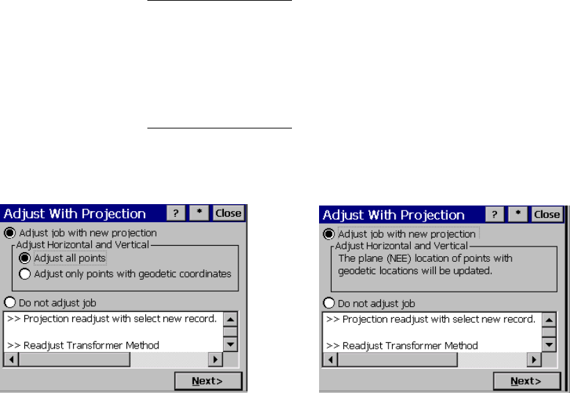
Adjust with Projection – Prompt Adjust
The Adjust with Projection Prompt Adjust screen is used to describe
the difference between the source and destination record, and to
prompt you whether or not you wish to adjust the job with the change
of projection. This screen only shows when the wizard is opened
because of a change of projection record.
Adjust job with new projection:
is where you choose to adjust the job file points with the change of
coordinate system.
Adjust Horizontal and/or Vertical: is where you choose how to update
the horizontal and vertical coordinates in the job. There are two
choices:
Prompt geodetic points only
Prompt choose points