
Reference Manual


Table Of Contents
- Table of Contents
- Welcome
- Main Menu
- File Menu
- Job Menu
- Job Menu – GPS
- Job Menu – Basic GPS
- Survey Menu
- Backsight Setup
- Traverse / Sideshot
- Repetition Shots
- Multiple Sideshots
- Radial Sideshots
- Distance Offset Shot
- Horizontal Angle Offset
- Vertical Angle Offset
- Auto Collect
- Corner & 2 Lines
- Corner & Angle
- Corner & Offset
- Corner & Plane
- Surface Scan
- Video Scan
- Shoot From Two Ends
- Record Mode
- Resection
- Remote Elevation
- Check Point
- Solar Observation
- Remote Control
- Survey Menu – GPS
- Survey Menu – Basic GPS
- Leveling Menu
- Stakeout Menu
- Stakeout Menu – GPS and Basic GPS
- Inverse Menu
- Cogo Menu
- Curve Menu
- Roads Menu
- Adjust Menu
- Miscelaneous Screens
- Appendix A
- Index
Survey Pro Reference Manual
R-222
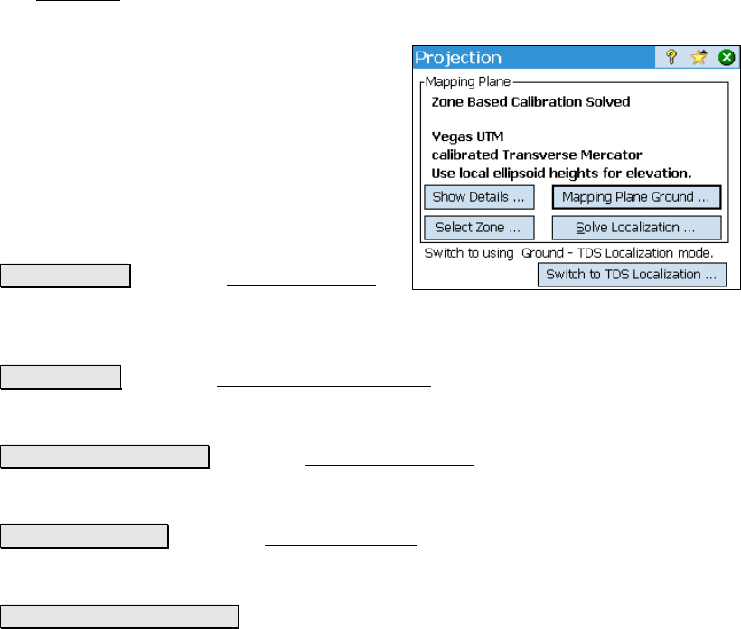
Projection – Mapping Plane Mode
The Projection screen is described below for when the horizontal
projection mode is set to Mapping Plane.
Use this setting when you want your
coordinate system to be a conformal map
projection chosen from the coordinate system
database file.
See Page R-210 for when the projection mode is
set to T
DS Localization.
Status Line: The text at the top of the screen
describes the status of the horizontal projection
solution.
Show Details… : opens the Projection Details
screen, where the complete details of the
localization solution, reference map projection, and Geoid model are
displayed.
Select Zone… : opens the Select Coordinate System screen (Page R-
230), where you can choose a zone or site from the data base, key in a
custom zone, and delete zones or sites from the database.
Mapping Plane Ground… : opens the Ground Coordinates screen (Page
R-230), where the grid to ground conversion parameters can be
calculated and applied.
Solve Localization… : opens the Solve Localization wizard (Page R-
214), where control points can be selected and the horizontal and
vertical localization are solved.
Switch to TDS Localization… : switches the horizontal projection mode
from Mapping Plane mode to Ground TDS Localization mode (Page
R-210).