
Reference Manual


Table Of Contents
- Table of Contents
- Welcome
- Main Menu
- File Menu
- Job Menu
- Job Menu – GPS
- Job Menu – Basic GPS
- Survey Menu
- Backsight Setup
- Traverse / Sideshot
- Repetition Shots
- Multiple Sideshots
- Radial Sideshots
- Distance Offset Shot
- Horizontal Angle Offset
- Vertical Angle Offset
- Auto Collect
- Corner & 2 Lines
- Corner & Angle
- Corner & Offset
- Corner & Plane
- Surface Scan
- Video Scan
- Shoot From Two Ends
- Record Mode
- Resection
- Remote Elevation
- Check Point
- Solar Observation
- Remote Control
- Survey Menu – GPS
- Survey Menu – Basic GPS
- Leveling Menu
- Stakeout Menu
- Stakeout Menu – GPS and Basic GPS
- Inverse Menu
- Cogo Menu
- Curve Menu
- Roads Menu
- Adjust Menu
- Miscelaneous Screens
- Appendix A
- Index
Survey Pro Reference Manual
R-218
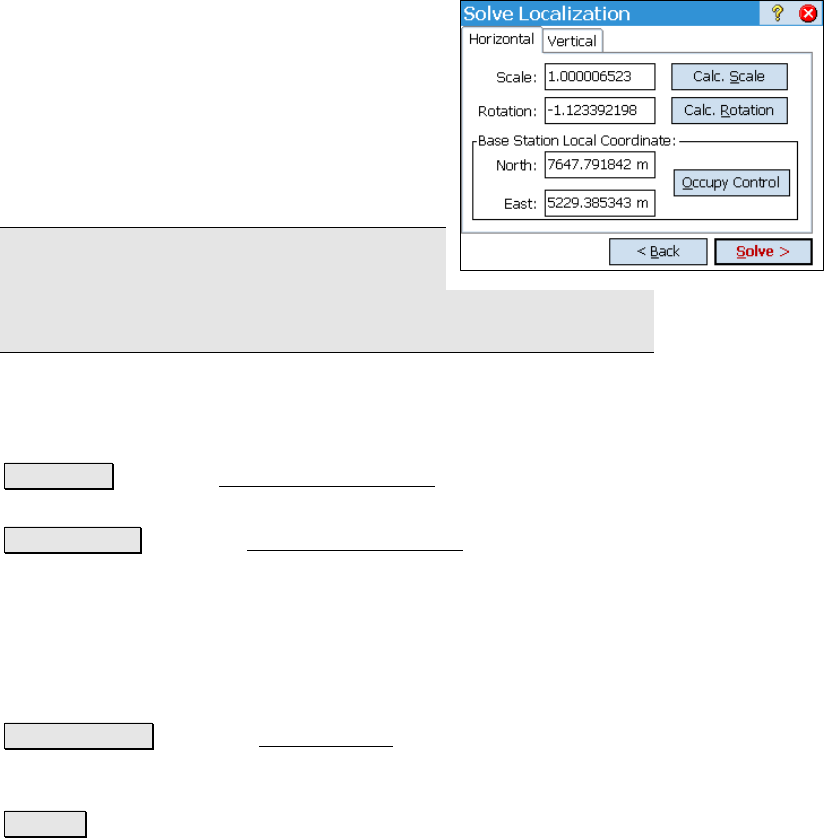
Localization Calculator
This sub section describes a feature available only in Ground – TDS
Localization mode.
The Localization Calculator is used to enter the
horizontal localization parameters using the
pre-Survey Pro 3.5 procedure.
Scale: is where you enter the scale factor used
to transform distances on the localization
mapping plane to your project coordinate
system.
Note: Using versions of Survey Pro after 3.5,
the localization scale should be very close to
1.0. See the user's manual for a more detailed explanation of
localization scale values.
Rotation: is where you enter the rotation angle used to transform the
orientation of the localization mapping plane to your grid orientation
of your project.
Calc. Scale : opens the Localization Calculator screen where the
horizontal scale factor is explained.
Calc. Rotation : opens the Localization Calculator screen where the
rotation can set parallel to a mapping plane selected from the
database.
Base Station Local Coordinate: are the local plane coordinates of the
base. If you set up on a new base point, these fields are blank and
you need to occupy one control point to calculate the base station local
coordinates.
Occupy Control : opens the Control Points screen (Page R-194), where
you select a control point to occupy. When you are done, the base
local coordinate is calculated using your entered scale and rotation.
Solve > : computes the horizontal localization parameters using the
entered scale, rotation, and base station local coordinates.