
Reference Manual


Table Of Contents
- Table of Contents
- Welcome
- Main Menu
- File Menu
- Job Menu
- Job Menu – GPS
- Job Menu – Basic GPS
- Survey Menu
- Backsight Setup
- Traverse / Sideshot
- Repetition Shots
- Multiple Sideshots
- Radial Sideshots
- Distance Offset Shot
- Horizontal Angle Offset
- Vertical Angle Offset
- Auto Collect
- Corner & 2 Lines
- Corner & Angle
- Corner & Offset
- Corner & Plane
- Surface Scan
- Video Scan
- Shoot From Two Ends
- Record Mode
- Resection
- Remote Elevation
- Check Point
- Solar Observation
- Remote Control
- Survey Menu – GPS
- Survey Menu – Basic GPS
- Leveling Menu
- Stakeout Menu
- Stakeout Menu – GPS and Basic GPS
- Inverse Menu
- Cogo Menu
- Curve Menu
- Roads Menu
- Adjust Menu
- Miscelaneous Screens
- Appendix A
- Index
Survey Menu – GPS Module
R-195
Note: The Topo SS function never puts the receiver in static mode, so
the precision of the rapid side shot will be less than a point occupied
in static mode.
Feature : opens the Feature Collection screen, where various
automatic and manual data collection options are available.
Offset : opens the Offset Shots screen, where a point can be collected
and stored at a specified offset.
Point : opens the Occupy Data Points screen (Page R-198), used to
occupy and store a new point.
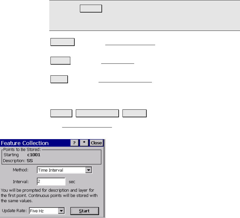
Feature Collection Screen
Survey Data Collection Feature.
The Feature Collection screen is used when you wish to set up
automated continuous data collection.
Points to be Stored: displays the starting
point name and description of the group of
points to be stored.
Method: is where you select the method of
continuous data collection. The available
methods are described below:
• Time Interval: After accepting the first
point, additional points will
automatically be stored after the
specified time interval (in seconds) has
elapsed. Each successive point name is
incremented to the next available name.
• Distance Interval 2D / 3D: After accepting the first point,
additional points will automatically be stored after traveling
the specified horizontal or 3D distance. Each successive point
name is incremented to the next available name.
• Hold Still For: After accepting the first point, additional
points are automatically stored when the pole is held in the
same spot for the specified interval of time (in seconds).