
Reference Manual


Table Of Contents
- Table of Contents
- Welcome
- Main Menu
- File Menu
- Job Menu
- Job Menu – GPS
- Job Menu – Basic GPS
- Survey Menu
- Backsight Setup
- Traverse / Sideshot
- Repetition Shots
- Multiple Sideshots
- Radial Sideshots
- Distance Offset Shot
- Horizontal Angle Offset
- Vertical Angle Offset
- Auto Collect
- Corner & 2 Lines
- Corner & Angle
- Corner & Offset
- Corner & Plane
- Surface Scan
- Video Scan
- Shoot From Two Ends
- Record Mode
- Resection
- Remote Elevation
- Check Point
- Solar Observation
- Remote Control
- Survey Menu – GPS
- Survey Menu – Basic GPS
- Leveling Menu
- Stakeout Menu
- Stakeout Menu – GPS and Basic GPS
- Inverse Menu
- Cogo Menu
- Curve Menu
- Roads Menu
- Adjust Menu
- Miscelaneous Screens
- Appendix A
- Index
Survey Pro Reference Manual
R-10
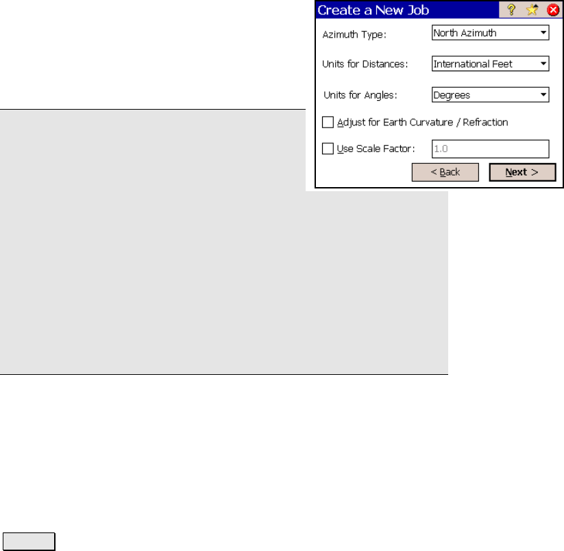
Create a New Job 3
Azimuth Type: specifies if you are surveying
with a North Azimuth or South Azimuth.
Units for Distances: specifies if your distances
will be entered in International Feet, U.S. Feet,
or Meters.
Note: You can enter a distance in any distance
field in units other than what is set for the job
by appending the distance value with the
following characters:
y f or ft or ift International Feet
y usf or usft US Survey Feet
y i or in Inches
y m Meters
y cm Centimeters
y mm Millimeters
y c or ch Chains
Once the cursor leaves that field, the distance will be converted
automatically. (A space between the value and the unit abbreviation
is optional.)
Units for Angles: specifies if angles will be entered in Degrees or
Grads.
; Adjust for Earth Curvature / Refraction: when checked, the
elevations recorded from all shots will be adjusted to compensate for
earth curvature and refraction.
; User Scale Factor: when checked, all horizontal distances when
taking shots will be adjusted by the scale factor entered here.
Next > : opens the final screen, which can be one of two different
possible screens depending on if a control file is being imported.