
Reference Manual Owner manual


Survey Pro Reference Manual
R-210
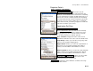
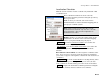
Localization Calculator – Scale
Note: This function is no longer necessary with Survey Pro versions
after 3.5. The new localization solution sets the origin scale of the
reference stereographic mapping plane based on ground height. This
screen was left in to explain scale factor to users who previously used
this work flow.
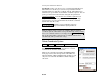
Use 1.0 Scale : returns to the Localization Calculator screen with a
scale factor of 1.0.
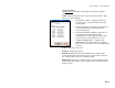
Localization Calculator – Rotation
In order to compute the localization rotation, you need a known
geodetic coordinate system for reference. Use this function to set the
localization coordinate system parallel to a selected mapping plane.
The calculate rotation function uses the Projection Calculator screen
(Page R-237).
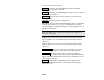
Note: Survey Pro versions prior to 3.5 allowed users to calculate
rotation using either a known mapping plane, or relative to the first
base setup. This function is now used only to calculate orientation
from a known mapping plane. Older jobs that had orientation
relative to the first base were automatically converted into a
localization solution when first opened with Survey Pro versions after
3.5.
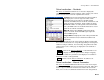
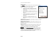
Solve Localization – Results
The Solve Localization Results screen is used to display the results of
the horizontal and vertical adjustment, and how the adjustment was
derived.