
User Manual Manual


GPS User’s Manual
84
record. You can also key in a custom map projection zone
using the wizard.
•
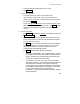
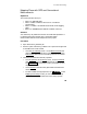
Make sure Oregon North is still selected and tap . You
are prompted that the conventional survey scale factor is set
to 1.0, which is probably not the correct value for this map
projection. You can tap to use the scale
calculator to set the conventional scale factor now. We will
set our scale factor when we start conventional
measurements, so tap to finish setting the projection.
4.
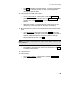
Set up the base station.
•
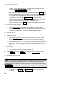
Go to Base Setup
and select point
MANE
. The geodetic
coordinate is computed from the plane coordinate using the
reverse transformation and the selected geoid model.
5.
Set the rover
6.
Data collection.
•
Go to Data Collection
and collect points
OIP1
,
OIP2
,
OIP3,
OIP4
. These are the corners of a ‘virtual’ quarter section.
•
Data collect Point
101
. This will be used as the well center to
stake out. Over write the existing coordinate for 101 in the
file.
7.
Stake Out
•
Go to Stake Points and select Point
101
.
8.
Tap and then to open the GPS Staking
screen.
9.
Navigate to the point.
Note: In the field, you would navigate to the point, place your mark
and then occupy the staked position. In order to get the demo to
recognize that you want to stake point 101, you must first switch to
.
•
Change from to . Enter Point
201
at
prompt.