
User's Guide Part 2


237
GPS Function
Continued
Example: Displaying a map of your current location
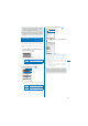
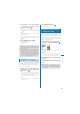
1
From the Menu, select [LifeKit]
→
[GPS]
→
[Position location] and press
.
ˎ
You can also check your current location by
pressing
for over a second in the stand-by
display. After positioning, the operations follow
the settings of the GPS button setting (P.278).
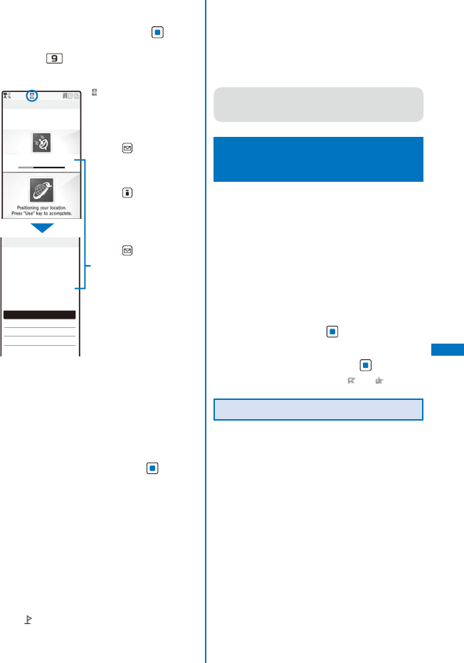
Positioning loc.
Accuracy:
★
☆
☆
Position location
Read a Map
Run i appli
Paste to mail
Add to phonebook
Attach to image
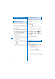
Positioning
completed.
Accuracy
★
★
★
“ ” flashes and the incoming
indicator flashes.
The progress of accuracy is
indicated by the bar.
To quit the Position location
Press (Cancel).
To display the result for
identifying a location right
away
Press (Use).
To retry the operation
Press (Retry).
Accuracy
★★★
: Nearly accurate
location information
(with an error less
than approximately
50 m)
★★☆
: Relatively accurate
location information
(with an error less
than approximately
300 m)
★☆☆
: Approximate
location information
(with an error more
than approximately
300 m)
ˎ
Use the positioning accuracy as a guide. The
accuracy may vary depending on the radio wave
condition of the vicinity.
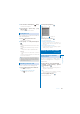
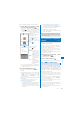
2
Select [Read a Map] and press .
The map of determined current location is
displayed.
ˎ
After displaying the map, you can search for the
neighborhood information using “
iエリア−周
辺情報−
” (i-mode area –Neighbor info–). For
details about “
iエリア−周辺情報−
”, see the
DoCoMo’s website.
To use the location information with GPS-compatible
i-
α
ppli software
Select [Run i appli]
→
software to be used.
To paste the location information to mail
Select [Paste to mail]
→
[Yes].
ˎ
“
location URL” that has a link to the location
information is entered in the mail main body.
ˎ
The location information URL being sent is
only displayed on the i-mode compatible
terminals.
To save the location information in the Phonebook
Select [Add to phonebook]
→
[New]/[Add].
ˎ
Follow the same steps as in the Add to FOMA
terminal phonebook (P.95, step 3 to 6).
To add location information on an image
Select [Attach to image]
→
an image from My
picture of the Data Box.
●
You can add location information using the GPS
function on an image recorded by the camera
automatically (P.171).
Using the GPS-compatible
i-
α
ppli
<i appli>
You can use the location information with GPS-
compatible i-
α
ppli software.
ˎ
When you use a GPS-compatible i-
α
ppli, the
location information is sent to the information
provider of the software being used.
ˎ
When you use the GPS function with a GPS-
compatible i-
α
ppli, set the Use location info of the
software being used to [Yes].
ˎ
The method of using the location information varies
depending on the software.
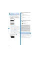
1
From the Menu, select [LifeKit]
→
[GPS]
→
[i appli] and press
.
The GPS software list display appears.
2
Select a software and press .
The software is started up and “ ” or “ ” appears.
Using
地図アプリ
(Map appli)
The preinstalled “
地図アプリ
(Map appli)”
uses the GPS function and a map to display
your current location or specified location, to
search the information on neighborhood, and
to navigate you to the destination by public
transportation, walk, or car.
ˎ
An additional packet communication charge is
required for using this function. It is recommended
to use the Pake-Houdai/Pake-Houdai Full for this
software.
ˎ
When you have deleted the software but you want to
restore it, download it from “
iエリア−周辺情報−
”
(i-mode area-Neighbor info-).
ˎ
You cannot use this software when 2in1 is set to the
B mode because it uses mail.
ˎ
Please note that DoCoMo will not guarantee any
result such as of the accuracy and immediacy of
information such as map or route.
ˎ
While driving a car, please let a person other than
the driver operate it.