
Operation Manual


26
Return to contents
3.10.2 To navigate using a ‘Different Position’
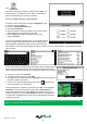
l Press the centre of the screen to enter the ‘Navigate to’ menu.
l Press the black arrow
once.
l Press the ‘Find by Nearest POI’ icon.
l Select ‘Different Position’
l Press ‘Country’ and select ‘UK’. (If ‘UK’ is already displayed, go to the next
step). Use the arrow keys on the right to scroll up and down the options.
l Next press ‘City’ and enter the city name using the keyboard displayed.
As you begin to input the city name, the Syrius will automatically prompt you
with a list of possible matches. If you can see the name of the destination you
are searching for in the lower window, you can select it easily by pressing that
name with your nger. If you wish to view the list of possible destinations in full
press the down arrow to the top right hand corner of the display and a list of
cities will be displayed then select your destination by touching on it. Use the
arrow keys on the right hand side of the display to scroll through the list.
l Press ‘Street’ and use the keyboard displayed to type in the street name.
As you begin to input the road or street name, the Syrius will automatically
prompt you with a list of possible matches similar to when searching for ‘City’
described above. When you see the road you require select it by pressing it with
your nger.
Once all elds have been completed you can view the new position by pressing ‘Map’ at the bottom of the screen.
l Press ‘Set’
l Select the maximum radius you wish the unit to search for (the default setting
is 30 miles) and then press ‘OK’
l Press ‘Category’ and enter the category type using the keyboard displayed.
If you do not know which category to type, you can press the down arrow to
the right of the lower window and all the category types will be displayed in
alphabetical order. Use the arrows to the right of the display to scroll up and
down through the category options. Once you nd the category you are looking
for select it with your nger.
A list of POI’s within the specied radius and category will be displayed. Use the
arrows to the right hand side of the screen to scroll up and down through the
options. When you nd the POI that you are looking for, select it with your nger
l To start the journey press ‘Calculate’
l To view the location of the POI, press ‘Map’.
l To change the route parameters press ‘Route Option’ (see Route Options on
page 35 for specic instructions).
l To return to the previous page press the return arrow located on the bottom right hand corner of the display.