
Operation Manual

Explanation of functions
Function Explanation Step
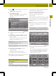
UnitsUnits
Selects km-display
(metric) or mi-display
(imperial)for the map
mi =miles
X
Press UnitsUnits.
The setting switches between
metric and imperial.
InfoInfo
Shows the respectivemap
data version for all
countriescontained in
the map
X
Press Info
Info.
X
Press 9 or : to scroll in the
list.
Speed limitSpeed limit
(Expert mode)
The maximum permissible
speed is shown when the
corresponding map data
is available and the
Speed limitSpeed limit functionis
not deactivated.
Awarning tone sounds if
the maximum permissible
speed is exceeded and one
of the Warning at xWarning at x
km/hkm/h settings is
activated.
i
The maximum
permissible speed
display may differ from
the actual traffic
situation, e.g. as a
result of incorrect map
data.
X
Press Speed limit
Speed limit.
X
Press WarningWarning at xat x km/hkm/h (several
settings possible), ShowShow
without warningwithout warning or Do notDo not
showshow in the list.
Your device codeYour device code
The device code is
required for map updates.
X
Press Your device codeYour device code.
The device code is shown.
i
The Plot GPS trackPlot GPS track function (Expert mode) is described in the "Route guidance"
section (Y page 49).
Point of interest on the map (Expert
mode)
Displaying point of interest symbols on
the map
Pointsofinterest are, for example,
Restaurant/NightlifeRestaurant/Nightlife, ShoppingShopping
centercenter, CinemaCinema or Gas stationGas station.The
corresponding symbols can be displayed on
the map.
i
The symbols are not shown on all map
scales.
56
Map operationand settings
>> Navigation.