
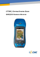
User's Manual


Page 2
2. OVERVIEW
2.1. FEATURES
LT500 is a handheld GNSS RTK receiver and a precision GIS data
collector that incorporate a survey-grade professional L1/L2 GNSS core
engine as well as Microsoft Windows Mobile® WEHH operating system.
LT500 comes in a rugged design suitable for all your demanding survey
and construction environment as well as numerous mapping
applications. LT500 is optimized to run with Carlson SurvCE® 3 field
survey software and/or DigiTerra Explorer 7 GIS data collection
software.
2.2. SPECIFICATIONS
GNSS characteristics
- 120-channel professional NovAtel OEM6 core
- GPS+GLONASS+BeiDou, L1/L2
- SBAS support (WAAS, MSAS and EGNOS)
- Update Rate: 1Hz, or higher
- Time to first fix : < 50 s typical
- Initialization time in Network RTK mode: <30 s typical
- External Antenna support
Performance specifications
(1)
- Autonomous: < 2 m RMS
- -time accuracy: < 1 m HRMS typical
-
Horizontal (External Antenna): 2 cm + 1 ppm
Horizontal (Internal Antenna): < 10 cm + 2 ppm
Initialization time: < 30 s typical
Initialization reliability: > 99.9%
System configuration
- Windows Mobile WEHH operating systems
- 4.3” VGA sunlight readable screen
- 806 MHz Intel PXA processor
- Internal memory : 512MB RAM and 256 MB internal flash storage
- Micro SD card slot up to 32 GB
- 5.0 megapixel camera with autofocus
Communications