
User's Manual
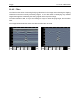
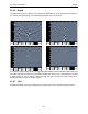
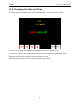
Table Of Contents
- 1 General Overview
- 2 Noggin Components
- 3 Noggin 100 Assembly
- 4 SmartCart Assembly
- 5 SmartTow Assembly
- 6 SmartHandle Assembly (Noggin 500 & 1000 only)
- 7 Rock Noggin Assembly (Noggin 500 & 1000 only)
- 8 Connecting GPS
- 9 Digital Video Logger (DVL)
- 10 Powering Up the System
- 11 Locate & Mark Mode
- 12 Survey & Map Mode
- 12.1 Survey & Map Menu
- 12.2 Data Acquisition
- 12.2.1 Replaying or Overwriting Data
- 12.2.2 Screen Overview
- 12.2.3 Position Information
- 12.2.4 Data Display
- 12.2.5 Section C - Menu
- 12.2.6 Gain
- 12.2.7 Collecting Data using the Odometer
- 12.2.8 Collecting Data in Free Run Mode
- 12.2.9 Collecting Data using the Trigger (or B) Button
- 12.2.10 Noggin Data Screens
- 12.2.11 Calib. (Calibration) Menu
- 12.2.12 Error Messages
- 12.3 Noggin Setup
- 12.4 Noggin File Management
- 12.5 Noggin Utilities
- 13 Troubleshooting
- 14 Care and Maintenance
- Appendix A Noggin Data file Format
- Appendix B Health & Safety Certification
- Appendix C GPR Emissions, Interference and Regulations
- Appendix D Instrument Interference
- Appendix E Safety Around Explosive Devices
- Appendix F Using the PXFER Cable and WinPXFER Software
- F1 Transferring Data to a PC using the PXFER Cable
- F1.1 Connecting the Digital Video Logger to a PC
- F1.2 PXFER Cable Types
- F1.3 Installing and Running the WinPXFER Program
- F1.4 Setting the DVL to the PXFER Cable Type
- F1.5 Transferring Noggin Data Buffer Files
- F1.6 Exporting Nogginplus Data
- F2 Transferring One or More Noggin PCX Files to an External PC using WinPXFER
- Appendix G GPR Glossaries

12-Survey & Map Mode Noggin
68
Grid collection involves collecting data in an organized pattern over an area. This type of data
acquisition allows the GPR data to be presented as plan maps with the EKKO_Mapper software
or 3D volumes with the EKKO_Mapper 3D software.
For inexperienced surveyors, laying out a grid with straight lines and all the corners at 90
degree angles can be difficult. Sensors & Software provides a product called EasyGrid to
make laying out an accurate grid simple. Contact Sensors & Software for more details.
The Grid menu allows the user to select a grid number and line number to save each data file to.
Before the data acquisition on a grid begins, the user must define the size of the area to be
surveyed, the direction of the survey lines and line spacing. The details of the grid survey are
specified in the Grid Setup menu option (Section 12.3.4: P.97).
12.1.3 Setup
There are many background setup parameters related to the Noggin Smart Systems operation
for line and grid surveys that can be edited. This menu allows the user to display and change
various settings for different aspects of the Smart system (see Section 12.3: P.84). The user can
also reset all the parameters to the factory default settings.
12.1.4 File Management
The File Management menu allows the user to delete data from the DVL and copy data from the
internal compact flash drive to the removable compact flash drive.
The Export options in this menu require the use of the optional PXFER cable and WinPXFER
software so this menu is not required for users transferring Noggin data using the removable
compact flash drive. This type of data transfer is described in Appendix F.
12.1.5 Run without Saving Data
This option allows the user to go straight into data acquisition. This feature is to allow a “quick
look” at the data in the area. The data collected when in this mode are NOT saved and cannot be
reviewed later or exported. Data that scrolls off the edge of the screen is gone and cannot be
reviewed.
If a GPS receiver is attached to the DVL, GPS information can be logged to a file even when the
Noggin data are not being saved (see Section 12.3.5: P.103).
12.1.6 Utilities
This menu has utility programs to:
a) Change the Date and Time on the DVL (see Section 12.5.1: P.110)
b) Calibrate the odometer (see Section 12.5.2: P.110),
c) Use the optional PXFER cable and the WinPXFER software installed on a PC
to transfer upgraded firmware to the DVL (see Section 12.5.3: P.111),
d) List or print or transfer system information to assist Sensors & Software in
troubleshooting problems with your system (see Section 12.5.4: P.111) and