
User's Manual
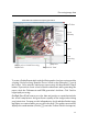


Processing image data
Glossary
AMSL Above Mean Sea Level
Your eBee’s altitude can be shown and set in eMotion using ATO or AMSL.
Your drone uses the EGM96 mean sea level standard for navigation.
ATO Above the Take-off Altitude
Your eBee’s altitude can be shown and set in eMotion using ATO or AMSL.
Altitudes in ATO are relative to the place your eBee started its motor just
before take-off.
DSM Digital Surface Model
A 3D digital representation of a surface.
FTDI Future Technology Devices International
A Scottish semiconductor device company specialising in Universal Serial
Bus (USB) technology. FTDI cables allow serial connections through a USB
cable. eMotion uses FTDI technology to connect to the ground modem.
You can often connect a computer to a GNSS base station using FTDI.
geo-reference A data point associated with a specific location on the earth’s sur-
face.
GSD Ground Sampling Distance
The distance measured on the ground between pixel centres in an image
or DSM. The smaller the GSD, the higher the spatial resolution of the image.
For example, a GSD of 5 cm means that one pixel in the image represents
5 cm on the ground.
mosaic A single map or terrain model created from several map sections that
have been placed side-by-side and merged together.
orthomosaic A single, corrected image constructed either from several images
taken from different angles, or from several orthophotos. Distortions due
59