ROUTE 66 Mobile 8 User Manual 1
ROUTE 66 Mobile 8 User Manual Copyright © 1993-2008 ROUTE 66. All rights reserved. ROUTE 66 and the ROUTE 66 logo are registered trademarks. Data copyright © NAVTEQ B.V. IMPORTANT REMARK: No part of this publication may be multiplied, be stored in a databank and electronically, mechanically, through photocopying, on sound carriers or in any other way be copied, without the explicit written approval of ROUTE 66. All other marks are the property of their respective owners.
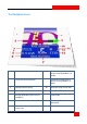
ROUTE 66 Mobile 8 User Manual Table of Contents Navigation screen....................................... 6 Send Information ...................................... 31 Main Menu Options.................................... 7 Save Information ...................................... 32 Contextual Menu Options........................... 8 GPS Information ....................................... 33 Searching Mode .......................................... 9 Route Information .................................
ROUTE 66 Mobile 8 User Manual Select and Open Category ........................ 56 Activate Travel Service.............................. 75 Select and Display Camera ....................... 57 Locate Travel Guides ................................ 75 Use Safety Cameras.................................. 57 Display Travel Info. ................................... 76 Weather.................................................... 58 Download Travel Guides...........................
ROUTE 66 Mobile 8 User Manual Automatic Zooming.................................. 94 Traffic Interval ........................................ 106 Alarm Speed.............................................. 95 Weather Interval .................................... 107 Alarm Type................................................ 96 Cameras Interval .................................... 107 Speed: Slider ............................................. 97 Publish Position.......................................
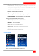
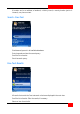
ROUTE 66 Mobile 8 User Manual The Navigation Screen 1 Road code 8 Graphi cal representa tion of current route. By defaul t, i t is purple. 2 GPS a rrow (current position) 9 Graphi cal representa tion of current turn. By defaul t, i t is green.
ROUTE 66 Mobile 8 User Manual Main Menu Options The Main Menu contains the mos t frequentl y used options . To open the Main Menu, select Options. The following options a re alwa ys a vailable during na viga tion or map browsing: Search – Select a database a nd find the places you need. Navigate – Select a da tabase and find the places you need. Travel mode – Select the na vi ga tion mode that bes t sui ts your needs (dri ve on the fas tes t route, dri ve on the shortes t route, or walk).
ROUTE 66 Mobile 8 User Manual Exit – Termi nate the current working session. Two more options a re a vailable onl y duri ng na vi ga tion: Stop navigation – Interrupt the current na viga tion. Define road block – Avoid a segment of the trip and find an al terna ti ve route. Contextual Menu Options The contextual menu contains the mos t relevant options for the current screen. The contextual menu contains ma ximum six options . To open the contextual menu, press the s croll key.
ROUTE 66 Mobile 8 User Manual Show information – Pla ce the cursor over any map object (ex. s treet, house, a rea) and displa y an information balloon. The informati on balloon disappea rs when you move the curs or to a di fferent posi tion on the map. Call –Dial the phone number of selected item. Save cursor position – Sa ve (in the appli cati on) your cursor posi tion. Send cursor position – Send (to somebody else) your cursor posi tion.
ROUTE 66 Mobile 8 User Manual A l ocation can be a n address, a landma rk, a history record, a nea rby loca tion (point-ofinteres t), or a phone contact. Search - Free Text Si mul taneously sea rch in all a vailable da tabases. Enter keywords and sta rt the sea rch query. Scroll the lis t of resul ts . Sta rt the sea rch query. Free Text: Results All resul ts tha t ma tch the Free text sea rch cri teria a re displa yed in the next view. Scroll the lis t of resul ts . Filter the resul ts , if necessary.
ROUTE 66 Mobile 8 User Manual Search - Address Sea rch locati ons by street name, city name, postcode or house number. Enter keywords and sta rt the sea rch query. Scroll the lis t of resul ts . Sta rt a search query. Address: Results All resul ts tha t ma tch the Address search cri teria a re displayed in the next view. Scroll the lis t of resul ts . Filter the resul ts , if necessary. Select an i tem from the lis t.
ROUTE 66 Mobile 8 User Manual Search - Nearby You can sea rch loca tions by selecting a ca tegory of landma rks . For exa mple, to find all res taurants a round your current position, select the Ea ting & Dri nking category. Select a ca tegory. Select the sea rch a rea. Sta rt the sea rch query. Scroll the list of resul ts. All resul ts tha t ma tch the search cri teria a re displayed in the next view.
ROUTE 66 Mobile 8 User Manual a round curs or posi tion – sea rches all loca tions tha t a re a round the current cursor position and whi ch match the selected ca tegory. a round depa rture –searches all loca tions tha t a re a round the route depa rture and whi ch ma tch the selected category. Notes : Covera ge for along the route - The resul ts a re physi cally loca ted on an a rea of 20 km along the road (10 km on the left side a nd 10 km on the right side).
ROUTE 66 Mobile 8 User Manual Search - History This view lists all history records . Any loca tion used during na viga tion (depa rture point, desti nation point, wa ypoints) is recorded as a history i tem. Any history record can be used for future na viga tions . The his tory records a re listed as they occurred: the mos t recentl y used record is the fi rst i n the list; the ol dest record is the last in the list. 100 records can be s tored in the His tory lis t.
ROUTE 66 Mobile 8 User Manual Any address, his tory record, nea rby loca tion, or point on the map can become a landma rk. Landma rks a re used when you s ta rt na viga ting, plan tri ps, or browse the map. All a vailable landma rks a re listed in alphabeti cal order. Home and Office a re two special landmarks a vailable by defaul t. Before you can use them you mus t configure them. Home is alwa ys the fi rst i tem i n the list. Office is alwa ys the second i tem in the list.
ROUTE 66 Mobile 8 User Manual Set Office Location Office is a special landma rk. It is a fa vouri te loca tion of grea t i mporta nce to you. It can be, for example, your real offi ce address . Before you can use the offi ce loca tion, you must confi gure i t. Select a da tabase and fi nd a loca tion. Sa ve that loca tion as your Office landma rk. Landmark Editor Landma rks a re fa vouri te locati ons you can use for na viga tion or when you plan trips .
ROUTE 66 Mobile 8 User Manual change the details of a landma rk; view the details of a landma rk. Scroll the lis t of landma rks a nd select an i tem. Select Options > Edit. Search - Contacts This view lists all conta cts a vailable on your mobile phone. Scroll the lis t of a vailable contacts . Note: If (no da ta ) is displa yed in this view, i t means tha t you ha ve an empty Contacts list on your mobile phone. Select an opti on.
ROUTE 66 Mobile 8 User Manual Contacts Editor You can view or modify the details of a conta ct. Voice Instructions During na vi gation, for ea ch cha nge of di rection (“turn”), ROUTE 66 Mobile 8 provides both a visual ins truction and a voice ins tructi on. Generall y, a voice ins tructi on is hea rd twice: fi rs t in advance (the wa rning dis tance is approx. 300 meters or ya rds before the a ctual change of di rection); secondl y, when the turn must be done (the wa rning dis tance is approx.
ROUTE 66 Mobile 8 User Manual To change the language of the voi ce ins tructions , refer to Settings > General > Voice language. To confi gure the sound i ntensity of your devi ce, refer to your mobile phone’s User Ma nual. To turn off the voice ins tructions, press 9. What is Trip Planning? Depending on the complexi ty of a route, and the frequency of using this route, you ca n s ta rt na viga ting: by simpl y indi ca ting your destina tion a nd, i f necessa ry, a wa ypoint along the route.
ROUTE 66 Mobile 8 User Manual di rectl y from the map: when the cursor indi ca tes a l ocation on the map, press the s croll key and select Add to route. from the main menu: select Options > Trips > Plan new route. from a ny list: hi ghlight an i tem and select Options > Add to route. Provide the trip name. Open Plan new route wi za rd. Add the Departure loca tion. Add the Destination loca tion. Add other wa ypoints . Repea t this s tep for ea ch wa ypoint. Sta rt na viga tion.
ROUTE 66 Mobile 8 User Manual Define Departure Change – opens the Add waypoint view in order to replace the selected i tem with a di fferent one. Set departure – opens the Set departure vi ew and allows you to locate the place you need for the departure of this trip. Set destination – opens the Set destination view and allows you to l ocate the place you need for the des tina tion of this trip. Add waypoint – opens the Add waypoint vi ew. Refer to Add waypoint section for details.
ROUTE 66 Mobile 8 User Manual Define Destination Change - opens the Add waypoint view in order to repla ce the selected item with a di fferent one. Set departure – opens the Set departure vi ew and allows you to locate the place you need for the departure of this trip. Set destination – opens the Set destination view and allows you to l ocate the place you need for the des tina tion of this trip. Add waypoint – opens the Add waypoint vi ew. Refer to Add waypoint section for details.
ROUTE 66 Mobile 8 User Manual Add Waypoint A tri p consists of a depa rture loca tion, a des tina tion loca tion, and an unlimi ted number of wa ypoints (i ntermediary s tages along the route) you intend to rea ch during your na vi ga tion. Use the sea rching mode to find and add the loca tions you need for your trips . Sea rch a da tabase and find the loca tion you need. Add loca tion to tri p.
ROUTE 66 Mobile 8 User Manual show on the map the enti re tri p. Refer to Show route for details. show trip details. simula te route. Refer to Simulate route for details. select the tra vel mode. change the trip content. delete the currentl y edi ted trip. modi fy the order of wa ypoints in the list. Show route – displa ys on the map the planned tri p. Show route details – opens the route des cription. Start navigation – s ta rts a new na viga tion, based on the current trip.
ROUTE 66 Mobile 8 User Manual Add waypoint – opens the Add waypoint vi ew. Refer to Add waypoint section for details. Move – changes the posi tion of the selected loca tion in the list and along the route. Delete - removes the selected loca tion (destina tion, depa rture or wa ypoint) from this tri p. Delete route – permanentl y removes the current trip from the appli cation. Map display - jumps from one l oca tion on the map to another, based on the i tems in the list.
ROUTE 66 Mobile 8 User Manual delete the selected trip. Open – opens the selected trip in edit mode. Mark/Unmark– selects a trip (or several trips ) from the list. The following options a re a vailable: Mark – selects the highlighted trip. Mark all – selects all trips in the list. Unmark – deselects the highlighted trip. Unmark all – deselects all trips in the lis t. Rename – allows you to provide a different name for the selected tri p.
ROUTE 66 Mobile 8 User Manual Depa rture is marked by a green flag. Des tina tion is ma rked by a checkered flag. Wa ypoi nts a re ma rked by blue ci rcles . Show list – s witches to the List view mode. Show route – opens the Route description vi ew. Start navigation – s ta rts a new na viga tion, based on the current trip. Simulate route – pla ys a trip demons tra tion. Send route - the current route is sent to another user. Travel mode – selects the method of tra velling.
ROUTE 66 Mobile 8 User Manual Resume = Continues the simula tion from the freezing point. Resume toggles to Pause. Back = Returns to Trips Restart = Res ta rts the simula tion from the very beginning. Restart toggles to Pause. Back = Interrupts the simulati on During the simulated trip, a limited number of options a re a vailable: Scroll up to increase the simula tion speed. Scroll down to decrease the simulation speed.
ROUTE 66 Mobile 8 User Manual Route Description An al terna ti ve to the na vi gati on ba r is the list display. It contains the same dri ving ins tructions but i n a simplified list. Route des cription: Info section: tra vel mode total length of route es tima ted dura tion of trip (in hours and minutes) Dri vi ng ins tructi ons Traffi c messages If the route contains a tra ffi c incident, this incident is indi cated by an i con and a short des cription.
ROUTE 66 Mobile 8 User Manual Avoid Trip Sections For va ri ous reasons (ex. crowded a reas , a ccidents , road works), you ma y decide to a void a pa rt of the planned route. Thus, that road segment is excluded (a voided) from your trip. An al terna ti ve route is cal culated automati call y, and you can continue your na viga tion wi thout any interruption. During na viga tion, you can a void a pa rt of the planned route in two wa ys : Select Options > Define road block.
ROUTE 66 Mobile 8 User Manual A roa d block i con is displa yed on the map. An alterna ti ve route is automa ti call y calculated, and the na vi ga tion continues . Avoid Incident Select Options > View > Lis t display. In the Route description, select a tra ffi c incident. Select Options > Avoi d incident. Taking into a ccount the tra ffi c incident to be a voided, a detour is searched and i ncluded i n the route. The route is automa ti cally recal cula ted and the na vi gation continues.
ROUTE 66 Mobile 8 User Manual Via text message Via multimedia Via e-mail Via Bluetooth Notes: Refer to your mobile phone’s User Ma nual for configurati on details. Conta ct your mobile phone provider for technical support.
ROUTE 66 Mobile 8 User Manual Cursor position – sa ve the cursor position as a new landma rk or conta ct, or update a landma rk or conta ct. Select Options > Sa ve. As landmark – opens the New landmark view. Update landmark – opens the Update landmark view. As contact – opens the New contact view. Update contact – opens the Update contact vi ew. GPS Information Press 5 to a ccess detailed information about the current GPS da ta .
ROUTE 66 Mobile 8 User Manual View 2: Detailed cha rt of cons tellation of satelli tes in view View 3: Si gnal s trength for the sa tellites in view Verti cal ba rs View 4: Si gnal s trength for the fi rs t 6 sa tellites in view Horizontal ba rs 34
ROUTE 66 Mobile 8 User Manual Route Information During na viga tion, you can view s tatis ti cal informa tion about your current tri p and about your overall na vi gati on. Travel dist. – distance you covered during your current na viga tion (compa red to the Odometer val ue) Travel time – ti me you spent during your current na vi gati on (compa red to the Total time value). Avg. speed – a vera ge speed of your pers onal ca r or lorry. Max. speed – ma ximum speed of your personal ca r or l orry.
ROUTE 66 Mobile 8 User Manual Stop – s tops counters . The s ta tisti cal data freezes to the last known values. Resume – res ta rts counters from the last known values . Reset – cancels the s ta tisti cal da ta for your current tri p (zero for Travel dist. and Travel time). The other counters a re not infl uenced. Restart – resets all counters to zero and s ta rts gathering new s tatis ti cal da ta . Clear – enabled when all counters a re s topped (Stop). It resets all counters to zero.
ROUTE 66 Mobile 8 User Manual Update Contact You can upda te an exis ting conta ct by a dding (sa ving) the details of a list i tem, the current GPS position or the cursor position. The modified conta ct will be used for future na vi ga tions . The Update contact selection list is displa yed. Select a conta ct. Provide the details and sa ve the modified contact.
ROUTE 66 Mobile 8 User Manual Extras ROUTE 66 provides Extra servi ces to ROUTE 66 Mobile 8 users . Available servi ces va ry based on the country, opera tor and local legislati on. Exa mples of extra servi ces include Maps and Travel guides. Note: To full y use these servi ces (purchase, upda te, etc.
ROUTE 66 Mobile 8 User Manual ROUTE 66 Online Store Go to Options > Extras. Browse the ca tegories and subca tegories of purchasable content. Select an i tem. Download the i tem. Provide the credi t ca rd informa tion.
ROUTE 66 Mobile 8 User Manual by credi t ca rd: provide your credi t ca rd details. by phone billing: the detailed purchasing transa ctions will be incl uded in your (monthl y) phone bill. by voucher: enter the voucher code. The a vailability of this method of pa yment depends on the country and region of purchase. The following items a re a vailable: Credit card number Expiry date (MMYY) Card holder Security code Enter the credit ca rd number (15 di gits ).
ROUTE 66 Mobile 8 User Manual Enter the expi ry da te of your credi t ca rd (4 di gi ts). The fi rst 2 digi ts represent the expi ry month (from 01 to 12); the las t 2 di gits represent the expi ry yea r (from 00 to 99, where 00 represents 2000 and 99 represents 2099) Note: The OK button is hidden until you enter all 4 digi ts . Enter the complete name of the credi t ca rd hol der (ma ximum 200 cha ra cters). Note: The OK button is hidden until you enter a t least one cha ra cter.
ROUTE 66 Mobile 8 User Manual Enter the securi ty code of your credi t ca rd (3 digi ts ). Note: The OK button is hidden until you enter all 3 digi ts . When completed, the a cti va ted content or servi ce is transferred to the Available list.
ROUTE 66 Mobile 8 User Manual ROUTE 66 Sync Application 1. Exi t the applica tion. 2. Connect the phone to the PC via the USB cable. 3. Insert the ROUTE 66 Sync DVD into the DVD dri ve. 4. Sta rt the ROUTE 66 Sync appli cation. 5. In ROUTE 66 Sync applica tion, s witch to ROUTE 66 Store. 6. Browse the ca tegories and subca tegories of purchasable content. 7. Select an i tem. 8. Cli ck on Add to cart. 9. Cli ck on Checkout. 10. Enter your email and phone number, then cli ck Next. 11.
ROUTE 66 Mobile 8 User Manual 13. Cli ck Submit. The pa yment informa tion is processed. 14. The di gi tal content is downloaded on the PC. A purchase confi rma tion e-mail is sent to the buyer. 15. When the downloading completes , you a re prompted to copy the downloaded content on your phone. Click Yes to copy and i nstall on your phone the purchased content. 16. Now, the content is a vailable in the Extras lis t and ca n be used in the appli ca tion.
ROUTE 66 Mobile 8 User Manual Maps When you cross the border from one country to another, you must change the currentl y used map in order to match your physi cal locati on (GPS coordina tes) wi th the ma p coverage. The Maps view displays all maps a vailable on your devi ce. Switch from one map to another when necessa ry. Refer to Activate maps section for details about a cti va ting other maps . Refer to Settings > Maps for details on how to cus tomi ze the look and beha vi our of the ma ps you use.
ROUTE 66 Mobile 8 User Manual Change Current Map Depending on the product you bought, and the country or region of purchase, at leas t one ma p is already a vailable and a cti va ted on your devi ce. Other maps can be displayed in the Available list, but onl y after you complete the a cti va tion procedure for each new map. You ca n easil y swi tch from the currentl y used map to another a vailable map. From now on, this map will be used for map browsing or na viga tion.
ROUTE 66 Mobile 8 User Manual Open the Shop ca talog. Scroll the lis t of maps you can download and/or a cti va te. The Maps ca talog is s tructured hiera rchi cally, as follows : Continents Regions Countries Ci ties Display Map Information In the Shop ca talog, loca te the map you need. Select Options > Show information. Download Maps In the Shop ca talog, loca te the map you need. Select Options > Download.
ROUTE 66 Mobile 8 User Manual Activate Maps Depending on the product you bought, and the country or region of purchase, at leas t one ma p is already a vailable and a cti va ted on your devi ce. Notes: You need a valid credi t ca rd and a functional GPRS connection in order to obtain a n a cti va tion key. Please note that a cti va ting a map is a purchasable extra servi ce provided by ROUTE 66. Traffic Information This is a purchasable extra servi ce provided by ROUTE 66.
ROUTE 66 Mobile 8 User Manual Locate Traffic Pack. Open the Shop ca talog. Scroll the lis t of pa ckages you can a cti va te. The Traffic information ca talog is structured hiera rchi call y, as follows : Continents Regions Countries Open – displa ys the content of the selected folder. Buy license – s ta rts the subs cribing process . Show information – displa ys pa ckage details.
ROUTE 66 Mobile 8 User Manual Display Pack. Information In the Shop ca talog, loca te the pa ckage you need. Select Options > Show information. Activate Traffic Pack. Sta rt the a cti va tion of the traffi c info servi ce. Product pri ce is displayed. Provide credi t ca rd informa tion. The credi t ca rd informa tion is processed (veri fied). When completed, the a cti vated pa cka ge is trans ferred to the Available list of traffi c i nfo packages .
ROUTE 66 Mobile 8 User Manual A li cense of use is onl y granted for, and compatible wi th, the country or region i t was li censed for. You cannot use the same license for several di fferent countries. Use Traffic Service Upda te the list of tra ffi c messages. Scroll the lis t of tra ffi c messages . Select an incident and displa y i t on the map. Ea ch traffi c incident has two i cons : Offi cial flag of country.
ROUTE 66 Mobile 8 User Manual Ma jor ci ty and region Da te and time when incident was reported Des cription of road segment Type of incident Expected dura tion of incident. Dri vi ng sugges tions (detours ) if possible Update – cl i ck this button to manuall y recei ve new traffi c informa tion. In the popup menu select: around GPS position – upda te the traffi c informa tion content covering an a rea of 20 km radius a round your current GPS position.
ROUTE 66 Mobile 8 User Manual Activate Cameras Service In order to use the safety ca meras servi ce for a pa rti cula r country or region, fi rst you mus t a cti va te (subs cribe to) this servi ce. Subscri bing means obtaining a license of use for a safety camera pa ckage and for a speci fied period of time. Note: You need a valid credi t ca rd and a functional GPRS connection i n order to subscri be to this servi ce. Choose Cameras Pack.
ROUTE 66 Mobile 8 User Manual Display Camera Info. Before purchasing a servi ce, check the pri ce, descri ption and validity period. In the Shop ca talog, loca te the pa ckage you need. Select Options > Show information. Download Cameras After you found the servi ce you need, sta rt downloading the safety ca mera servi ce. In the Shop ca talog, loca te the pa ckage you need. Select Options > Download. Note: The downloading time can va ry, depending on the pa cka ge size and the network condi tions .
ROUTE 66 Mobile 8 User Manual Use Cameras Service OK. You downloaded, a cti va ted and purchased the servi ce. It’s time to re cei ve on your devi ce the real informa tion about safety cameras . After the safety ca meras da tabase is upda ted on your devi ce, you can check the a vailable categories of tra ffic control , and thei r loca tion on the current map. Open the servi ce. Upda te the list of sa fety ca meras . Scroll the lis t of ca tegories and open a ca tegory.
ROUTE 66 Mobile 8 User Manual Select and Open Category The content can va ry, depending on the a vailable tra ffic control devi ces in the selected region. Update – cli ck this button to manuall y recei ve new safety camera informa tion. In the popup menu select: around GPS position – upda te the safety ca mera content covering an a rea of 20 km radius a round your current GPS position. to entire map – upda te the safety camera content covering the entire map.
ROUTE 66 Mobile 8 User Manual Select and Display Camera Upda te – cli ck this button to manually recei ve new safety camera informa tion. Note: Upda ting ca n be also done automa ticall y. Go to Settings > Extras > Camera interval and set the frequency of automa ti cally recei vi ng new informa tion.
ROUTE 66 Mobile 8 User Manual during map browsing, you can check in adva nce whi ch a re the traffi c control devi ces or s peed limi t road segments . Thus, you can plan your tri ps by choosing the fas test route or by a voiding unpleasant events along the route. Weather This is a purchasable extra servi ce provided by ROUTE 66. ROUTE 66 Mobile 8 allows you to recei ve the la test weather forecasts on your devi ce. Thus , you a re informed in advance of the wea ther condi tions along your route.
ROUTE 66 Mobile 8 User Manual Locate Weather Packages Open the Shop ca talog. Scroll the lis t of pa ckages you can a cti va te. Open – displa ys the content of the selected folder. Buy license – s ta rts the subs cribing process . Show information – displa ys pa ckage details. Display Weather Info. In the Shop ca talog, loca te the pa ckage you need. Select Options > Show information.
ROUTE 66 Mobile 8 User Manual Activate Weather Pack. Sta rt the a cti va tion of the wea ther servi ce. Product pri ce is displayed. Provide credi t ca rd informa tion. The credi t ca rd informa tion is processed (veri fied). When completed, the a cti vated pa cka ge is trans ferred to the Available list of wea ther pa ckages . Notes : The purchase procedure is identi cal for all Extras servi ces . Refer to Activate maps section for full details about provi ding the credit ca rd informa tion.
ROUTE 66 Mobile 8 User Manual Open Weather Pack. Show informa tion – displa ys details about the selected wea ther pa ckage (name, des cription, validity, etc.). Open – opens the selected wea ther package Open a Weather Package Options : Add city – add a new ci ty and recei ve ci ty forecas ts .
ROUTE 66 Mobile 8 User Manual Add Cities Before you can recei ve wea ther forecasts , you mus t speci fy whi ch a re the ci ties you a re interes ted in. There a re 3 methods of adding a ci ty: Search - you select one of the a vailable data bases and s ta rt a sea rch query. Special city - you manuall y enter the details of the city (name, lati tude, longi tude). GPS position- your current GPS position is a utoma ti call y sa ved.
ROUTE 66 Mobile 8 User Manual Add City (Custom City) Manually enter the details of the ci ty (name, lati tude, longi tude). Open the editor. Enter the na me, the la ti tude, and the longi tude. All fields a re manda tory. Sa ve the details. The new ci ty is added to the lis t of fa vouri te ci ties. Note: All fields a re manda tory. Please provide valid data . Add City (GPS Position) The details of your current GPS position (na me, coordinates ) a re automa ti cally prefilled. Open the editor.
ROUTE 66 Mobile 8 User Manual Note: All fields a re manda tory. Please provide valid data . Update City Forecast You added your fa vouri te ci ties, but there is no wea ther i nforma tion a vailable. It’s ti me to upda te the wea ther forecas t. Update – cli ck this button to manuall y recei ve new wea ther forecas ts for all ci ties in the list. Note: Upda ting can be also done automa ti call y. Go to Settings > Extras > Weather and set the frequency of automati call y recei ving new forecas ts.
ROUTE 66 Mobile 8 User Manual Weather: Today This is a short report for toda y’s weather condi tions for the selected ci ty. The following informa tion is a vailable: Current weather sta tus (text and i mage) Da y’s a vera ge tempera ture Night’s a vera ge tempera ture Comfort: value Wi nd: di rection and speed UV: i mage and value Precipi t: i mage and value Update – cl i ck this button to ma nuall y recei ve new wea ther forecas ts for all ci ties in the list.
ROUTE 66 Mobile 8 User Manual Weather: Day List This is a summa ry report for the next 15 da ys for a pa rti cula r ci ty. Select Options > View > Da y list. Da y: Weekda y <2 letters > Da te <2 digi ts for da y> <3 cha racters for month> Tempera ture: / Details – opens the Today report for the selected da y. Update – cl i ck this button to manually recei ve new wea ther forecas ts for all ci ties in the list.
ROUTE 66 Mobile 8 User Manual Weather: Graph This is a graphi cal representa tion of the a verage wea ther condi tions for the next 5 da ys for a pa rti cula r ci ty. Select Options > View > Graph.
ROUTE 66 Mobile 8 User Manual Weather: Current Conditions This is a detailed report of the current wea ther condi tions for a pa rti cula r ci ty. Select Options > View > Current condi tions The following informa tion is a vailable: Current weather sta tus (text and i mage) a t Wi nd di rection and i mage Wi nd speed Pressure and ima ge Visibility and ima ge Update – cl i ck this button to manually recei ve new wea ther forecas ts for all ci ties in the list.
ROUTE 66 Mobile 8 User Manual Colour Schemes You ca n easil y change the look of the map elements and the na vi ga tion ba r by using the colour schemes (themes ). Refer to Settings > Maps for details on how to cus tomize the look of the interfa ce. Lis t of colour schemes .
ROUTE 66 Mobile 8 User Manual Scroll the lis t of a vailable s chemes. Select an i tem. Select Options > Open. Select Colour Scheme Open the ROUTE 66 Store ca talog. Scroll the lis t of s chemes you can download and/or a cti va te. The following options a re a vailable: Open – displa ys the content of the selected folder. Download – s ta rts the downloading process. Show information – displa ys map details. Synchronize license keys - allows you to recover your li cense keys .
ROUTE 66 Mobile 8 User Manual Display Colour Scheme Information In the ROUTE 66 Store ca talog, loca te the colour scheme you need. Select Options > Show information. Download Colour Scheme In the ROUTE 66 Store ca talog, loca te the colour scheme you need. Select Options > Download. Activate Colour Schemes Refer to Purchasing Digital Content chapter for details.
ROUTE 66 Mobile 8 User Manual Voices This is a purchasable extra servi ce provided by ROUTE 66. During na viga tion, you ha ve a ccess to two types of i nstructions : Visual ins tructions : na viga tion s creen, na viga tion ba r, a rrow lis t, list view (route details), progress ba r, GPS informa tion, tri p informa tion. Voi ce ins tructions : for ea ch turn ahead on the route, a short ins truction is spoken in the preferred language.
ROUTE 66 Mobile 8 User Manual Locate Voices Open the Shop ca talog. Scroll the lis t of voi ces you can download and/or a cti va te. Open – displa ys the content of the selected folder. Download – s ta rts the downloading process. Show information – displa ys voi ce details. Display Voice Info. In the Shop ca talog, loca te the voi ce you need. Select Options > Show information.
ROUTE 66 Mobile 8 User Manual Download Voices In the Shop ca talog, loca te the voi ce you need. Select Options > Download. Note: The downloading time can va ry, depending on the si ze of the voi ce file and the network conditions. Activate Voices The voice is al ready downloaded. Sta rt the voi ce a cti va tion. Product pri ce is displayed. Provide credi t ca rd informa tion. The credi t ca rd informa tion is processed (verified).
ROUTE 66 Mobile 8 User Manual Travel Guides During na vi ga tion or before you visi t new pla ces , i t’s useful to know a few things about local a ccommoda tion, tra nsport and entertainment. You can ei ther buy pri nted books, or you can jus t check the vi rtual Tra vel Guides provided by ROUTE 66 Mobile 8. Activate Travel Service This is a purchasable extra servi ce provided by ROUTE 66. In order to use the tra vel guides servi ce, fi rs t you must a cti va te (subscri be to) this servi ce.
ROUTE 66 Mobile 8 User Manual Display Travel Info. In the Shop ca talog, loca te the tra vel guide you need. Select Options > Show information. Download Travel Guides In the Shop ca talog, loca te the tra vel guide you need. Select Options > Download. Note: The downloading time can va ry, depending on the size of the tra vel gui de file and the network conditions. Activate Travel Guides The tra vel guide is already downloaded. Sta rt the tra vel guide a cti vati on. Product pri ce is displayed.
ROUTE 66 Mobile 8 User Manual Use Travel Guides After you downloaded and a cti va ted a tra vel guide, it’s time to open it. Scroll the lis t of a vailable tra vel guides. Hi ghlight a tra vel guide. Select Options > Open. A tra vel guide ma rked with a padlock is alrea dy downloaded but not a cti va ted (purchased). Buy license - opens the Credit card info s creen and s ta rts the purchasing procedure. This option is shown for servi ces whi ch a re not acti va ted.
ROUTE 66 Mobile 8 User Manual Settings This section allows you to confi gure your ROUTE 66 Mobile 8 beha vi our and customi ze i ts opera tion, based on your personal needs and preferences . Check the list of a vailable settings . Select and open a section. Default – res tores all settings to the defaul t values . Any personal preference or previous configura tion will be los t.
ROUTE 66 Mobile 8 User Manual Settings: General This view lists all a vailable general settings . Scroll the lis t of a vailable options . Select an option and open the corresponding submenu. Volume Set the sound level for the voi ce instructions duri ng na vi ga tion. Scroll left or right to increase or to decrease the volume. There a re 10 levels of sound intensi ty. Sa ve the selected level .
ROUTE 66 Mobile 8 User Manual Voice Language Select the language of the voi ce ins tructions during na vi ga tion. Scroll the lis t of a vailable languages . Select a nd save a langua ge. Scroll up or down to select a di fferent langua ge. Map Language Select the language of the current map. This is the langua ge of all objects displa yed on the current map: streets , ci ties, a reas, POIs .
ROUTE 66 Mobile 8 User Manual Backlight Specify the beha viour of the s creen during na viga tion. Ba cklight represents the illumina tion of the s creen. Scroll the lis t of a vailable options . Select an option and sa ve the configura tion. Always on - the s creen is permanentl y illumina ted. During navigation - the s creen is illumina ted onl y duri ng the na vi ga tion. During instructions - the s creen is illuminated onl y when a voi ce ins truction is spoken.
ROUTE 66 Mobile 8 User Manual Show Disclaimer Define the beha vi our of the Disclaimer wa rning. In the list of general settings , highlight Show disclaimer. Press the s croll key i n order to toggle from Yes to No a nd vi ce-versa . Settings: Map This view lists all a vailable map settings . Scroll the lis t of a vailable options . Select an option and open the corresponding submenu. Night Colours Select the beha viour of the s creen colours during night na vi ga tion.
ROUTE 66 Mobile 8 User Manual By using night colours during a ni ght na viga tion, you can see the on-s creen i nforma tion more easily. Thus , you are not distra cted by bri ght colours . Scroll the lis t of ni ght colours options . Select and sa ve an option. The following options a re a vailable: On – ni ght colours a re used. Off – night colours a re not used.
ROUTE 66 Mobile 8 User Manual Colour Scheme You ca n easil y change the look of the map elements and the na vi ga tion ba r by using the colour schemes (themes ). Scroll the lis t of a vailable colour schemes . Select and sa ve a col our s cheme. Scroll up or down to select a di fferent colour s cheme.
ROUTE 66 Mobile 8 User Manual 3D Perspective You can easily cha nge the wa y the map is displa yed: 2D perspective - view the map from above, as you look at a printed map. 3D perspective - ha ve a panora mi c view, as you a re a ctuall y seeing the road ahead of you. If you a re in the 3D perspecti ve and you a cti va te the cursor (press the s croll key), you automa ti cally swi tch to the 2D perspecti ve. In the list of map settings , hi ghlight 3D perspective.
ROUTE 66 Mobile 8 User Manual When you a re na vi ga ting in 3D perspecti ve, you ca n change the panora mi c wa y (viewing angle) of percei ving the road ahead. Scroll left or right to select a di fferent value. Select the visualiza tion angle. Scroll left or right to select a di fferent value. Show Scale You can display or hide the map s cale in the upper-right corner of the na viga tion s creen. The map s cale is a gra phi cal and textual aid on the map.
ROUTE 66 Mobile 8 User Manual You can set the beha vi our of the map and the GPS a rrow duri ng na vi ga tion. During na vi ga tion, the GPS a rrow i ndi cates your movi ng di rection (ex. up orienta tion of the GPS a rrow for a northwa rd na vi ga tion, left orienta tion of the GPS arrow for a wes twa rd na vi ga tion). In this case, the GPS a rrow is mobile, while the map is fi xed. However, you can change the beha viour when you a cti va te the map rota tion.
ROUTE 66 Mobile 8 User Manual Show Landmarks You can enable or disable the drawing of the landma rks on the map. Dra wing means showing on the map the i con of landma rk ca tegory. Scroll the lis t of landma rk ca tegories. Select/deselect some or all ca tegories. These are the ca tegories you manuall y defined in ROUTE 66 Mobile 8. You can also ha ve landma rk ca tegories automa ti cally imported from the Nokia La ndma rks appli ca tion.
ROUTE 66 Mobile 8 User Manual Show Points-of-Interest You can enable or disable the drawing of the POI ca tegories on the map. Dra wing means showing on the map the i con of POI ca tegory. Scroll the lis t of POI ca tegories. Select/deselect some or all ca tegories. The following options a re a vailable: All categories – use this opti on to select or unselect all ca tegories. Ca tegories automa ticall y i mported from the Nokia Landma rks appli cation (where a vailable).
ROUTE 66 Mobile 8 User Manual Settings: Navigation This view lists all a vailable na viga tion settings . Scroll the lis t of a vailable options . Select an option and open the corresponding submenu. Travel mode In this view you can select the method of tra veling, or how to reach the final destina tion. Scroll the lis t of use options. Select and sa ve an option. The following options a re a vailable: As fast as possible – tra vel by ca r and use the fas test route to des tinati on.
ROUTE 66 Mobile 8 User Manual Pedestrian – walk to your des tina tion. Scroll up or down to select a di fferent option. Car Type In this view you can select the type of ca r used to rea ch the final des tinati on. This option is a vailable onl y when the Settings > Na vi ga tion > Type of use value is As fast as possible or As short as possible. Scroll the lis t of a vailable options . Select and sa ve an option.
ROUTE 66 Mobile 8 User Manual Navigation Bar Content Select the la yout (content) of the na vi ga tion ba r. Scroll the lis t of a vailable options . Select and sa ve an option. Scroll up or down to select a di fferent option. Navigation Bar Transparency Options > Settings > Navigation > Navigation bar transparency. Select the degree of tra nspa rency of your na vi gati on ba r. Move the slider to the left (mini mum transpa rency) or to the right (ma xi mum transpa rency).
ROUTE 66 Mobile 8 User Manual Call Handling Configure the beha viour of the voi ce ins tructions during a phone call. Scroll the lis t of a vailable options . Select and sa ve an option. Dim instructions – the voi ce ins tructi ons a re lower than the conversati on on the phone. Call and instructions – the voi ce ins tructi ons and the conversa tion on the phone ha ve the same volume level . Beep for instructions – the voice ins tructi ons a re repla ced by a short beep.
ROUTE 66 Mobile 8 User Manual Avoid Toll Roads Enable or disable the Avoid toll roads option. Depending on this configura tion, toll roads will be excluded or not from the calculated route. Thus, for the same depa rture and des tination loca tions , al terna ti ve routes will be a vailable. In the list of na vi gation settings , highlight Avoid toll roads. Press the s croll key i n order to toggle from On to Off. On – excludes toll roads from your route.
ROUTE 66 Mobile 8 User Manual Off - i f you want to manuall y select the zoom level you need; the zoom level you selected is preserved until you manuall y change i t. Alarm Speed Wha t is safety s peed? This is a pers onal preference. You set a ma xi mum speed limit you don’t want to exceed during na vi gation. Thus , when you tra vel and rea ch this speed, a n a cous ti c and/or a visible alarm wa rns you tha t you a re dri ving too fast. See also Settings > Navigation > Alarm type.
ROUTE 66 Mobile 8 User Manual If the entered value is smaller than the minimum value, OK is hidden a nd you ca nnot sa ve the entered value. Alarm Type Set the type of ala rm for the alarm speed. The alarm can be an a cousti c wa rning and/or a graphi cal representation on the s creen. Both alarms wa rn you tha t you a re dri vi ng too fast. See also Settings > Navigation > Alarm speed. Scroll the lis t of a vailable options . Select and sa ve an option.
ROUTE 66 Mobile 8 User Manual Speed: Slider When you s ta rt a na vi ga tion, or when you plan a route, the trip to the des tina tion is cal culated, based on the generi c speed value for ea ch type of road (see Settings > Speed > Advanced for details). When the route is cal cula ted, you can see the esti ma ted tra vel ti me and the es tima ted time of a rri val.
ROUTE 66 Mobile 8 User Manual When you s ta rt a na vi ga tion, or when you plan a route, the trip to the des tina tion is cal culated, based on the generi c speed value for ea ch type of road (see Settings > Speed > Advanced for details). When the route is cal cula ted, you can see the esti ma ted tra vel ti me and the es tima ted time of a rri val.
ROUTE 66 Mobile 8 User Manual Speed: Advanced - Edit When you s ta rt a na vi ga tion, or when you plan a route, the trip to the des tina tion is cal culated, based on the generi c speed value for each type of road. When the route is cal culated, you can see the es tima ted tra vel time and the es tima ted time of a rri val. When you cal cula te a trip and then change the generi c speed values , you will ha ve a new es tima ted tra vel time and a new esti ma ted time of a rri val .
ROUTE 66 Mobile 8 User Manual During na vi ga tion, you ca n be wa rned in advance that you a re approa ching a speci fi c loca tion along your route. For example, select the POI category Eating & Drinking; this means tha t you will be wa rned when you a re approa ching a res taurant. The wa rning can be an i con (displa yed in the upper-left corner of the na viga tion s creen), a sound, or both.
ROUTE 66 Mobile 8 User Manual To deselect an indi vi dual i tem, s croll the list, highlight i t and press again the s croll key. When you select an item, the defaul t ala rm is automa ti cally applied to tha t i tem. If you select Yes, you can manually set the following settings : visual alarm, wa rning s ound, wa rning distance, wa rning onl y on route. Note: Ea ch ti me you cus tomize a ca tegory, ROUTE 66 Mobile 8 sea rches all audio files a vailable on your phone.
ROUTE 66 Mobile 8 User Manual To select an indi vidual i tem, s croll the list, highli ght it and press the s croll key. To deselect an indi vi dual i tem, s croll the list, highlight i t and press again the s croll key. When you select an item, the defaul t ala rm is automa ti cally applied to tha t i tem. If you select Yes, you can manually set the following settings : visual alarm, wa rning s ound, wa rning distance, wa rning onl y on route.
ROUTE 66 Mobile 8 User Manual Warn only along route: On/Off – when the value is On, the appli cati on ignores loca tions whi ch a re not pla ced on the cal cula ted route. A loca tion is considered on the route if the physi cal distance from the road to tha t pla ce is less than 50 meters/60 ya rds, or when the loca tion is on a seconda ry road (parallel, perpendi cula r or otherwise). Warning Sound In this view you select the ringtone or musi c clip to be used when an alarm is triggered.
ROUTE 66 Mobile 8 User Manual Warning Distance In this view you specify the distance from user to POI loca tion when an alarm is triggered. Enter a numeri c value and sa ve the new setting. An ala rm is tri ggered when the dis tance (in meters or ya rds) from you to the POI loca tion is rea ched.
ROUTE 66 Mobile 8 User Manual Access point – lis t of a vailable GPRS servi ce providers and current GPRS servi ce provider. Traffic interval – current tra ffi c interval . Weather interval – current weather interval . Camera interval – current safety cameras i nterval . Publish position - Enable or disable the sending of your GPS position to a server a t regula r intervals or never. Scroll the lis t of a vailable settings . Select and open a submenu. Sa ve the new settings .
ROUTE 66 Mobile 8 User Manual Access Point Define a ccess points . This is a list of a vailable GPRS servi ce providers . You need an a ccess point to a ccess or download informa tion. Refer to your phone’s User Manual for techni cal details. Scroll the lis t of a vailable GPRS provi ders . Select and sa ve a GPRS provider. Note: The lis t of servi ce providers differs from country to country. Traffic Interval Specify the frequency (in minutes) of recei ving new traffi c informa tion on your devi ce.
ROUTE 66 Mobile 8 User Manual Select and sa ve a frequency. Weather Interval Specify the frequency of recei ving new wea ther informati on on your devi ce. This option is a vailable onl y after the Weather servi ce was a cti va ted. Scroll the lis t of a vailable wea ther intervals. Select and sa ve a frequency. Cameras Interval Specify the frequency of recei ving new sa fety camera informa tion on your devi ce. This option is a vailable onl y after the Sa fety Ca meras servi ce was acti va ted.
ROUTE 66 Mobile 8 User Manual 10 / 20 / 30 minutes – your current GPS positi on will be sent to a server every 10 / 20 / 30 minutes . Legend Unders tand the meaning of all objects displa yed on the map. Toggle from one tab to another. Scroll the list of a vailable i tems . Open an i tem (where appli cable). Legend: Symbols View all pla ce s ymbols and road numbers . Scroll the lis t of a vailable i tems .
ROUTE 66 Mobile 8 User Manual Open an i tem (where applicable). Legend: Roads View all road types and the corresponding colours . Scroll the lis t of a vailable i tems . Open an i tem (where applicable). Legend: Areas View all a rea objects. Scroll the lis t of a vailable i tems . Open an i tem (where applicable).
ROUTE 66 Mobile 8 User Manual Zoom Map You can change the zoom level by using the phone keys . Press * to zoom in. Press to zoom out. Press a nd hold * to keep on zooming in to the desi red level. Press a nd hold to keep on zooming out to the desired level. Press 8 to display the enti re map. You can also change the zoom level by using the options in the Zoom menu: Select Zoom > in to zoom in. Select Zoom > out to zoom out.
ROUTE 66 Mobile 8 User Manual of the current zoom level); after you cross the s treet junction, the zoom level will be es tablished to the ini tial level . Location Based Service This is a purchasable extra servi ce provided by Route 66. ROUTE 66 Mobile 8 allows you to find the nea res t poi nts-of-interes t a round your GPS position or around the screen center. You can also become pa rt of a communi ty of users (“friends ”). This is a web servi ce. The applica tion beha ves as a web browser.
ROUTE 66 Mobile 8 User Manual Ca tegories of poi nts-of-interes t – depending on your physi cal loca tion, the appli ca tion searches for the fi rst 10 landma rks tha t a re the nea res t to you. Friends – depending on the number of people belonging to the group you a ccessed, the appli ca tion genera tes a list of friends . You can conta ct them, displa y their position on the map, or na vi ga te to them.
ROUTE 66 Mobile 8 User Manual LBS – List of Friends After the list of friends is loaded you will see: the s creen na me of friends ; the dis tance between user and friend; the email of friends ; the phone number of friend.
ROUTE 66 Mobile 8 User Manual Disclaimer This servi ce is provided by ROUTE 66 and Bibi t Global Pa yments Servi ces . For any questi ons please conta ct support@66.com. By purchasing you a ccept the TERMS OF USE & PRIVACY NOTICE, see www.66.com\legal\. To the ma ximum extent permi tted by a ppli cable la w, ROUTE 66, i ts subsidiaries and licensors hereby disclaim all liability a rising out of any use of this product, servi ces and i ts contents .