
User Guide


13
THE MAIN
INTERFACE
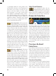
Once the game has finished loading, you will
see the main interface. It consists of a large map
that displays the provinces in a small portion of
the world, and a variety of buttons and other
interface elements that you will use frequently
while playing. In this section, we will give you
an overview of this interface and provide refer-
ences to the chapters where you will find more
detailed information about each of the game’s
elements and features.
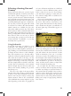
The Main Map
The largest portion of the screen is filled with
a main map. The world is divided into ap-
proximately 1700 individual provinces, shown
on the map with a thin, dotted grey border.
About 450 of these are water provinces which
your fleets will use to navigate and explore the
world. The remaining 1250 are land provinces
which have various types of terrain. You may
see forests, swamps, rivers, hills and mountains,
all of which will have an impact on the move-
ment and combat capabilities of your armies.
We will discuss this in detail in the chapter on
the Military.
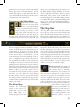
Land provinces are the main building
blocks of nations. Each province generates im-
portant tax and trade revenues to support your
country’s economy, and contributes manpower
that is used to build and maintain your mili-
tary forces. National borders are drawn on the
map using a thick, continuous red line. Only
land provinces may be owned by a country.
Water provinces are never owned, and do not
contribute to a nation’s economy in any way.
Historically, provinces usually contained