
User's Guide


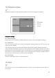

Table Of Contents
- Welcome to the Q Experience 2.0.
- Important information
- Introduction
- 1 Sidebar
- 2 View
- 3 Application
- 4 Home menu
- 5 Map
- 5.1 Map basics
- 5.2 Location properties
- 5.3 Navigation/ Set a destination
- 5.4 Map’s application menu
- Widgets
- 5.5 Chart settings
- Chart orientation
- Heading line
- Show trail
- Autocenter
- Autozoom speed limit
- Low speed zoom level
- Easy view™
- SonarChart™
- 2D shading
- Community edits
- Chart details
- Satellite overlay
- Satellite overlay opacity
- Default zoom level
- Safe water depth
- Shallow water depth
- Spot soundings
- Depth contours
- Minimum fishing range
- Maximum fishing range
- Reset chart settings
- 5.6 Location and route properties
- 6 Dashboard application
- 7 Compact dashboard widget
- 8 Fishfinder
- 9 Radar
- 10 Music
- 11 Weather
- 12 Info
- 13 Settings
- 14 Q Mobile App
- 15 Glossary

33
11 Weather
The Weather App provides real time weather forecasts for the next 24 hours, based on
AccuWeather’s weather data.
Launch the Weather application by opening the Home menu and selecting
Weather
. The
Weather application consists of a tab list on the left and a content area on the right.
Weather is a utility application, that opens on top of your current view. To close Weather
application and return to your previous view, press the (X) close button in the top right
corner.
Weather app
The Tab list on the left features daily overviews for the next 5 days. If you have upgraded
your AccuWeather service, you are also able to view the hourly forecasts for up to 7 days
ahead.
The Content area on the right features the hourly forecast for the selected date and up to 12
hours ahead.