
Operation Manual


Table Of Contents
- Hardware User Manual
- Software User Manual
- Contents
- How do I get started?
- How do I use the touch screen?
- How do I go from A-B?
- How do I view my route?
- How do I create a trip with multiple stops?
- How do I capture a location or a journey?
- MY PLACES
- How do I search for a POI?
- How do I receive current traffic information via TMC?
- What is Travel Book?
- What can I customise?
- What is the NavDesk?
- For more information
15
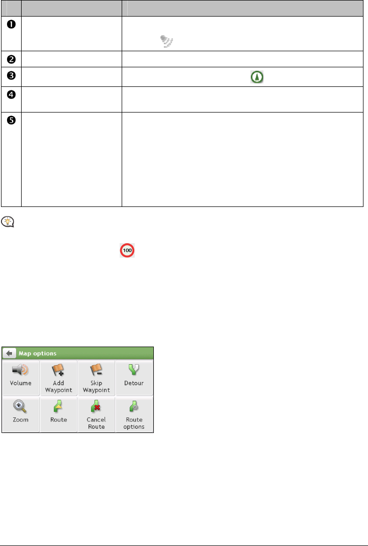
Item Description
Direction and distance of
next turn
The direction and distance to your next turn.
Tap
to repeat the vocal instruction.
Current route Your current route is highlighted.
Current position
Your current position is marked with
.
Address bar The current address will be displayed in the text box at the bottom of
the Map screen.
Distance and time
information
Tap to expand and select the following options:
DTG (Distance to Go)
TTG (Time to Go)
km/h or mph (speed) and compass heading
ETA (Estimated Time of Arrival)
Time
Depending on your driving route, you may see some icons that provide different information on your Map
screen. Please note that these icons will not be always displayed during your journeys.
For example: the Speed Limit icon (
) on the Map screen. The Speed Limit icon shows the speed limit of
the current road. If greyed out, you are below this speed limit. When over set limit, you will be warned with an
audible and visual warning.
How do I change the route configuration?
Tap anywhere on the Map screen to bring up the Map options screen, which allows you to change the
route-related configuration.
For more information about changing the route configuration, refer to the following sections in this manual.