
Operation Manual
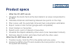

Product specs
• What the PC APP can do
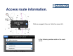
1. Visualize the Gold charts at the best detail in an area corrspondent to
an XL9.
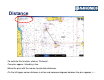
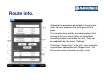
2. Calculate distances and bearing between two points on the map.
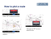
3. Plan routes, with the automatic time and fuel consumption estimation.
4. Export routes in kmz format (google earth compatible).
5. Insert markers or favourites.
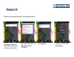
6. Search ports, point of interest or favourites.
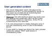
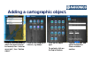
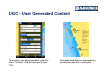
7. Visualize the objects added by other users (User Generated Content).
8. Add new objects (UGC) and share them with the other users.
What the PC APP does not do
1. Transfer routes, from the PC to the plotter and vice versa.
2. Connect a GPS to the PC and visualize the boat position on the map,
the speed and bearing.