Manual Simrad MX500 Navigation System English www.simrad-yachting.
Manual Simrad MX500 Navigation System English Document no: 500 100 2003 Revision: C Date: April 2009 The original language for this document is English. In the event of any discrepancy between translated versions and the English version of this document, the English document will be the official version. To the best of our knowledge, the content in this publication was correct at the time of printing.
IMPORTANT NOTICE!! THE MX500 IS AN AID TO NAVIGATION ONLY. Under no circumstances should it be used in lieu of authorized government charts. Its accuracy can be affected by many factors such as equipment defects, environmental conditions, or improper operation. The user is responsible for safe navigation of the vessel. This includes consulting authorized government charts and exercising common prudence and navigational judgement at all times.
Symbols Used In This Manual Danger Indicates an imminently hazardous situation which, if not avoided, will result in death or serious injury. Warning Indicates a potentially hazardous situation which, if not avoided, could result in death or serious injury. Caution Indicates a potentially hazardous situation which, if not avoided, may result in minor or moderate injury and/ or appreciable material, financial and environmental damage. This symbol is also used to alert against unsafe practices.
Blank page 4 | MX500
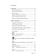
Contents 1 General........................................................ 9 Related Documents........................................9 About GPS Navigation................................... 10 Special Notes.............................................. 11 MX500 USB Feature Overview....................... 12 MX500 Networking Overview ........................ 12 Network Cables & Waterproofing:................... 13 2 Basic Operation......................................... 15 Functional Description.........
SOG Based on Arrival Date & Time:................ 58 RTE2 - The Route Bank................................. 59 Waypoint.................................................... 61 Creating and Editing Waypoints...................... 62 Removing Waypoints.................................... 69 Moving waypoints........................................ 71 Uploading Waypoints from a Personal Computer. 78 Mark or MOB....................................... 80 GOTO.................................................
4 Installation.............................................. 153 List of Components.................................... 153 Mechanical and installation drawings............ 155 MX500 Electrical Installation Drawings.......... 160 Installation notes....................................... 168 Equipment Interfacing................................ 175 Troubleshooting Guide................................ 188 Software Update Procedure......................... 191 5 Specifications.................................
Blank page 8 | MX500
1 General This manual reflects the software capabilities in version 3.0 software. We have attempted to take care and develop manuals which provide in-depth information. Where possible, we have attempted not only to describe what you see on the screen, but how to understand and use it as well. Obviously, we can’t teach you how to navigate, but we can help make your work more thorough and enjoyable. Throughout the manual, you will find helpful hints about the interaction of various functions.
About GPS Navigation This GPS receiver is a precision navigation instrument utilizing the latest technology available today to provide optimum performance from the GPS satellite and Beacon land signals received. As with all other forms of radio signals, the ultimate navigation result is dependent upon the quality of these signals. Radio signals may, on occasion, be distorted, jammed, or otherwise incorrect.
with built-in beacon receivers are designed to provide low cost reception of DGPS corrections broadcast (normally free of charge) by coastal authorities. Special Notes GPS Never rely solely on any single navigational aid. Always use whatever information is available, and cross-check information when possible. GPS expected position accuracy is dependent upon multipath environment, number of satellites in view, baseline length (for local services), ionospheric activity, and HDOP.
MX500 USB Feature Overview USB stands for Universal Serial Bus, and is a data port in the MX500 that allows the use of USB flash drive (memory stick) to save and restore waypoints, routes and configuration data. In addition it can also be used to download the MX500 firmware for software updates. Not all commercially available USB flash drives are compatible with the MX500. USB Formatting: Before the USB device (i.e. flash drive) can be used for the MX500, it is important to format it to FAT32 file system.
•• A maximum of five units may be connected in a network. •• In a Multiple Unit Control (three or more units) networking system, all Slave and Repeater units must be enabled in CFG1/Dual Contrl before enabling it in the Master unit. The MX antenna sensor is connected to the master unit and in turn shares its position to all the slaves.
Item Component Type Part Number 1.0 LAN Patch Cable Assembly (3 m) (RJ45, single-ended waterproof connector) CAT5 500 100 4004 1.1 LAN Cross-over Cable (3 m) (RJ45, double-ended waterproof connectors) Cross-over 500 100 4005 Table 1a: MX500 Waterproof Network Cables Ethernet Switches: Ethernet switches allow for the interconnection of more than two MX500 units. Each MX500 can exchange data with any other MX500 connected to the switch.
2 Basic Operation Functional Description MX500 Configurations The MX500 Navigation System is available in several configurations. Please refer to the Auxiliary Unit Information section of the manual to view sample screens to identify your particular model. Described below are the various MX500 configurations and their differences. MX500 GPS This MX500 CDU configuration is equipped with two (2) bidirectional user NMEA ports and one (1) high-speed Local Area Network (LAN) port.
MX500/DC (Dual Control) This is a dual-control CDU system where one MX500 (operating as a master) and the other (operating as a slave) are supplied. Only one smart DGPS antenna is required. The antenna unit is connected only to the MX500 master unit. LAN port must be setup before enabling this feature. The units can be connected together over an Ethernet crossover cable or using an Ethernet switch.
LAN port must be setup before enabling this feature. The units can be connected over an Ethernet cross-over cable or using an Ethernet switch.
MX Smart GPS Antenna (Host) MX 422 Profe ssional DG PS Navigator MX500 CDU LAN Master unit (Client 1) MX 422 Profe ssional DG P (Client 2) MX 422 Profe ssional DG P S Navigator LAN S Navigator LAN Hub/Switch/Router MX500 CDU MX500 CDU N LA S Navigator MX500 CDU Repeater unit #1 N (Client 3) MX 422 Profe ssional DG P Slave unit #2 LA Slave unit #1 (Client 4) MX 422 Profe ssional DG P S Navigator MX500 CDU Repeater unit #2 1) In general, this manual will refer to all versions of this pr
DGPS Beacon System As Maritime Safety Administrations, Navy, and Coast Guard Organizations realize the limitations of standard GPS positioning, many have begun installing DGPS Beacon Stations. While an understanding of this system is not necessary for operating receivers with internal beacon receivers, you may want to read on to have a better understanding of how your receiver is capable of achieving the high levels of accuracy made possible by this network of transmitters.
Keypad & Display Description Display Traffic Lights USB Connector Function Keys Cursor Key Select Virtual Softkey Refer to the illustration above. The Traffic Lights on the left side of the display will tell you how your navigator is operating. You need to take care in reading the traffic light indications, as there are overlapping possibilities between the GPS and DGPS modes. If you are unsure of the current operating mode, select the CFG function key and scroll down to the DGPS selection.
Differential GPS Traffic Light Operation: Red Flashing Not tracking satellites (no position update). This is normal for the first 2 minutes or so when turning the unit on. The very first time you turn the unit on, or if the memory is reset or lost, this condition is also normal. Allow the receiver to run for at least 30 minutes under these circumstances. If it still does not change to Red Solid, refer to the troubleshooting section in the Installation section of this manual.
level for dropping DGPS corrections is 600 seconds. During this period, your positioning information is less than optimal, and position accuracy may be off by as much as 3 to 5 meters. Press the GPS function key and refer to the DGPS section in this manual for guidance if this light condition occurs. Yellow Solid DGPS position update with poor HDOP value. You may see this from time to time during normal operation.
Red/Yellow Solid Dead Reckoning . When normal GPS or DGPS operation is not available, this LED sequence is provided to quickly identify the DR navigation mode. A DR indicator is also displayed on all screens in the upper left hand corner of the display. Red Solid Tracking one or more satellites (no position update). This is also normal for the first 2 minutes or so when turning the unit on.
This is the normal operating condition and no icon will be displayed. The Display: The CDU uses a Transflective LCD display screen. It provides optimum viewing in virtually all lighting conditions. To change the display contrast or backlight condition, select the CFG function key and scroll down to the Lighting menu choice. Refer to the CFG section of the manual for a complete description of menu options.
finished editing. If after editing you press a function key and nothing seems to happen, check to make sure you didn’t accidentally alter your information and press the EDIT key to end editing. Some edit screens provide an Escape softkey. If you decide for some reason that you don’t want to use the changes you have made, pressing the Escape softkey will restore the original information. However, once you press the EDIT key, all changes are accepted and the original data is lost.
Mark Position/MAN OVER BOARD (MOB) Key This dual function key stores your present position, date and time at the next available waypoint location in the waypoint bank. A window pops up on the screen to confirm your key depression, and to tell you where the mark position is being stored. You can go into the WPT menu and edit the coordinates or description later. The CDU is also capable of performing this function from a remote contact closure input via AUX Cable (MOB/Event) wire.
mation in these other screens relate to the MOB position, not the next waypoint in the active route, until MOB is canceled. To cancel a MOB condition, make sure you are in the MOB Plot screen. Press the EDIT function key, then select the Cancel MOB softkey. The MX500 is also capable of performing the MOB function from a remote contact closure. If the contact closure is made for 1 second, the input is registered as a Mark Position.
onds. When the GPS is turned off using this technique, you can not reapply power for 10 seconds. An occasion may arise when you need to reset the memory back to the factory default values. Doing this will cause the CDU to lose all of your defined settings, as well as all 2,000 of your waypoints and routes. If you hold down the “CLR” button when power is applied for about six seconds, then the memory will be cleared.
keys. When pressing the EDIT key to activate the softkeys, the ENT key is used to select the particular virtual softkey of user’s choice. 1 N AV ABC FUNCTION You might have noticed that above and below each primary function key there are numbers and letters. These numbers and letters are used when you are in the edit mode. You will find that they are most often used in the RTE, WPT, and CFG screens, but they are used in other screens as well.
Use the CFG key when in the edit mode to cycle through these other optional characters. ‘“$&!()?/+-°.,: 9 AIS Automatic Identification System (AIS) YZ (AIS not available in this model) Navigate There are six basic NAV screens. NAV4, NAV5, and NAV6 only provides data if appropriate sensors (e.g. wind speed/direction logs, NMEA compass, etc.) are interfaced and activated on the CDU. The NAV functions are highly interactive with the RTE1 screen, and a number of CFG menu selections.
•• Datum - sets the reference datum for your present position and waypoints in the active route. •• GPS Offset - sets an offset for calculating the GPS antenna position if you can’t physically locate the antenna exactly where you want it (e.g. over the centerline of the boat).
You have probably already figured out that you will need to pay close attention to the configuration screens. The good news is that you should only have to setup one time. Keep in mind, though, that you may need to revisit these and other configuration screens from time to time to get the CDU to do exactly what you want it to. Dead Reckoning The MX500 CDU is capable of Dead Reckoning (DR) calculation when appropriate compass/heading and speed log sensors are connected and activated.
line changes direction at the flags, which represent your waypoints, and continues through to the end of the active route you entered in RTE1. Notice that the crosstrack error lines end at the first flag. As you pass the flag and start the next leg of your course, these lines will be redrawn to reflect the course change.
•• Show Off Track Limit - allows you to turn the crosstrack error limit lines on or off on the display. •• Show Data Window - allows you to select between the two NAV 1 display types depicted at the beginning of this section, one in which the data is displayed in various parts of the graphic screen, the other in which the data is displayed in a separate window to the left of the graphic screen.
In the bottom half of the window, the vertical line in the center represents your course line. The checkered area on the left and right side of this area represents the out of bounds or beyond the cross-track error limit area. Whenever the boat is left or right of the course line, the corresponding checkered area changes to solid black, indicating the side of the course line that you are on. The number next to the course line is your calculated crosstrack error.
Skip Waypoint softkey one time. Press the EDIT key to end this procedure. If you skip one waypoint manually, and the CDU starts skipping more waypoints by itself, you probably need to change your Waypoint Pass Criteria in the CFG1 Navigate menu. Refer to the Route section of this manual for more details about skipping waypoints. Just as in NAV1, you will see an RL or GC symbol in the upper right corner of the display indicating whether you are navigating under Rhumb Line or Great Circle.
graphical representation of your actual course line approach angle relative to the next leg of your course. This approach angle is continuously updated in real time and will help you setup for course changes. Reset XTE and Skip Waypoint, described at the end of NAV2, is also available in NAV3. NAV4 - Sensor Input Navigation The NAV 4 screen applies the wind instruments, speed log, compass, and depth sounder inputs from external sensors to your active route, as appropriate.
tion. This provides you the capability of knowing the wind source exactly. This screen is divided into four windows. The window on the top left provides details relating to the True Wind Angle (TWA), True Wind Speed (TWS) and True Wind Direction (TWD), which are taken from the NMEA 0183 record of MWV or VWR. If the wind information is given in relative terms, the CDU calculates true values using available GPS course and speed information to make the necessary adjustments.
On the right side of the lower left window you will find the Speed Over Ground (SOG, calculated by MX421 smart GPS antenna), Speed Log (LOG, the NMEA 0183 or pulse speed input), and the Waypoint Closure Velocity (WCV). WCV reflects the real time velocity from your present position and course towards the next waypoint. The VMG and WCV are calculated from GPS data. Refer to the diagram below to see a graphical representation between VMG and WCV.
section and the Installation section of this manual for full details on depth data. Below the depth data you will find the next route leg vector, the Range to the waypoint and Time To Go data, explained in the NAV3 section. NAV5 - Compass Display Screen The NAV 5 screen is used to display the Heading and Rate of Turn values given by a heading sensor like the MX575A Satellite Compass. In addition, it also displays the position, COG, SOG, BRG, and RNG.
Route There are two RTE screens. The NAV functions are highly interactive with the RTE1 screen. The RTE2 screen allows you to create a pool of predetermined routes that you might use often, so you need only create the route one time. Routes are created from waypoints. All waypoints are stored in the Waypoint Bank, regardless of which function is used to create them.
or copy new routes from the RTE1 (active route) screen. Later you can choose individual routes or link two or more routes in the RTE1 screen (refer to Creating a Multi-Waypoint Active Route section of this manual). When you are finished using the copied route in RTE1, you can erase the route from the RTE1 screen and the original stored route will remain intact in the RTE2 screen. The following CFG1 menus directly impact the RTE functions: •• Navigation - sets a variety of important functions and alarms.
stored (up arrow ) for your current route. The CDU will recalculate the route when a navigation mode, either Rhumb Line or Great Circle is selected.You can enter waypoints using different datums into the route The RTE1 screen is where you are likely to do most of your trip preparation. There are several methods you can use to create routes. You are sure to find one or more methods which meet your needs in the following sections.
Choose In Bank - allows you to scroll through the Waypoint Bank. Align the cursor with the desired waypoint and press the EDIT key. The waypoint is automatically inserted into the active route and the unit will revert to the NAV screens, displaying bearing and distance to this waypoint. Lat. Lon. - allows you to define a coordinate and description, which is also stored at the next available waypoint location in the Waypoint Bank.
fined waypoint is copied to the active route automatically. If you make a mistake, you can use the cursor key to position the cursor over the mistake and overwrite the error. Use the 9 key to insert a space in the description, if needed. Use the 0 key to select a special character, if needed. International characters are available by selecting the associated function key. Refer to the EDIT keypad & Display Description section at the front of the manual.
Waypoint 0 is displayed in Inverse Video, that is, white characters on a black background (when in the normal Daylight display mode; see CFG1 Lighting). This indicates that you have already passed this coordinate. The time stamp at the lower portion of the description window indicates when the route was created. If you want to adjust your point of departure position, you can edit Waypoint 0 in the WPT function. To the right of the coordinate window of Waypoint 0 is a bent arrow.
5 Highlight the Yes softkey and press the ENT key to confirm. The active route is now erased and ready for new input. If you want to work in other areas of the CDU first, you will need to press the EDIT key to exit the edit mode.
•• Insert Route - allows you to copy a previously defined route in the RTE2 screen to the active route. This choice is only displayed when one or more routes are defined in the RTE2 screen. Our experience has shown that you are likely to choose several of these methods at any given time to create a route. You can mix any of these routines to create routes, amend routes, or insert waypoints in the middle of existing routes. The software is designed to be as flexible as possible to meet your changing needs.
5 Use the EDIT keypad to type in the number you want or the beginning number of a range you would like to select from, or use the cursor key to scroll through the previously stored waypoints in numerical order. 6 When you have found the waypoint you want, highlight the Insert this WPT softkey and press ENT.
3 Highlight the Insert softkey from the display and press ENT. Skip to the next step if RTE1 is empty. 4 Highlight Choose in Bank from the display and press ENT. 5 Select a waypoint by: a Highlight the Sort By softkey and press ENT to arrange the waypoints by number, name, type, distance, or age (refer to the Waypoint section for a full description), then using the cursor key to scroll through the previously stored waypoints in the Waypoint Bank. b Highlight the Search for WPT softkey and press ENT.
6 Don’t forget to press the EDIT key to end your editing. Insert New Waypoint The following example assumes RTE1 is empty. Follow the directions in the Erasing an Existing Route section to start with an empty route if you have waypoints in the RTE1 screen. 1 Select the RTE key until the RTE1 screen is displayed. 2 Press the EDIT key to enter the edit mode. 3 Highlight Insert softkey from the display and press ENT. Skip to the next step if RTE1 is empty.
7 You can then choose to enter another waypoint using the same method, select Escape to go back one level and use another method to enter waypoints, or select Done to go back to the main menu. 8 Don’t forget to press the EDIT key to end your editing. Insert Route The following example assumes RTE1 is empty. Follow the directions in the Erasing an Existing Route section to start with an empty route if you have waypoints in the RTE1 screen.
7 You can then choose to select another route using the same method or select another method to enter waypoints. 8 Don’t forget to press the EDIT key to end your editing. Maneuvering Within the Route Scrolling You can use the cursor key to scroll up and down the active route. You will probably want to do this when you update your log book to indicate when you passed a given waypoint, or when you want to know the ETA to a waypoint other than the one you are currently traveling towards.
Use the up (↑) softkey to unpass or the down (↓) softkey to pass waypoints in the route until the waypoint marked by the cursor is displayed with white characters on a black background (Daylight display, see CFG1 Lighting). Press the EDIT key to end editing. If for some reason you can’t select the waypoint you want (the screen keeps passing waypoints you unpassed), you are probably too close to one of the waypoints.
3 Then press the EDIT key. 4 Use one or more of the insert methods described in the Creating a Multi-Waypoint Active Route section above. This example shows Waypoint 7 inserted into the route using the Insert by Number method: 5 Press the EDIT key to end editing. There is one special way to add a waypoint to the active route using the Plotter display. This method adds the waypoint between your present position and the next waypoint in your active route. 1 Select either PLOT1 or PLOT2 display.
3 Use the cursor key to move the magnifying glass icon over the waypoint or marker that you want to go to. Verify that the waypoint number and coordinates are correct in the left hand window. 4 Press the GOTO function key. 5 Press the EDIT key to exit the edit mode. Note that RTE1 and PLOT1 are updated with your new waypoint. Reversing the Active Route Once you get to your final destination, you might want to follow the same route home.
4 Highlight the Reverse Direct softkey and press ENT. 5 Press the EDIT key. It’s that simple! Notice that you still keep the same orientation on the screen, in other words, you always read from the top of the screen to the bottom of the screen. The waypoints are rewritten in reverse order for you. ETA Setup If you choose to use this function, it is probably better to operate the unit in UTC time mode if you are going to cross one or more time zones.
4 Highlight the Change softkey and press ENT to select which value you want the CDU to calculate, either ETA based on speed, or speed (SOG) based on desired time and date of arrival. SOG Based on Arrival Date & Time: 1 Enter the arrival time and date. Be sure to enter the date as day, month, year, as indicated on the screen. 2 Highlight the Done softkey and press ENT. In this mode, the actual SOG is compared to the required SOG to meet the specified arrival date and time.
ETA Based on Speed: 1 Select a Speed Basis of either GPS SOG, which uses a long filter time (in seconds) that you define, or Constant, which uses a speed you intend to maintain (you define the speed). 2 Highlight the Done softkey and press ENT. RTE2 - The Route Bank The Route Bank is a convenient place for you to preprogram segments of a long voyage, or to program routes that you follow over and over again.
If you have a route in RTE1 that is not stored in RTE2, you can copy it into the Route Bank by selecting Insert then Insert Route, either in the forward or reverse direction. 5 When you are finished selecting waypoints, highlight the Route Name softkey and press ENT. You can enter any name, number or symbol you want this route to be identified by. 6 Highlight the Done softkey and press ENT when you are finished editing the name.
Waypoint The Waypoint Bank (WPT) is a single list of up to 2,000 waypoints that you store for use in the routes you create. It also stores special coordinates and time, through the use of the Mark or Event function key or external input, or the MOB function key or external input. You can also enter waypoints from other NMEA 0183 devices (see CFG1 WPT & RTE In), such as plotters. You can also output waypoints and routes from the CDU to other NMEA 0183 devices (see CFG1 NMEA Out Rnn, RTE, and WPL).
•• Search For WPT - allows you to type a symbol or name and the screen displays all waypoints having the exact match of the name you type. If you are unsure of the complete name, type a few of the characters you know are in the name, and the software will display all waypoints having the corresponding characters. For example, if you are looking for the LA HARBOR ENTRANCE and you enter HAR, the screen will display all waypoints with these three characters in this exact order.
3. Make New WPT 4a. Use WGS-84 Datum Select Lat/Lon (W84) 4b. Use Datum Other Than WGS-84 Select Lat/Lon Datum Select desired datum from displayed list. Press Select. 4c. Create a new WPT Based on a Range & Bearing from an existing WPT Select Range Bearing Enter desired range and bearing. Press the cursor down arrow . 5. Enter Coordinates Press the cursor down arrow . 6. Modify WPT Number (Optional) Press the cursor down arrow . 7. Modify WPT Text & Symbol (Optional) Press the Done softkey .
the desired datum and highlight the Select softkey then press ENT. Refer to Appendix A - Datum List for a complete list of datums and their WGS-84 offset. Go to step 5. Range Bearing - allows you to define new waypoint coordinates from an existing waypoint in the Waypoint Bank. When you use this feature make sure you align the cursor next to the from waypoint number before you highlight the Make New WPT softkey and press ENT. Once you have entered the range and bearing, the CDU calculates the coordinates.
Range & Bearing Lat/Lon This feature allows you to create a range of waypoints within a particular area. For example, you could put all of the waypoints for fishing spots near Catalina Island in the range of 500 to 530, all the waypoints for Cabo San Lucas in the range of 575 to 600, etc. 5 Move the cursor down, and enter the symbol and name information (optional). Use the techniques described in the EDIT keypad & Display Description section at the front of this manual.
About one second after you stop scrolling through the alpha characters, the cursor will automatically advance to the next space. 6 Highlight the Done softkey and press ENT. 7 When you are finished, highlight the Lock this WPT softkey and press ENT to avoid accidentally erasing the waypoint in the future. Locked waypoints can not be overwritten by waypoints downloaded from the NMEA port or saved by the Mark or MOB functions. 8 Then press the EDIT function key to end editing.
ing input over the data port. Note that when a waypoint received on the data port has the same waypoint number as a locked waypoint already stored in the CDU, the waypoint data received on the data port is disregarded and lost.
4 Highlight the Unlock this WPT softkey then press ENT. 5 Press the EDIT key. If you simply want to modify the waypoint, Edit this WPT will be displayed on the bottom left of the screen. To Lock all Waypoints 1 Select the WPT key until the WPT1 screen is displayed. 2 Move the cursor to the desired waypoint. 3 Press the EDIT key. 4 Highlight the More softkey and press ENT. 5 Highlight the More softkey again and press ENT. 6 Highlight the Lock all WPT softkey and press ENT.
3 Press the EDIT key. 4 Highlight the More softkey and press ENT. 5 Highlight the More softkey again and press ENT. 6 Highlight the Unlock all WPT softkey and press ENT. 7 Press the EDIT key. Removing Waypoints Unlocked waypoints can be overwritten by waypoints received on the NMEA port or downloaded from the USB stick. Waypoints that are contained within a stored route can not be removed until they are removed from the stored route in the RTE2 screen.
There are three methods to remove a waypoint: Remove this WPT, Remove Unused, and Remove Range: 5a If you select Remove this WPT, the waypoint will immediately be removed from the Waypoint bank. 5b If you select Remove Unused, the CDU will delete all waypoints that are not locked or stored in a route. You will be prompted to confirm the deletion: 5c If you select Remove Range, the CDU will delete all unlocked waypoints that are not stored in a route between a range of waypoint numbers that you enter.
Moving waypoints This feature allows you to create a range of waypoints within a particular area. For example, you could put all of the waypoints for fishing spots near Catalina Island in the range of 500 to 530, all the waypoints for Cabo San Lucas in the range of 575 to 600, etc. To move a waypoint or range of waypoints: 1 Select the WPT key until the WPT1 screen is displayed. 2 Press the EDIT key. 3 Highlight the More softkey then press ENT. 4 Highlight the Move softkey then press ENT.
If the destination waypoint number is already being used, you will be prompted to either overwrite the first waypoint (Yes) and each subsequent waypoint that is to be overwritten, confirming each waypoint one at a time, overwrite all the waypoints (Yes To All), not overwrite any waypoints (No); or Escape back to base softkey menu. Downloading Waypoints & Routes to Other Devices Refer to the Installation section of this manual for hardware interfacing guidelines.
Rnn - Routes: Waypoint identifiers, listed in order with starting waypoint first, for route number “nn”. The active route in the CDU is always route zero, but in the Rnn sentence the route number can be transmitted as either route 00 or 01. Rnn is NMEA version 1.5. Use of GPRTE is recommended to comply with NMEA version 2.1. field#: 1 2 3 4 1 1 1 4 5 6 $GPRnn,cccc,cccc,cccc,.....
3: Message number. 4: Message mode: c = complete route, all waypoints, w = working , 1st listed waypoint is ‘FROM’, 2nd is ‘TO’ and remaining are the rest. c/w can be set to c or w (default w). 5: Route identifier, always 00 (Active Route only). 6 - 16: Waypoint identifiers, (less than 11 waypoints may be in the message). The number of remaining waypoints can be set to 1, 2 or “all” (default all) shortening the drawn track on the plotter. 17: Checksum can be set on or off (default on).
WPL - Waypoint with Symbols & Description NMEA 0183 Expanded: Latitude and Longitude of specified waypoint. The content of this sentence will normally be the position of the next waypoint in the route. The CFG1 NMEA out WPL has a special “Send All” option. Selecting this feature will send all the waypoints in the Waypoint Bank once independent of the WPL sentence setup as ON or OFF. This format does not strictly conform to the NMEA 0183 standard, and may not work with all equipment.
Downloading Waypoints to a Personal Computer You can use any terminal or communications program to download or upload waypoints and routes to or from the CDU and a PC. Set the PC to: 4800 baud 8 bits 1 stop bit no parity no flow control When sending data to the CDU, it must be sent in block form, followed by (with an appended) CR (carriage return) and LF (line feed). Normal communications programs, like Windows XP Hyper Terminal, are sufficient to get the job done.
10 Highlight the Done softkey and press ENT. 11 Set the WPL record to Off (you will need to turn the data off while setting up the computer). 12 On the computer, select All Programs - Accessories - Communications, and click on the Hyper Terminal icon. 13 Give your Connection Description a name and click OK. 14 Under the Connect using option, choose COM1 (or COM2, depending where the external interface is).
Uploading Waypoints from Other Devices The CDU will accept waypoints from any device which follows the WPL formats identified earlier in the Waypoint section. The first two characters following the $ can be any NMEA defined talker ID. You do not have to calculate and include the checksum; however, you must end each data record with a carriage return and line feed. If you do include the checksum at the end of the data record, the CDU will verify the checksum.
When sending data to the CDU, it must be sent in block form, followed by (with an appended) CR (carriage return) and LF (line feed). Normal communications programs, like Windows XP Hyper Terminal are sufficient to get the job done. Using Windows XP Hyper Terminal, do the following (from the Program Manager): 1 Using an RS-422 to RS-232 convertor, connect the CDU’s port 1 or 2 to the PC’s communications port (Refer to the page 195 - MX500 PC Interface section of this manual).
14 When all the waypoint sentences are sent, press the WPT key and scroll through the list to ensure all the waypoints transferred properly. Go back to the CFG1/WPT & RTE In option and change External WPT Input to No. Uploading Waypoints from a USB Memory Stick Waypoints and routes can also be downloaded or uploaded using a USB device (i.e. USB flash drive). Please refer to the CFG1/USB feature of this manual for details.
seconds causes a Man Over Board condition to be generated. The marker function stores the position of the antenna location. Keep this in mind if you are trying to pinpoint items such as buoys, crab pots, etc. For some special applications such as these, you may need to locate the antenna at the point on the boat or ship where you need to make this exact measurement. GOTO Using the GOTO function key is the fastest way to create a single leg route.
present position, which is also stored at the next available waypoint location in the Waypoint Bank. If you make a mistake, you can use the cursor key to position the cursor over the mistake and overwrite the error. Use the DGPS key or cursor key to insert a space in the description, if needed. Use the CFG key to select a special character, if needed. 4 To activate the GOTO waypoint, press the EDIT key. A warning is briefly displayed indicating that the active route will be replaced with the GOTO route.
Waypoint 0 is displayed in Inverse Video, that is, white characters on a black background (when in the normal Daylight display mode; see CFG Lighting). This indicates that you have already passed this coordinate. The time stamp at the lower portion of the description window, indicates when the route was created. To the right of the coordinate window of Waypoint 0 is a bent arrow.
The following CFG menus directly impact the PLOT functions: •• Navigation - sets a variety of important functions and alarms.
2 or at large values such as 64 or 128). Each solid dash mark represents 1 nautical mile. A broken dash mark indicates 1/100th of a nautical mile when you are zoomed in at low scale. You will find your bearing and range to the next waypoint just below the page number. The CFG1 Navigation menu allows you to display fractions of the major unit (nautical miles, statute miles, or kilometers) ranges less than 1000 in alternate units of feet or meters.
•• Show Boat - Yes is the default condition, which places the boat icon in the middle of the screen. No places the boat in a Compass Rose in the upper right corner of the screen (see the diagram below), where your direction is indicated by the boat in the Compass Rose. The boat’s position is then indicated by an X in the center of the screen.
•• Show Lat/Lon Grid - No is the default condition, which causes the coordinate grid not to be displayed. Yes causes the Lat/Lon grid to be displayed (regardless of positioning reference system selection in CFG1 Position). Note that the grid is only displayed at the 4 Nm scale or lower. •• Automatic Zoom - No is the default condition, which causes the displayed scale to be controlled by you.
Selecting Record Track then pressing ENT allows you to define how your course is saved. Choosing not to save your track may free the processor up to run other functions a little bit faster; however, you are not likely to notice any difference in performance unless all data ports are near their full throughput capacity. You also have three different levels of track saving capability: Normal, Fine, and Detailed. The software saves each calculated position coordinate to draw the lines for the plot screen.
Man Over Board The Man Over Board function key shares the same key with the “Mark or Event” function key. When depressed for 3 seconds, it activates a number of automatic functions described below. Most obviously, it brings up an MOB1 (Plot) screen. This is an automatic scaling screen. The screen centers on half the distance between your present position and the MOB position.
tion by also indicating the bearing and range back to the MOB position (until the MOB is canceled). This way, other interfaced equipment can also help guide you back to the MOB position. When the MOB condition is canceled, the NMEA sentences will automatically revert to the active route information. Don’t forget to cancel the MOB so your interfaced equipment will read the correct data. The MOB function key and remote MOB input are disabled from subsequent activation until Cancel MOB is selected.
Auxiliary There are eight Auxiliary screens described in this section: AUX1 - Alarm Log AUX2 - Speed Graph AUX4 - Sun Almanac AUX5 - Moon Phases AUX6 - Batteries AUX7 - Unit Information AUX10 - Current Tide Display AUX11 - Tide Table Port List AUX1 - Alarm Log All alarms are registered in this screen, whether or not they have been corrected, until the log is erased or the log is full. When the log is full, the oldest alarms are overwritten.
AUX2 - Speed Graph The graph scales automatically to the speed you are at. You can zoom out to the last 56 minutes or in to the last 3.5 minutes. It is a handy tool if you are trying to maintain a certain speed. AUX4 - Sun Almanac This almanac provides the sunrise and sunset times for a given day and location. You can enter another date or location of interest by pressing the EDIT key, and editing the appropriate date and/or place.
AUX5 - Moon Phases There are no edit functions available here. Moon phases are given in approximately one week increments and include all dates for new, half, and full moon. You change the year displayed by pressing the up or down cursor keys. AUX6 - Batteries This is where you reset the Lithium battery age. Press the EDIT key and highlight the Reset Age softkey then press ENT after you replace the Lithium battery. Please note that the age reset requires that the unit is tracking satellites.
AUX7 -Unit Information This screen indicates the specific CDU model, software version number, the hardware configuration, and the printed circuit board (PCB) serial number of your CDU. If you are having problems with your CDU, refer to this screen for information to provide to customer service personnel. A special softkey sequence displays sub-version levels, the actual software build date and time, and allows access to a selftest sequence.
Tide There are two TIDE screens, which are located under the AUX option. The AUX 10 screen displays graphic and digital information about the tide conditions at your present position. This is based on tide table constants that you must enter in the AUX 11 screen, then access through the AUX 10 screen. You can store up to 100 tide tables in AUX 11. The following CFG1 menus directly impact the TIDE functions: •• Depth - sets the measurement units in meters, feet, or fathoms.
time. When the tide marker is in the automatic mode, the cross-hair indicator is enclosed with a circle (like a clock). You can move the marker forward or backward in time using the softkeys at the bottom of the screen. Return the marker to the present time by simply highlighting the Marker to Now softkey then pressing the ENT key. When you move the tide marker off of the present time, the marker changes to a + sign.
Admiralty Tide Tables and Tidal Stream Tables Published by the Hydrographer of the Navy, United Kingdom Hydrographic Office Tauton, Somerset TA1 2DN, United Kingdom +44-1823-337-900 +44-1823-323-753 Fax 46274 Telex This is a three volume set of tide tables, divided as follows: Volume 1 Volume 2 Volume 3 Volume 3 6322-0 1A.
Adding a Port To add a port to the list, first locate it in Part III of the tide table book, then align the cursor with Add port to the Port List and press EDIT. The Zone in the upper left corner refers to the time zone offset to UTC. Use the name given in the tide table for the name given in the Place portion of the screen. To help you locate this port in the printed volume later, use the table number given in the first column of the manual as the tide number in the CDU.
Position There are three POS screens in the CDU. The POS functions are highly interactive with a number of CFG1 menu selections. The following CFG1 menus directly impact the POS functions: •• COG SOG - sets the filtering time for the displayed values. •• Datum - sets the reference datum for your present position. •• DGPS - sets the internal or external control for RTCM SC-104 corrections which affect your position accuracy.
POS1 - Position Display (Large Digits) This single window display provides the largest presentation of the coordinate information from the CDU. In addition to the coordinates and datum in use, this screen displays the current course and speed over ground. There are no edit functions available in this screen unless it is in Demonstration mode. Refer to Appendix E Demonstration Mode for a full description of this feature.
POS2 - Position, Altitude, Magnetic Variation, & Time This screen is divided into three windows. The upper left window provides your position coordinates, the antenna altitude (above Mean Sea Level - MSL), altitude mode (2D or 3D), the magnetic variation (Variation) for your present position, and the present datum in use for calculating your position. The lower left window displays your course and speed over ground.
The lower left window is also the same as POS2 and displays your course and speed over ground. If the degree symbol has a small c under it, this indicates that the magnetic variation and compass deviation table are being calculated and displayed. Refer to the CFG Compass section for more details on how to set this up. The right hand window indicates your accumulated mileage since the CDU was first turned on. You will also find two Trip Reset softkeys if you press the EDIT key.
GPS Several GPS and DGPS screens are available under the GPS function key. The GPS/DGPS functions are highly interactive with these CFG1 menu selections: •• GPS - sets the lowest elevation at which a satellite will be tracked. •• DGPS - sets the internal beacon receiver to Auto, DGPS only, or Off. GPS1 - GPS Status Screen There are two windows in this display. The left window has twelve graphic Power Bars representing the twelve GPS receiver channels of the MX421 antenna.
GPS2 - GPS Health Screen There are two windows in this display, the top window is a table indicating which satellites are reported Healthy or Unhealthy by the satellite almanac. The PRN (PseudoRandom Number) ID table is divided into columns and rows. The rows represent the 10’s digit of the ID number and the columns represent the 1’s digit of the ID number. The satellite system consists of up to 32 ID numbers. The ID numbers are called PseudoRandom Numbers.
To mark a satellite as unhealthy, do the following; 1 Press the EDIT key. 2 Use the UP/DOWN arrows to move the cursor to the PRN number. 3 Highlight the “Force Unhealthy” softkey and press the ENT key. The “H” mark for healthy will become “-” for unhealty. 4 Press the EDIT key to exit. GPS5 - RAIM Status Screen (for RAIM Enabled Models Only) RAIM (Receiver Autonomous Integrity Monitoring) is a standard feature in the MX500 CDU. The RAIM feature is mandatory for IMO compliant vessels.
value. It also shows a table containing the PRN numbers of satellites in use, their residual errors and elevations. Below it is the RAIM Status indicator and time. The RAIM icon is shown on the top-right corner of the display. Position errors may be caused by unhealthy satellites, incorrect pseudoranges, poor DGPS corrections and excessive atmospheric interference. When the RAIM caution or RAIM unsafe alarm is on, the GPS/DGPS accuracy may be degraded but still usable when navigating in open waters.
The GPS5 RAIM Status screen is available in MX500 models with program version 3.0 and using the MX421, MX521A, MX525A or MX575A antenna sensors. The MX500 and RAIM feature is an aid to navigation ONLY. Under no circumstances should it be used in lieu of authorized government charts. Its accuracy can be affected by many factors such as equipment defects, environmental conditions, or improper operation. The user is responsible for safe navigation of the vessel.
ing DGPS corrections from the selected station in manual tuning mode. You might see the label Tracking, which indicates that a MSK beacon signal is present but DGPS corrections are not being received. This is usually caused by high noise on the beacon receiver or external device. If you press the EDIT key, you can select between Automatic beacon search mode, Manual beacon tuning mode, or Off.
When you are in manual tuning mode, pressing the EDIT key will bring up the cursor on the Frequency. You can only complete the manual tuning operation by pressing the EDIT key when the Frequency is highlighted. Program the frequency you desire and press the EDIT key. The CDU will automatically update the Station ID. If the beacon is transmitting its location, the CDU will calculate the distance between the reference station and the receiver.
GPS7 - DGPS Messages This screen will display the Type 16 messages received from the beacon station being used. These messages may contain information regarding operational problems and status or any scheduled equipment maintenance of beacon stations operating within the general area. The GPS screens are inactive if an MX antenna is not connected or not detected.
3 Advanced Operation Configuration The CFG screen includes setup and control of all of the receiver’s primary functions. There are more than 20 separate configuration items in this screen. The display is divided into two windows. The left hand window identifies the primary configuration items. The right hand window displays the current settings. Use the cursor key to select a configuration item of interest, then press the EDIT key to edit the actual settings.
Anchor - Anchor Watch Alarm This screen allows you to setup an anchor watch alarm and maximum drift radius after you drop the anchor. The receiver will remember the drop coordinates and provide an alarm if the antenna drifts beyond the maximum distance you entered. If you are on a large commercial ship, don’t forget that the anchor may be several hundred feet from the receiver antenna. You will need to consider this when setting in the distance.
Compass - External Compass Input & Magnetic Variation Table The receiver will accept a magnetic compass input using the NMEA 0183 data record of xxHDT, xxHDG, xxHDM, xxHCC, xxHCD, xxVHW, or any of the above. “xx” refers to the Talker Identifier as specified in the NMEA 0183 standard. The receiver will accept these data records from any talker ID, and from any version (1.5 or higher) of the NMEA 0183 standard. To implement this feature, change Compass Connected to Yes.
Gyro: Set the constant Gyro Heading Offset (or bias) if any. Specify the input NMEA 0183 record for the Input Sentence. HDT, HDG, HDM, HCC, HCD, VHW, or Any. MX575A: Set the constant MX575A Heading Offset (or bias) if any. If the MX575A is used as a positioning and heading device, set Data input port no: to 3. If the MX575A is used as a heading device only, set Data input port no: to any available port (1 or 2) other than port 3 (See MX575A Satellite Compass Installation & Operation Manual for details).
Depth - NMEA Input Control This screen allows you to configure the depth unit (meters, feet, or fathoms) for the NAV 4 and TIDE 1 screens. Depth information is accepted by the receiver from the NMEA 0183 data sentence DBK, DBS, DBT, or DPT on any input NMEA port. Refer to the Installation section of this manual for hardware interface instructions. Press the EDIT key and move the cursor to the Echo Sounder Connected line.
in. If your boat draws about the same amount of water each time you use it, you may want to put in the difference between the sensor and the waterline height. If your boat’s draught changes from one trip to another, as would be the case when the receiver is used on a freight ship, you may want to put in the difference between the sensor and the lowest point of the ship’s hull.
DGPS Mode: Auto - sets the receiver to automatic DGPS or GPS modes. This is the default setting. If DGPS corrections are being received and their age is less than the Max Age limit, the receiver will operate in DGPS mode (assuming you are receiving corrections for enough satellites to operate in DGPS mode). Otherwise, the receiver operates in GPS positioning mode. The traffic light will be green when it is in DGPS mode.
The default setting is Yes. If the alarm is set to Yes, you should notice that the receiver drops out of DGPS mode and into the mode selected in DGPS Mode described earlier in this section at the same time the alarm sounds. Alarm on health change - Sets the alarm to On or Off if the satellite becomes unhealthy or unusable. WAAS/EGNOS enabled - sets the source of differential correction to come from satellite based augmentation system such as US-WAAS or European-EGNOS system.
To set the DR to ‘Yes’ press the EDIT key then highlight the ‘Change’ softkey and press the ENT key. Press the EDIT key again to exit the edit mode. Dual Control - Dual Station Control This screen sets the functional control between two or more MX500 CDU’s interfaced together. The default setting is No. When this selection is changed to Yes, one receiver is set to Master, the other receiver(s) is set to Slave(s). If the MX500 is a Slave, it will have the Repeater option.
GPS - Elevation Mask Control This screen controls the elevation mask angle, or the angle above the horizon, at which the receiver will attempt to track a satellite. Satellites with an elevation below this angle will be tracked but will not be included in the position solution. You can set the elevation limit to any value up to 90°. For most marine applications, the default limit of 5° is appropriate. The Antenna Offset allows you to virtually offset your antenna location.
stellation consistent with the last known receiver coordinates. In this event the receiver may “get lucky” and find common satellites between the old position and the new location, or it may take up to 20 minutes to go through all of the constellation possibilities. Note that the receiver will stay on the original constellation for 15 minutes before attempting other constellation possibilities.
Number - this option is only available when Type is Client. The available values are 1, 2, 3, or 4 (which determines the IP address of the CDU). Each Client has to be assigned with a unique number (1, 2, 3, or 4). Any two or more Clients with the same number will create an IP address conflict, and therefore, will activate an IP Conflict Alarm. Please refer to the table below for the MX500 IP Address. When the connection is successful, the Status will display ESTABLISHED. Type Host IP Address 192.168.100.
LORAN-C Integration The MX500 has two selections for Loran-C integration (Raytheon and Locus). This feature will be available when the Loran-C license is activated. Please copy the PCB & part number and call SIMRAD to obtain the license. Raytheon To implement this feature, change LORAN-C connected to Yes. Identify the appropriate input port (1 or 2) that the LORAN-C device connects to by using the Change softkey. Select the appropriate Version Number with the range from 0 to 9.
The POS 4 screen displays the GPS/LORAN-C combined position and navigation modes received from the $PMVX1 message (which is based on (D)GPS if GPS is available, and based on (D)GPS calibrated LORAN-C position if GPS is not available) from the LORAN-C receiver. The $PMVX1 message is formatted just like the NMEA GGA message, except that its GPS quality indicator ranges from 0-5. The GPS quality indicator is displayed as a navigation mode on the POS 4 screen.
When Loran-C (Raytheon) is enabled, the MX500 gives the option to accept EUROFIX DGPS corrections instead of the External DGPS corrections under the CFG1/DGPS Configuration screen. Locus: To implement this feature, change LORAN-C connected to Yes. Identify the appropriate input port (1 or 2) where the LORAN-C device connects to by using the Change softkey. Select the chain selection mode, either Auto or Manual.
Manual: Select this option to manually add or remove the list of chains. To add a chain, use the left or right arrow key to highlight the Add Chain softkey, and press the ENT key to select. Enter the 4 digits chain GRI then select the Done softkey to add the chain. To remove a chain, use the left or right arrow key to highlight the Remove Chain softkey, and press ENT to select. Enter the 4 digit chain GRI and select the Done softkey to remove the chain.
The POS 5 screen displays the Station GRI, Time Difference (TD), Warning status (CYCLE, BLINK), and Signal-to-Noise (SNR) data for different slave stations of a particular Loran-C chain being used. This screen also allows you to scroll through data of different chains if multiple chains are being used. To implement this feature: 1 Press EDIT key to bring up the PREVIOUS CHAIN and NEXT CHAIN softkeys.
Lighting - Display/Keyboard Light & Contrast Control There are two basic display setups. The light function key allows you to instantly switch between two predefined screens (Daylight & Nightlight). Log - Speed Log Input (Pulse or NMEA 0183) This screen controls the input port (NMEA-0183 or Pulse) and format of the speed log input to the receiver. In the default condition, the speed log is not connected. NMEA 0183 speed is accepted from the xxVHW data sentence originating in any of the version 1.5, 2.0, 2.
Correction Factor - Allows you to make minor adjustments to observed or measured errors in your speed through water calculation. The input value will be multiplied by this value before it is used in the receiver. The default value is 1.00. Digital Pulse Input: Pulses Pr. Nm - This is the calibrated pulses per speed unit value that you must get from the speed log manufacturer.
Activate the output by selecting Yes to Emulation Enable and set the pulse rate based on the device that you are connecting to. Memory This screen allows the user to have the option to save and restore waypoints, routes, and system configuration using the MX500 internal flash memory. Save on power off - When enabled, the MX500 CDU will save waypoints, routes, and system configuration to flash memory before powering off.
Navigation: Sets navigation to Rhumb Line (default) or Great Circle mode. When the navigation mode is set to Great Circle, the PLOT screens will not show your course or cross-track error lines. Range Unit: Sets the unit of measure for all range calculations. You can choose between Nautical Mile (default), Nautical Mile & Meters, Nautical Mile & Feet, Statute Mile, Statute Mile & Meters, Statute Mile & Feet, Kilometers, and Kilometers & Meters.
XTE Limit: Sets the distance left or right from the course line you consider to be the maximum allowable off-track error (known as cross-track error, “XTE”). The PLOT screens will display the scaled cross-track error distance. The NAV screens will indicate the cross-track error in numerical format and present the cross-track error graphically scaled left or right of the course line. XTE Alarm: Causes an alarm to sound if your position exceeds the maximum XTE Limit defined above when Yes is selected.
Distance: Passing the waypoint is determined by reaching an imaginary circle around the waypoint, the radius of which you can define in WPT Pass Distance. The default value is 0.10 Nm. If you set this distance to 0.00, you will never pass the waypoint. This is a great way to perform station keeping maneuvering. Refer to the Plot Screen Use Examples in the Plot section for further details on this application.
Autopilot Alarm: Causes an alarm when your position is outside the crosstrack error limit defined in XTE Limit (above) or when you change course to a new leg in your route (manually or automatically passing a waypoint) when Yes is selected. It also causes the NMEA data records of APA, APB, and XTE to change their reported status of Valid to Invalid when you reach the waypoint of the current leg. This tells the autopilot not to use the data from the receiver.
MX500 NMEA Out Menu Scroll down the list using the cursor key to the desired NMEA 0183 sentence. Highlight the Change softkey then press ENT to select On. Highlight the Details softkey then press ENT to view the characteristics for the NMEA record you select. If you notice that the top of some text is cut off by the Capacity Needed window, this indicates that there are more selections available than can fit in the window. Use the cursor key to scroll down the list.
Most: NMEA Version - Some of the NMEA 0183 records are no longer supported by version 2.3. However, you may have an autopilot, plotter, or other older model equipment that does not support the newer version of the NMEA 0183 standard. The receiver provides you the flexibility to interface using older versions of the NMEA standard to support these devices. Decimals In Lat/Lon - The software allows you to select from 2 to 5 decimal places in records containing position or waypoint information.
ensure that you don’t lose data due to lack of throughput on the data port. Total load is - Due to the throughput limitation of the NMEA 0183 standard, you can not turn on all of the output records available from the receiver at a once per second output rate at one time. The “Total load” counter will help you maximize the port usage on the receiver. It monitors the total throughput capability of all the output records that are currently turned on.
The WPL record, as defined by the NMEA 0183 standard, technically does not allow the output of waypoint descriptions when interfacing to other devices such as Chart Plotters. However, SIMRAD realizes that with 2000 waypoints, you have spent a lot of time preparing your library of waypoints with definitions and symbols. You probably will want to record these to a PC, just in case the memory in the receiver fails in the future.
Other Special Cases Affecting NMEA 0183 Records: BWC, BWR, APA, APB, RMB, RMC, and Man Over Board (MOB): During the period when the Man Over Board function is activated, NMEA 0183 records which contain bearing and range data, such as those identified above (but not limited to these), will reflect the bearing and range back to the MOB position until the MOB function is canceled. Refer to the MOB section of this manual. APA, APB, XTE, and the Navigation Autopilot Alarm: Refer to the CFG Navigation section.
Operation - General Setup and Control Settings This screen controls a few basic operating settings: Remember Display: When set to Yes (default), the receiver remembers the Page Number or screen you viewed the last time you used a particular function. For example, if you normally monitor the NAV3 display and you decided to look at the PLOT1 screen, the next time you press the NAV function, the receiver will automatically revert to the NAV3 screen immediately.
Engineering Display: This enables an expanded series of display screens in some of the functions. In general, these screens are used by the technician during troubleshooting or by SIMRAD engineers during development testing. Screens which are relevant for troubleshooting are described in Installation section of this manual. The default setting is No. If you should enable these screens, the receiver will automatically turn them off the next time power is cycled on the unit.
The setup is straight forward. Use the Change softkey to increment forward through the available choices. Use the Go Back softkey to increment backward through the available choices. You can also use the left and right cursor keys to accomplish these same operations. Enter text the same as you do for the waypoints and routes. Use the numeric key pad to enter the appropriate time. Don’t forget to set Message Active to Yes when you are finished editing, to enable the alarm.
When you select UTM, you can set the Zone yourself (Man), or let the receiver calculate the zone for you (Auto, default). Alarm For High HDOP: This allows the receiver to create an alarm for HDOP values which rise above a number that you determine. This indicates that position accuracy is becoming bad, due to poor satellite geometry relative to your position and/or the number of satellites currently under track. You may want to set the alarm to Yes if position accuracy is critical to you.
A sample of the Full printer output format is given below: MX500 Navigator ==================================== 20:42:41 UTC 12 Apr 2002 POS Mode : DGPS 3D Datum:W84 Position : N 33 48.5056 W 118 21.0073 Altitude : 5.6 m COG: 346 T SOG: 0.1 Kn ROUTE: From WPT NAV Mode : RL BRG: 345 T 0 To WPT XTE: .108L Nm Dist: 2.51 Nm SATS Used: 6 HDOP 1.4 DGPS Age : 9s SW Vrs. 1.5 1 VDOP 1.6 Station ID: 262 MX421 V4.
Here is a sample of the Brief format without an active route: MX500 Navigator ==================================== 21:24:00 UTC 12 Apr 2002 POS Mode : DGPS 3D POS: N 33 48.5124 Datum:W84 W 118 21.0213 COG: 152T SOG: 0.1 Kn --------------------------------------------------------------Here is a sample of the Brief format with an active route or MOB condition: MX500 Navigator ==================================== 21:24:00 UTC 11 Aug 1997 POS Mode : DGPS 3D POS: N 33 48.5124 Datum:W84 W 118 21.
Stop Bits: This allows you to match the printer’s requirement of 1 (default) or 2 stop bits. Parity Check: This allows you to match the printer’s requirement of None (default), Even or Odd parity. Handshake: This allows you to match the printer’s requirement of No (default), XON/XOFF or HW (Hardware; CTS, RTS ). ROT (Rate of Turn) The ROT configuration menu is available in the MX500 model.
Security The Security screen allows you to lock out the EDIT key in order to keep crew members or visitors from changing settings that you have made. Once this feature is enabled, a press of the EDIT key will require the correct password to gain access. To disable the security functions, you will be prompted to enter a 5 digit password. You will then be prompted to reenter the password. The security function is then disabled until you enter a new password through the CFG1 Security screen again.
Time - Mode and Format Control This menu item sets the method in which time is displayed on the receiver. Time System: Sets the time to UTC (default) or Local. When Local is selected, several parameters associated with local time are displayed. Time Format: Sets the time to either a 24 Hour (default) or 12 Hour clock. Time Offset: Sets the local offset to UTC time. 0:00 is the default.
USB flash drive) beforehand, and restore them from your USB device after the software upgrade is completed. This way, you do not have to manually re-enter all your waypoints, routes, and system configuration settings. To implement this feature, plug your USB device into the USB port of the MX500 CDU first, and change USB Connected to Yes. Allow a few moments for the CDU to read and detect your USB device. Ensure that status displays Connected before continuing.
If you are finished using this feature and wanted to remove your USB device from the CDU, ensure that USB Connected is changed to No and press the EDIT key once more to exit EDIT mode before removing the device. Please format your USB device using FAT32 file system before use. Refer to page 192 for formatting procedure and hardware compatibility list. Wind The receiver will display wind information in the NAV4 screen when connected to a NMEA 0183 sensor which can provide the MWV or VWR sentence.
Wpt & Rte Input - Uploading Waypoints into the Receiver This screen enables the input data port to receive waypoints and routes from a chart plotter, PC (VMS), or other device to the receiver. You can receive this data through any of the user NMEA 0183 input data ports. Load the WPL sentences first, then the RTE sentences. Change Transducer Connected from No (default) to Yes and select the appropriate port.
Blank page 152 | Simrad MX500
4 Installation List of Components Table 4.0 Standard Parts for MX500 Model Item 1.0 1.1 Component Qty. MX500 Control and Display System Consisting of: MX500, 2 Port Control and Display Unit (Console) 1 Part Number 1 500 000 0000 Remarks 1.2 Mounting U Bracket 1 500 100 2002 1.3 Mounting Knobs 1 500 100 2006 1.4 Power /NMEA Cable 1 500 100 2001 1.5 MX500 Operator’s & Installation Manual 1 500 100 2003 1.6 MX500 Quick Reference Guide 1 500 100 2005 1.
Table 4.2 MX Antenna Cable Assembly Item 3.0 3.1 154 | Simrad MX500 Component Antenna Cable Options (open ended) 3 meters 20 meters 40 meters 60 meters 80 meters Antenna Cable Options (double-ended Female LTW connector) 3 meters 20 meters 40 meters Qty.
Mechanical and installation drawings NAV ABC 4 PLOT JKL 7 2 RTE DEF 5 G OTO MNO 8 POS D/GPS EDIT CFG STU VWX 0 3 WPT GHI 6 AUX PQR 9 AIS YZ CLR USB 102.00 mm 1 MX 500 NAVIGATION SYSTEM MOB 198.00 mm Figure 4.1 MX500 Display Console Dimensions (Front View) Grounding Stud Power/ Data Connector (12-Pin Male) Antenna Connector (10-Pin Male) Auxiliary Connector (8-Pin Male) LAN Connector (RJ-45) Figure 4.
26.00 mm 67.00 mm Figure 4.3 MX500 Display Console Dimensions (Top and Side View) 156 | Simrad MX500 87.94 mm 82.16 mm 70.0 mm 23.79 mm 92.44 mm 22.24 mm 178.01 mm 185.
Figure 4.
200mm FRONT PANEL Figure 4.
89 mm 182 mm 8-Pin Connector 20 mm 1 in.- 14 TPI 1 IN. DIA. MOUNTING POLE (USER SUPPLIED) Figure 4.
MX500 Electrical Installation Drawings Figure 4.
MX 500 MX421 MX521A MX525A LAN Cable (RJ-45 Conn.) PWR/Data Cable (12-Pin Connector) Negative GND (Black) 10.5 to 32 VDC (Red) NMEA TX1 - (Blue) NMEA TX1 + (Brown) NMEA RX1 - (Orange) NMEA RX1 + (Green) NMEA TX2 - (Yellow) NMEA TX2 + (White) NMEA RX2 - (Purple) NMEA RX2 + (Grey) GND Fast Channel IN (Lite Green) Shield AUX Cable (8-Pin Connector) MOB Ext.
3 meters 12-Pin (Female) Connector Assembly 9 10 1 11 2 8 7 1 2 3 4 5 6 7 8 9 10 11 12 6 12 4 3 5 Black (Negative GND) Red (+10-32 VDC Input) Blue (TX NMEA1 -) Brown (TX NMEA1 +) Orange (RX NMEA1 -) Green (RX NMEA1+) Yellow (TX NMEA2 -) White (TX NMEA2 +) Purple (RX NMEA2 -) Grey (RX NMEA2 +) Lite Green (GND Fast Chnl IN) (Shield) Figure 4.9 Power/Data Cable Diagram 3 meters 8-Pin (Female) Connector Assembly 1 7 8 6 5 4 2 3 1 2 3 4 5 6 7 8 Yellow (MOB Ext.
Length 10-Pin (Female) Connector 9 10 1 8 7 2 4 6 10-Pin (Female) Connector 1 2 3 4 5 6 7 8 9 10 3 5 Black (Negative GND) Red (+12 VDC Input) Blue (TX NMEA3 +) (LPM) Brown (TX NMEA3 -) (LPM) Orange (RX NMEA3 +) (GPS) Green (RX NMEA3 -) (GPS) Yellow (RX NMEA4 -) (BEACON) White (RX NMEA4 +) (BEACON) Purple (Ext. RTCM In +) Grey (Ext. RTCM In -) 1 2 3 4 5 6 7 8 9 10 9 10 1 8 7 2 4 6 3 5 Figure 4.11 Antenna Cable Diagram MASTER UNIT SLAVE UNIT LAN RJ-45 Conn. Cross-Over Cable Assy.
MX ANT. MASTER UNIT LAN RJ-45 Conn. MX500 LAN RJ-45 Conn. Power & NMEA Data Interface Ext. MOB Spd. Pulses Ext. Alarms SLAVE UNIT #1 LAN RJ-45 Conn. SLAVE UNIT #2 Hub/Switch/Router Power & NMEA Data Interface REPEATER UNIT #1 LAN RJ-45 Conn. REPEATER UNIT #2 Power & NMEA Data Interface Power & NMEA Data Interface LAN RJ-45 Conn. Power & NMEA Data Interface Figure 4.
Figure 4.
Figure 4.
Figure 4.
Installation notes General The MX500 Control and Display Unit (CDU) is splashproof and can be installed both above and below deck. To ensure that the back of the display unit remains splashproof, protection covers must be used around the connectors. The installation should meet the requirements of the helmsman, the crew or other users. To flush mount, use the optional flush mount bracket. Ensure that the navigator is mounted in a dry place or where water flows off easily.
Wire Preparation Procedure Power/Data (12-pin) Cable: This is a 6-pair twisted cable. We recommend that the main cable insulation (black plastic) be stripped about 5 inches back to expose the color-coded leads. Below are the color and signal designation of the wires: Pin 1 --- Red ----------- +10-32 VDC Pin 2 --- Black -------- Negative GND.
Auxiliary (8-pin) Cable: This is a 4-pair twisted cable. Below are the color and signal designation of the wires: Pin 1 --- Yellow ------- Ext. MOB Input Pin 2 --- Green -------- GND.
MX GPS Antenna Installation Antenna Location The MX antennas (MX421, MX521 & MXB5) are designed for exposed installation. They should be mounted with a relative clear view of the horizon. Do not, mount the antenna on top of a very tall mast, as this may degrade the COG and SOG calculations, particularly when in DGPS mode.
MX Smart Antenna Configurations 10-Pin Conn. (MX521/MX525) 10-Pin Conn. (MX421-10) Pin # Wire Color 1 BLK/ SHIELD Negative Ground 2 RED +10.
External Differential Connection Differential corrections from an external beacon receiver can only be connected to either the MX421-10 or the MX521/MX525 GPS model. Connections are done directly through Pins 7 (yellow) and 8 (white) of the antenna cable for the MX421-10, and Pins 9 (purple) and 10 (grey) of the antenna cable for the MX521 and MX525. It will accept the RTCM SC-104 signal at 2400, 4800, 9600, or 19200 baud.
Attach all the cable interfaces to the appropriate connectors. Finally, mount the entire assembly to the panel from the display side. Turning Power On and Off The navigator is turned on by briefly pressing the key. Please do not keep the key pressed for more than one second, as this will turn the navigator off again when the key is released.
Equipment Interfacing Introduction The MX500 has two user NMEA ports. Anyone of these ports can be used to communicate with other external equipment which utilize the NMEA 0183 standard. All NMEA interface ports are configured for RS-422 standard. This configuration complies with NMEA 0183 version 3.0 and earlier. The RS-422 electrical interface will almost always work with the older NMEA 0183 version 1.5 electrical interface; both of which are balanced line interfaces.
Speed Over Ground Pulse Output The MX500 can output the GPS calculated speed over ground in a pulse format. Refer to the Specifications section of this manual for signal characteristics. The pulse output is derived from pins 7 (orange) & 8 (brown) of the AUX cable. The speed log out (+) is the orange wire, while the speed log (-) is on the brown wire. It is an RS-422 level signal, and may not be compatible with every installation. To setup the MX500 software, select the CFG1/Log Pulses screen.
Ext. Alarm Relay Conditions MX500 turned OFF Energized MX500 Turned ON (No Alarm) Not Energized MX500 Turned On (With Alarm) Energized 12 VDC Input Power Failure Energized The external alarm is derived from the “EXT alarm” port on AUX (8-pin) cable, pin 3 (Blu) and pin 4 (Prpl). The software is setup in each of the appropriate CFG1 (Alarms) menu. The relay coil supply voltage must be connected to an independent battery backed-up alarm supply.
NMEA Interface The MX500 meets the NMEA 0183 version 2.3 electrical standard for marine interface communications with other marine equipment, such as: Radars, Plotters, Autopilots, Fish Finders, etc. There are differences in the electrical interface specification between NMEA 0183 version 1.5 (introduced in 1987) and NMEA 0183 version 2.0 and later (introduced in 1994). Some older model equipment utilize RS-232, others use RS-422, and others meet the older version 1.5 specification.
threshold and may be the cause of interface problems. If this is the case, try using an RS-232 to RS-422 convertor to interface with the MX500. This may more likely solve the problem. Otherwise third party conversion boxes may be necessary. Cables provided for the NMEA signals are shielded pairs. If extension cables are needed, be sure to use similar shielded pair cables in order to avoid spurious signal radiation. More than one NMEA listener can be connected in parallel to the same NMEA talker.
of characters from the beginning of the sentence. The last data field is not followed by a comma delimiter. When a checksum is used, the last data field is followed by an asterisk “*”, indicating that the checksum follows. The checksum is the absolute value calculated by exclusive -OR’ing the 8 data bits (no start bits or stop bits) of each character in the sentence between, but excluding “$” and “*”.
ID DESCRIPTION ID DESCRIPTION * APA Autopilot Sentence A RMB APB Autopilot Sentence B RMC Recommended Minimum Navigation Information Recommended Minimum Specific GPS/ Transit Data BOD Bearing Origin to Destination *Rnn Routes BWC Bearing & Distance to Waypoint - Great Circle RTE Routes BWR Bearing & Distance to Waypoint - Rhumb Line *SNU Loran- C SNR Status DTM Datum Reference VDR Set & Drift GGA GPS Fix Data VHW Water Speed and Heading GLL Geographic Position - Latitude/ Lon
for any NMEA sentences received. Any pair of characters within the NMEA specification are recognized. The MX500 does process floating numerical formats in the received sentences. Although the current version of the NMEA 0183 standard requires that a checksum be present, the checksum is not required by the MX500. However, if the checksum is included in the NMEA sentence, the MX500 will reject any sentence where the checksum and data do not correlate.
Press the up or down cursor key until the proper input port number is selected. The data that you will see on the screen is unprocessed. Therefore, if there are errors in the data, you can compare the data against the NMEA 0183 standard. You can also use this screen to verify that data is being received from external RTCM sources or other equipment communicating with the MX500.
cables with an Ethernet switch (for more than two units). You can purchase a pre-made LAN cross-over cable or CAT5 Ethernet cable assembly from SIMRAD dealers or you can make it up yourself using the diagram below.
Data Base Comments Present Position Update once per second Time Update once per second. Displayed in the same mode on both units. Date Routes Only one unit can make changes at any given time. Waypoints Leave the screen and reenter it or press the E key to refresh the screen if viewing the screen at the same time in both units. Only one unit can make changes at any given time.
MX500/BRIM Dual-Control with Integrity Monitoring Feature The Integrity Monitoring (IM) feature allows the two dual-control MX500 units to constantly compare each of the two GPS position solutions and, if configured to do so, give an alarm and/or automatically switch to the unit with the “better” GPS solution. UNIT #1 UNIT #2 LAN RJ-45 Conn. MX500 Cross-Over Cable Assy. Power & NMEA Data Interface Ext. MOB Spd. Pulses Ext. Alarms LAN RJ-45 Conn. MX500 Power & NMEA Data Interface Ext. MOB Spd.
Mx500 MASTER UNIT Mx500 SLAVE UNIT LAN RJ-45 Connector LAN RJ-45 Connector LAN TX + 1 1 LAN TX + LAN TX - 2 6 LAN TX - LAN RX + 3 7 LAN RX + NC 4 4 NC NC 5 5 NC LAN RX - 6 6 LAN RX - NC 7 7 NC NC 8 8 NC Cross-Over LAN Cable Diagram Once the Dual Control IM is enabled, CFG1/Dual Control screen looks like this: DUAL CONTROL Mode: Master (options: Master, Slave) Dual Control: Yes (options: Yes, No) GPS Source: Automatic (options: Automatic, Master, Slave) Integrity
Troubleshooting Guide The MX500 is virtually maintenance free. There are, however, a few important points to note. Please check your installation carefully before returning the MX500 to the dealer or factory for service. A few troubleshooting tips follow. The MX500 performs a variety of self tests during normal operation. If a function fails the self test, the navigator will display an Internal Error message every one minute.
Problem Diagnosis All data lost at power up Backup battery is dead. No DGPS update; not tracking beacon station DGPS mode set to Off, so no corrections are being received. Replace the internal backup battery. Station Select is set to Manual.
MX500 PC Interface The MX500 data ports 1 & 2 are both RS-422 type data interface. If you need to connect the MX500 to a PC we recommend using an RS-422 to RS-232 converter as shown below. MX 500 12 VDC + - PWR/Data Cable (12-Pin Connector) Negative GND (Black) 10.
Software Update Procedure Using USB port: Tools, cables and software needed: •• 12-pin power cable •• DC power supply 12-24 VDC •• One (1) USB device (i.e. USB flash drive) (Refer to page 194 for hardware compatibility list) •• PC or laptop with Windows xx and a USB port •• *.bin file – the program itself Procedure: 1 Insert your USB device into a PC or laptop. 2 Format the USB device using FAT32 file system. Refer to page 192 for instructions of how to format. 3 Download the MX500.
11 Upon completion of Copying program to RAM, the software bootloader will burn the program to flash. 12 Upon completion of Burning program to flash, the MX500 will jump to the program itself (POS2 screen), and software up-grade procedure is completed. 13 If there’s any problem, please go back to step 1 and try again. Hint: It is highly recommended that the MX500 navigator be cold started after downloading the program. Please note that all settings including waypoints and routes will be lost.
3 Ensure that the File System is set to FAT32. DO NOT check on Quick Format. 4 Click on the Start button to begin format. 5 Click OK after format is completed. 6 Safely remove your USB device from the PC or laptop.
USB Flash Drive Hardware Compatibility List The following is a list of USB flash drive brands that have been tested and recommended by SIMRAD: •• Sandisk (256MB recommended) •• Lexar (256MB recommended) •• PNY (256MB recommended) •• Memorex (256MB recommended) USB flash drives that do not belong in the list above may not work properly with the MX500.
5 Specifications MX521/MX525 Smart D/GPS Antenna Receiver GPS: Type: . ............ L1, C/ A Code, 12 channel continues tracking Update rate:............................................. Once per second Accuracy: .........................<1 m 2DRMS Position with DGPS <3 m 2DRMS without correction Dynamics:.................. Velocity: 460 m/s, Acceleration: 2.5g Time to first fix: ............... Less than 1 minute with almanac 15 minutes from coldstart. Reacquisition:.......................................
Front enclosure: Plastic: .................................................. Black ABS/Plastic Back enclosure: Plastic: ............ Black ABS/Plastic with EMI conductive spray Connectors: Power/Data:........................................... 12-Pin Male (LTW) Antenna connector:............................ 10-Pin Female (LTW) AUX Connector: ...................................8-Pin Female (LTW) LAN Connector: ...................................................... RJ-45 Front Connector:......................
MX521 Antenna: Height:.................................................................89 mm. Diameter:........................................................... 182 mm. Cable:............................Choose from 3, 20, 40, 60 or 80 m Environmental MX500 CDU: Operating Temperature: . -15 to +55 °C. IEC/EN 60945 Ed. 4 Storage Temperature: -30 to +70 °C. IEC/EN 60945 Ed. 4 Humidity: .......................................... IEC/EN 60945 Ed. 4 Vibration:...........................................
MX500 CDU Inputs and Outputs: The input and output circuits of the serial interfaces meet the requirements of: •• IEC 61162-1 including the requirements of ITU-T V.11. •• NMEA 0183 version 1.5, 2.0, 2.1, 2.2 & 2.3 NMEA talker (all outputs): Levels: Maximum ±6 volt, minimum ±2 volt, A out relative to B out Current: Minimum 15mA Protection: -1 volt to +6 volt, output relative to shield, ±50 volt, output relative to external power lines NMEA listeners (all inputs): Insulation: Opto-coupler.
Alarm output Signal levels: When not in Alarm state, or after acknowledged alarm: Normally Open When in Alarm On state: Closed to Ref. GND Antenna voltage output DC voltage: 12 VDC, +1.0 VDC loaded; (11.5 VDC nominal unloaded) DC current: Maximum 500 mA at 12.
Blank page 200 | Simrad MX500
Appendix A - Datum List The receiver supports more than 100 datums. Table A-1 provides the names and abbreviations for these datums. Table A-1.
Table A-1. Datum Names and Abbreviations NAD 27 (CARIBBEAN) ncr REUNION REU NAD 27 (CENT. AMER) nca ROME 1940 MOD NAD 27 (CUBA) ncu RT 90 SWEDISH swe NAD 27 (GREENLAND) ngl SANTO (DOS) SAE NAD 27 (MEXICO) nmx SAO BRAZ SOA OBERVATORIO 1966 nob SAPPER HILL 1943 SAP OLD EGYPTIAN OEG SCHWARZECK SCK OLD HAWAIIAN OHA SOUTH AMERICAN 1969 SAN OMAN FAH SOUTH ASIA SOA O.S.G.
Appendix B - Beacon List The following list of known DGPS beacon transmission sites is compiled from government agencies and several publications - see next page. There may be other beacon sites available which are not on the following list, as the network continues to grow. You can usually find more information regarding available beacon stations from the maritime authority in the country you are in.
ALGERIA RAX CAXINE LT. 36º00’N.02º57’E 287.0 kHz xxx baud Range: 200 n.m. ID: ------- AUSTRALIA ALBANY, WA 35º05’ S.117º54’E. 315.0 kHz 200 baud ID:711 BRISBANE, QLD. 27º04’ S. 153º03’E. 294.0 kHz 200 baud ID:707 KARRATHA 20º45’ S.116º27’E. 304.0 kHz 200 baud ID:701 Mackay, Qld. 21°06’12”S 149°12’41”E 315.0 kHz 200 baud ID: 704 Mallacoota, Vic. 37°34’05”S 149°44’10”E 318.0 kHz 200 baud ID: 713 Perth, WA 31°47’53”S 115°56’01”E 306.0 kHz 200 baud ID: 712 CAPE FLATTERY, QLD.
OOSTDYCK 51º16’N. 02º26’E. 311.5 kHz Baud: 200 Proposed OOSTENDEN PHARE 51º14’N.02º55’E. 312.0 kHz 200 baud Range: 119 n.m. ID:420 REF1: xxx Proposed BERMUDA ST. DAVIS HEAD 32º22’ N.64º39’W. 323.0 kHz 100 baud ID: 950 BRAZIL Abrolhos 17°57’53”S 38°41’38.2”W 290.0 kHz 100 baud ID: 461 Aracaju 10°58’10.7”S 37°02’11.1”W 320 kHz 100 baud ID: 468 Calcanhar 05°09’36.8”S °29’15.2”W 305.0 kHz 100 baud ID: 467 Canivete 00°30’31.6”S 0°24’50.1”W 310.0 kHz 100 baud ID: 463 Ilha Rasa 26°S 43°06’W 315.
REF2: SOMBRA 42º43’ N. 82º29’W. 306.0 kHz 100 baud ID: REF1: REF2: TROIS RIVIERES 46º23’ N. 72º27’W. 321.0 kHz 100 baud ID:928 REF1: 314 REF2: 315 LAUZON 46º48’ N. 71º09’W. 314.0 kHz 100 baud ID:927 REF1: 316 REF2: 317 ST JEAN SUR RICHELIEU 46º19’ N. 73º18’W. 308.0 kHz 100 baud ID:929 REF1: 312 REF2: 313 WIARTON 44º42’ N.81º08’W. TBA kHz 100 baud ID:918 REF1: 310 REF2: 311 EAST COAST Planned: HALIFAX 44º40’ N. 63º36’W.
CAP. DES ROSIERS 48º51’ N.64º12’W. TBA kHz 100 baud ID:924 REF1: 322 REF2: 323 LA ROMAINE 50º12’ N.60º41’W. TBA kHz 100 baud ID:923 REF1: 324 REF2: 325 DEVIL’S HEAD 49º07’ N.58º24’W. TBA kHz 100 baud ID:943 REF1: 344 REF2: 345 CAPE BONAVISTA 48º42’ N.53º05’W. TBA kHz 100 baud ID:943 REF1: 346 REF2: 347 PARTRIDGE ISLAND 45º14’ N.66º03’W. 311.0 kHz 100 baud ID:939 REF1: 326 REF2: 327 WESTERN HEAD 43º59’ N.64º39’W. 296.0 kHz, 100 baud ID:935 REF1: 334 REF2: 335 CAPE RACE 46º39’ N.53º04’W. 288.
TOFINO 48º18’ N.123º32’W. 309.9 kHz 200 baud ID:908 REF1: 304 REF2: 305 SANDSPIT 53º14’ N.131º48’W. TBA kHz 100 baud ID:906 REF1: 305 REF2: 306 CHINA BEI TANG 39º06’ N.117º43’E. 310.5 kHz 200 baud ID: BT REF1: 608 REF2: 609 QING HUANG DAO 39º55’ N.119 º37’E. 287.5 kHz 200 baud ID: QH REF1: 606 REF2: 607 DA SAN SHAN 38º52’ N. 121º50’E. 301.5 kHz 200 baud ID: DS REF1: 602 REF2: 603 WANG JIA MAI DAO 36º04’ N.120º26’E 313.5 kHz 200 baud ID: MD REF1: 614 REF2: 615 BAO HU 20º00’ N.110º56’E 310.
REF 1: REF 2: FINLAND KLAMILA 60º30’N.27º30’E. 287.0 kHz Range: 135 n.m. KOKKOLA 63º50’N.23º10’E 290.5 kHz Range: 135 n.m. KUOPIO 63º00’N.27º30’E 295.0 kHz Range: 38 n.m. MARJANIEMI 65º02’N.24º35’E 314.5 kHz Range: 135 n.m. PORKKALA 59º58’N.24º23’E 293.5 kHz 100 baud ID:400 REF1:600 REF2: PORVOO 60º12’N.25º50’E 292.5 kHz Range: 135 n.m. MÄNTYLUOTO 61º36’n.21º28’E. 287.5 kHz 100 baud ID:401 REF1: 601 REF2: OUTOKUMPU 62º41’N.26º01’E. 304.5 kHz 100 baud ID:403 REF1: 603 REF2: PUUMALA 61º24’N.
CAPE FERRET ZEVEN CAP BEAR ICELAND 44º39,N. 01º15’W. 310.0 kHz Range: 97 n.m. 42º31,N. 03º08’E. 304.5 kHz Range: 97 n.m. CAP S MATHIEU PHARE 48º20,N. 04º0846’E. 310.5 kHz Range: 97 n.m. PONT DE BUIS 48º18,N. 04º0546’E. 308.5 kHz Range: 108 n.m. PORQUEROLLES PHARE 42º59,N. 06º12’E. 286.5 kHz Range: 195 n.m. REVELLATA (Corsica) 42º35,N. 08º46’E. 294.5 kHz 100 Baud GERMANY KOBLENZ 50º22,N. 07º35’E. 302.5 kHz Range: 122 n.m. WUSTROW 54º20,N. 12º23’E. 308.
ID:430 REF1: 660 TORY ISLAND 55º16,N. 08º15’E 288.5. kHz 100 baud ID:435 REF1: 670 WICKLOW HEAD 52º58,N. 06º00’E 306.5 Range: 150 n.m. ITALY C FERRO 21º09’N. 09º31’E 298.0 kHz. Range: 150 n.m. S MARIA D LEUCA 39º47’N. 18º22’E 292.0 kHz Ragne: 150 n.m. S VITO LO CAPO 38º11’N. 12º44’E 306.5 kHz Range: 150 n.m. TRIESTE 45º41’N. 13º46’E 284.5 kHz Range: 150 n.m. VIESTE 41º53’N. 16º11’E 292.5 kHz Range: 150 n.m. JAPAN TURUGI-ZAKI 35º08’ N.139º40’E 309.
288.0 kHz 100/200 baud ID: REF1: REF2: 37º51’ N.136º55’E. 295.0 kHz 100/200 baud ID: REF1: REF2: 30º16’ N.141º35’E. 316.0 kHz 100/200 baud ID: REF1: REF2: 35º42’ N.140º52’E. 295.0 kHz 100/200 baud ID: REF1: REF2: 34º53’ N.132º02’E. 305.0 kHz 100/200 baud ID: REF1: REF2: REF1: REF2: 31º59’ N.128º21’E. 302.0 kHz 100/200 baud ID: REF1: REF2: 31º22’ N.131º20’E. 309.0 kHz 100/200 baud ID: REF1: REF2: LATVIA VENTSPILS 57º22,N. 21º31’E. 308.5. kHz 100 baud LITHUANIA KLEIPADA 55º43,N. 21º05’E. 304.
IJMUIDEN PHARE 52º28’N. 04º35’E. 301.0 kHz Range: 49 n.m. VLIELAND PHARE 53º18’N. 05º04’E. 294.0 kHz Range: 119 n.m. NORWAY ANDENES 69º20’N. 16º08’E. 311.0 kHz Range: 162 n.m. BJORNAYA 74º30’N. 19º00’E. 301.0 kHz Range: 200 n.m. EKOFISK 56º35’N. 03º12’E. 289.0 kHz Range: 100 n.m. FAERDER 50º01,N. 10º31’E. 310.5 kHz 100 baud ID: 500 REF1: 780 FRUHOLMEN 71º06’N. 23º59’E. 309.5 kHz Range: 162 n.m. UTSIRA 59º18,N. 04º52’E. 313.0. kHz, 100 baud ID: 505 REF1: 785 UTVAER 61º02,N. 04º30’E. 314.0.
REF1: REF2: TORUNGEN 58º23,N.08º48’E. 299.0 kHz 100 baud ID: 501 REF1: REF2: HELNES 71º03,N.26º13’E. 308.5 kHz 100 baud ID: 518 REF1: REF2: BELLSUND 77º23,N.13º57’E. 302.5 kHz 100 baud ID: 523 REF1: REF2: POLAND DZIWNOW 54º01,N.14º44’E. 283.5 kHz 100 baud ID: 481 REF1: REF2: JAROSLAWIEC 54º33’N.14º44’E. 295.0 kHz Range: 49 n.m. ROZEWIE 54º49,N.16º33’E. 301.0 kHz 100 baud ID: 482 REF1: REF2: PORTUGAL Planned 214 | Simrad MX500 CARVOEIRO 39º22’N.09º24’W. 311.5 kHz Range: 200 n.m.
Range: 130 n.m. KODOSHSKIY 1 44º06’N.39º02’E 289.5 kHz Range: 110 n.m. KODOSHSKIY 2 44º06’N.39º02’E 308.5 kHz Range: 110 n.m. NOVOROSSIYKAY 1 44º36’N.37º58’E 292.0 kHz Range: 110 n.m. NOVOROSSIYKAY 2 44º36’N.37º58’E 315.0 kHz Range: 110 n.m. SHEPELEVSKY 1 59º59’N.29º08’E 298.5 kHz Range: 110 n.m. SHEPELEVSKY 2 59º59’N.29º08’E 311.0 kHz Range: 110 n.m. TAGANROGSKY 47º12’N.38º57’E 286.0 kHz Range: 110 n.m. TEMIRYUKSKIY 1 45º20’N.37º14’E 285.0 kHz Range: 110 n.m. TEMIRYUKSKIY 2 45º20’N.
ESTACA DE BARES 43º47’N. 07º41’W. 293.0 kHz Range: 97 n.m. LA ENTALLADA 28º13’N. 13º56’W. 284.0 kHz Range: 111 n.m. MAHON 39º52’N. 04º18’E. 293.0 kHz Range: 97 n.m. MALAGA 36º43’N. 04º25’W. 299.0 kHz Range: 97 n.m. PUNTA ROSCA 28º01’N. 16º33’W. 285.0 kHz Range: 111 n.m. PUNTA LLOBREGAT 41º19’N. 02º39’E. 288.5 kHz Range: 97 n.m. PUNTA SILLA 43º24’N. 04º25’W. 289.0 kHz Range: 97 n.m. ROTA 36º38’N. 06º23’W. 303.5 kHz Range: 97 n.m. TARIFA 36º00’N. 05º39’W. 302.5 kHz Range: 97 n.m.
RHINNS OF ISLAY 55º40’ N. 06º30 ‘W. 293.5 kHz 100 baud ID: 443 REF1: 683 REF2: BUTT OF LEWIS 58º31’ N. 06º16’ W. 289.5 kHz 100 baud ID: 444 REF1: 684 SUMBURGH HEAD 59º52’ N. 01º16’ W. 304.5 kHz 100 baud ID: 445 REF1: 685 REF2: GIRDLE NESS 57º08’ N. 02º03’ W. 311.5 kHz 100 baud ID: 446 REF1: 686 REF2: FLAMBOROUGH HEAD 54º07’ N. 00º04’ W. 302.5 kHz 100 baud ID: 447 REF1: 687 REF2: NORTH FORELAND 51º22’ N. 01º27’ E. 310.
REF 1: 262 REF 2: 263 Message: TYPE-9 REF 2: None Message: TYPE-9 MOBILE POINT, AL CAPE HENLOPEN, DE 30°14’N.088°01’ W 300 KHz 100 baud ID: 813 REF 1: 026 REF 2: 027 Message: TYPE-9 38° 47’N.075°05’W 298 KHz 200 baud ID:.05 REF 1: 010 REF 2: 011 Message: TYPE-9 CAPE MENDOCINO, CA CAPE CANAVERAL, FL 40°26’N.124°24’ W 292 KHz 100 baud ID: 885 REF 1: 270 REF 2: 271 Message: TYPE-9 28°28’N.080°33’W 289 KHz 100 baud ID: .09 REF 1: 018 REF 2: 019 Message: TYPE-9 PIGEON POINT,CA EGMONT KEY, FL 37°11’N.
ID: 879 REF 1: 258 REF 2: 259 Message: TYPE-9 ROCK ISLAND, IL 42°00’N.090°14’ W 311 KHz 200 baud ID: 863 REF 1: None REF 2: None Message: TYPE-9 ENGLISH TURN, LA 29°53’N.089°56’ W 293 KHz 200 baud ID: 814 REF 1: 028 REF 2: 029 Message: TYPE-9 CHATHAM, MA 41°40’N.069°57’ W 325 KHz 200 baud ID: 802 REF 1: 004 REF 2: 005 Message: TYPE-9 Brunswick, ME 43°53’N.069°57’W 316 KHz 100 baud ID:.00 REF 1: 000 REF 2: 001 Message: TYPE-9 CHEBOYGAN, MI 45°39’N.
313 KHz 200 baud ID: 860 REF 1: 150 REF 2: 151 Message: TYPE-9 FT MACON, NC 34° 42’ N 76° 41’ W 294 KHz 100 baud ID: 807 REF 1: 014 REF 2: 015 Message: TYPE-9 PORTSMOUTH HARBOR, NH 43°04’N.70°43’ W 288 KHz 100 baud ID: 801 REF 1: 002 REF 2: 003 Message: TYPE-9 SANDY HOOK, NJ 40°28’N.074°00’ W 286 KHz 200 baud Site ID: 804 REF 1: 008 REF 2: 009 Message: TYPE-9 WILDWOOD, NJ 38°57’N.074°51’ W 301 KHz 200 baud ID: 111 REF 1: 038 REF 2: 039 Message: TYPE-9 MONTAUK POINT, NY 41°04’N.
Appendix C - Engineering Mode The Engineering Display, which is activated in CFG1 Operation, enables an expanded series of display screens in some of the functions. In general, these screens are used by the technician during troubleshooting or by SIMRAD engineers during testing and software debugging. This section describes what information is relevant to you, or the information we need to help you troubleshoot your MX500.
from white to black. Highlight OK then press ENT if it varies correctly or Fail if it doesn’t. Next, the CDU will conduct a Backlight test. Observe that the display goes through its full range of illumination. Highlight OK then press ENT if it varies correctly or Fail if it doesn’t. Then, the CDU will conduct a Keylight test. You may need to dim the lights in the room or shade the keyboard so that you can see the backlights behind the function and softkeys.
However, when you clear the memory (also known as a Cold Start), you will erase all waypoints and configuration settings. A cold start sets the CDU back to factory default settings. Otherwise, record the failure(s) and contact your dealer or SIMRAD to arrange for service or repairs. It is possible, but unlikely, that a cold start will correct other failures noted during the selftest. SIMRAD will need the CDU serial number (from the rear panel) and the Software Version number to help you further.
properly reset. If it does not, try the procedure again. A common source of memory corruption is an aged Lithium memory back-up battery. This will result in either a slow deterioration of memory retention or it may abruptly dump all its memory. SIMRAD recommends the battery be changed every 2 to 3 years of operation by an authorized technical dealer. Marine electronics dealers or radio shops will typically stock the replacement battery, Lithium type TL-5902, 3.6V (1/2 AA).
other high power transmitters. Review the installation of the entire system to ensure you have followed proper procedures for cabling, power, and, most importantly, grounding and antenna placement. The majority of these problems will be resolved by better grounding and antenna location selection. Regarding grounding, the water intake for the engine, or any other electrical ground relying on the engine or generator for Earth ground, is not good for the GPS and especially the beacon receiver.
softkey resets the differential beacon board. MX Ant Reset Procedure: This procedure will work only under Engineering level mode. 1 Press the AUX key several times to bring up the AUX7 screen. 2 Press the EDIT key to bring up the softkeys. 3 Press the ‘#1’ or ‘NAV’ button 3 times (to bring-up Eng’g level 3). 4 Highlight the “MX Ant Reset” softkey then press ENT to reset the GPS engine (or the “CSI Reset” softkey to reset the beacon engine). 5 Press the EDIT key to exit.
Appendix D - Multiple Unit Control (Via LAN Connection) Dual Control Configuration: The Dual Control mode, which is enabled in the CFG Dual Contrl. screen, allows you to connect one MX500 as a Master and another MX500 as a Slave unit. This allows a common data base to be shared between the two CDU control heads. This configuration also allows you to use one antenna connected to the Master unit for both CDUs.
Multiple Unit Control Configuration: The Multiple Unit Control mode, which is enabled in the CFG Dual Contrl. screen, allows you to connect one MX500 as a Master, up to two MX500 as the Slave units, and up to three MX500 as the Repeater units. The Repeater unit, however, only acts as a display unit. It has no capability to modify any setting unless a password (set by the Master unit in CFG1/Security) is entered.
The interface among the units takes place over a high speed (100 Mbps) data link. The master unit must be connected to the antenna. The master unit receives the NMEA signals from an MX antenna and pass it along to the slave and repeater units at a one second rate. Due to the high speed data link, there is virtually no visible position delay among the units.
Table D-2. Independently Controlled Functions Data Base Comments Plotter Setup Navigate Displays GPS Engineering Display Dual Control Setup Position Displays Lighting Setup Tide Displays DGPS Displays (slave reflects the conditions in master) NMEA Out GPS Displays (slave reflects the conditions in master) Auxiliary Displays Printer Out 2 Waypoint Sorting The Table D-3 below shows all the possibilities in the Multiple Unit Control system. Table D-3.
Dual-Control Integrity Monitoring The Dual-Control Integrity Monitoing (IM) feature is an optional feature wherein two independently navigating MX500 units connected as a master/slave configuration can compare their position solutions. The unit that has the best position accuracy becomes the controlling unit. Its Position, Speed and Course calculations are used for display, navigation and data output.
Blank page 232 | Simrad MX500
Appendix E - Demonstration Mode This enables the CDU to function as though you are under way, even though you are completely stationary. The default setting is No. When set to Yes, all three Traffic Lights will be illuminated, and a D symbol is displayed in the upper left corner of every display. Generally speaking, this feature is used by SIMRAD and your dealer for show room or trade show demonstrations. However, you can use it as a training tool until you become familiar with the CDU.
Before you adjust your position, set your WPT Pass Criterion to Distance in the CFG1 Navigation screen. To adjust your position, pick a point near your first waypoint. A distance of 1 or 2 miles from the first waypoint is good to start with. Go to the POS1 screen and press EDIT. Next, press the NAV function key, then the E key. Press the Reset XTE softkey. Press the EDIT key. This resets your cross-track error and updates the active route in RTE1 with the adjusted position.
Appendix F - Glossary AIS - Automatic Identification System. A shipboard broadcast transponder system in which ships continually transmit their ID, position, course, speed and other data to other nearby ships and shoreline authorities on a common VHF radio channel. ALARM Message by which the navigator signals the occurrence of an event. The alarm is indicated by an audible tone and/ or a message (or icon) on the display.
Assigned Mode A transponder operates in an assigned mode if it is instructed by an external system to follow certain dictated rules, such as, which slots to use for transmission. Autonomous Mode A transponder operates autonomously if it is independent of external control. AUX Auxiliary Port – A communication port on the AIS transponder, which can be used for NMEA or RTCM, input.
CLICK (KEYBOARD) The audible tone generated when a key is activated. CLOCK A precisely-spaced, stable train of pulses generated within an electronic system to synchronize the timing of digital operations within the system. CLOCK OFFSET The differences between the times at the CDU/processor tracking a satellite, the satellite itself, and GPS system time.
from north clockwise through 360°. (Strictly the term applies to direction through the water, not the direction intended to be made good over the ground). The course is often designated as true, magnetic, or compass as the reference direction is true, magnetic, or compass, respectively. COURSE LINE A line, as drawn on a chart, extending in the direction of a course (Rhumb Line). COURSE OVER GROUND Course made good relative to the sea bed.
DEFAULT A condition that the navigator assumes automatically if no other condition is initiated by the operator. DEVIATION (COMPASS) Magnetic compass reading error due to local magnetic field influences. DGPS See DIFFERENTIAL GPS. DIFFERENTIAL GPS (DGPS) A method of refining GPS position solution accuracy by modifying the locally computed position solution with correction signals from an external reference GPS CDU (monitor).
ELEVATION ANGLE The angle made by the line-of-sight range to the satellite and the horizontal plane of the navigator antenna. Thus, the elevation angle is 90 degrees when the satellite is overhead and 0 degrees when it first appears on the horizon. Satellites whose maximum elevation angle is less than 5 degrees are not good candidates for providing an accurate position (latitude and longitude) update. ELIPSOID A spheroid whose north-south axis is shorter than the east-west axis (oblate spheroid).
FM Frequency Modulation – The method by which a signal offsets the frequency in order to modulate it on a data link. FORCE HEALTHY A feature of the navigator that permits the user to override the data flag in the almanac that tells the navigator that the quality of the data from a satellite is inadequate for navigation. This feature should be used only with the greatest care.
GDOP (Geometric Dilution of Precision) An indicator of the accuracy in position (latitude, longitude, altitude, and time). See DILUTION OF PRECISION. GFSK Gaussian-Filtered-Shift-Keying – A standardized method of modulating digital data prior to transmission on a data link. GMSK Gaussian-Minimum-Shift-Keying – GFSK using BTproducts and modulation index which optimizes the modulated signal. GNSS Global Navigation Satellite System – A common label for satellite navigation systems (such as GPS and GLONASS).
GREAT CIRCLE NAVIGATION Navigation based on a Great Circle calculation. The advantage of Great Circle navigation is that it brings you the shortest way through the active route. The disadvantage is that a Great Circle track may differ from the straight rhumb line that is easily drawn on a Mercator projected chart. Great Circle navigation is recommended for ocean voyages only. The advantage increases by higher latitude (north or south).
INTERFACE Electronic circuits that permit the passage of data between different types of devices; For example, the speed and heading interface circuit permits data from a speed log and compass to pass to the navigator processor. IONOSPHERE A layer of ionized air about 80 kilometers (50 miles) above the earth’s surface. IONOSPHERIC INTERFERENCE Distortion imparted to a broadcast radio signal as it passes through the ionosphere.
LOCAL TIME ZONE OFFSET The number of hours by which the local time zone differs from Universal Time Coordinated. LORAN-C TIME DIFFERENCES (TDs) The phantom Loran-C Time Differences used in the navigator are based on mathematical models. Local deviations in propagation speed and Additional Secondary Factors (ASF) are not included in the algorithm. The calculated positions may therefore differ from positions obtained when using a dedicated Loran-C receiver by several hundred meters.
MERIDIAN The circumference line of a meridian plane. The meridians define longitude. A special case meridian is the Greenwich meridian, whose longitude is 0 degrees and to which all other meridians are referenced. MMSI MOTION DYNAMICS Characteristics of changes in attitude and location of a moving object according to its application and/or environment. For example, vessels at sea in rough waters may have low forward velocity but high-rate, short-term changes in attitude due to yaw, pitch and roll.
PARITY CONVENTION In checking message parity (refer to PARITY CHECK), the software may be designed to check either odd parity or even parity. The choice is called parity convention: either odd or even parity convention. Under odd parity convention rule, the binary-coded message has the parity bit set to make up an odd number of message bits. Under even parity convention rules, the binary-coded message has the parity bit set to make up an even number of message bits.
PSEUDORANDOM NUMBER (PRN) The identification number of a GPS satellite. PSEUDO-RANGE Range that includes errors due to clock offset. PSP Presentation System Port – A communication port on the AIS transponder used as an interface to external systems, i.e. the MX420. PULSE SPEED SENSOR Speed log whose speed output signal is defined by a pulse rate output.
RESET To return stored values to either the default value or zero in memory. RHUMB LINE The course of a vessel that keeps a constant compass direction, drawn as a line on a chart or globe and cutting across all meridians at the same angle. A rhumb line is a straight line on a Mercator chart. RHUMB LINE NAVIGATION Navigation based on Rhumb Lines. See also GREAT CIRCLE NAVIGATION. RMS See ROOT MEAN SQUARED. A statistical measure of probability, stating that an expected event will happen 68% of the time.
SELECTIVE AVAILABILITY (S/A) A system whereby the accuracy of GPS is reduced. S/A is controlled by the U.S. Department of Defense. SEMIMINOR AXIS The distance from the center of the earth’s ellipse to the ellipse surface as measured along the polar axis. It is identified symbolically with the letter B, and it varies according to the reference datum used for position coordinates. SENSOR A device that detects a change in a physical stimulus and turns it into a signal that can be measured.
SPEED OVER GROUND Speed in relation to the sea bed. SPHEROID See ELLIPSOID. STEERING COMPASS The compass used for navigation. It may be a directreading compass from which the heading may be entered into the navigator via the keyboard; or, it may be an electronic heading sensor that enters heading data to the navigator via an optional interface. TDMA Time Division Multiple Access – An access scheme for multiple access to the same data link.
GPS signals. See also GPS LOG. TRUE HEADING Direction in relation to true north. True heading is compass heading corrected for MAGNETIC DEVIATION and VARIATION. The true heading used by the navigator for navigation calculations is a composite of magnetic heading input from the NMEA compass, magnetic variation as calculated by the navigator, and the values entered into the compass deviation table. TRUE NORTH Direction along the meridian of the observer to the north pole.
UTM See UNIVERSAL TRANSVERSE MERCATOR. UNIVERSAL TRANSVERSE MERCATOR Alternative grid system used in harbor areas and for land applications instead of latitude and longitude. VDL VHF Data Link. VDOP (Vertical Dilution of Precision) An indicator of the accuracy in altitude. See DILUTION OF POSITION. VELOCITY MADE GOOD (VMG) The speed by which the vessel is moving in the upwind direction. When tacking, the optimization should be based on VMG (assuming that TWD is expected to be fairly constant).
WAYPOINT CLOSURE VELOCITY (WCV) The speed the vessel is moving in the direction of the next waypoint. WCV should be used for optimization in cases where TWD is expected to vary drastically before the waypoint is reached. See also VELOCITY MADE GOOD. WAYPOINT PASS CRITERIA The criterion by which the navigator determines the passing of a waypoint. The criterion is selected in CFG 1, Navigation. WCV See WAYPOINT CLOSURE VELOCITY.
PRODUCT WARRANTY AND LIMITATION OF LIABILITY SIMRAD products are warranted by SIMRAD (the “Seller”) to original purchaser (the “buyer”) for use only to be free of all defects in material and workmanship for a period of twelve (12) months from date of purchase by Buyer. If during the warranty period, the SIMRAD products or parts thereof (“Product”) are found to be defective in material or workmanship, Seller shall repair or replace the defective Product, at the discretion of the Seller.
How Are We Doing? Please help us to help you and our other valued customers by sending us your evaluation of this manual.
Reader Comment Sheet MX500 Operator’s & Installation Manual P/N 500 100 2003 SIMRAD welcomes your evaluation of this manual. Please note errors, suggest additions, or make general comments below. Use extra pages if you like. All comments and suggestions become the property of SIMRAD. Do not use this form to request purchases, maintenance assistance, or additional publications.
Place Stamp Here SIMRAD, A Division of NAVICO 23868 Hawthorne Blvd.
REQUEST FOR SERVICE SIMRAD is represented by a worldwide network of service representatives who are available to service the complete range of marine products. Contact SIMRAD for the location of your nearest authorized service representative. SIMRAD, A Division of NAVICO 23868 Hawthorne Blvd., Suite 201 Torrance, CA 90505-5908 USA Attn: Field Service Phone: (310) 791-8213 Fax: (310) 791-6108 E-Mail: info@mx-marine.
Blank page 260 | Simrad MX500
MX500 Navigation System Manual EN, Doc.no.