
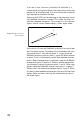
Specifications


81
Notice that all observation sessions, except for session 6, pro-
duce 2 vectors required from the network design. Observation
6 produces only one since there were an odd number of re
-
quired vectors (19).
This completes the discussion on how to execute the observa-
tion plan.
The next question to answer is “When do we perform the ob-
servations?”
The best time to perform GPS surveys is determined by an ex-
amination of the GPS satellite constellation at your location
for a given time of day. The number of visible GPS satellites
and the distribution of the satellites in the sky are important
factors impacting the observation time required to produce
quality GPS vectors.
Times when the number of visible GPS satellites is low or the
satellite distribution is poor will require extended data collec-
tion periods to ensure quality results. In rare instances, avail-
ability and distribution may be so poor that you are better off
not performing your survey during these periods.
Included in the GNSS Solutions processing software package
is a module called Mission Planning. The Mission Planning
software provides you with the tools to examine the GPS sat
-
ellite constellation. Using satellite almanac information,
which predicts the location of the GPS satellites into the fu-
ture, you can examine satellite availability and distribution for
the day(s) when you wish to perform your survey to isolate any
time periods were observation times may need to be extended
or periods where it is best not to collect data.