
Specifications


68
Click on the button to access the list of points available
from the open job.
Click OK after selecting a point from the list. A new screen
then appears asking you to enter the true coordinates of the
point. There are three different methods for entering these co
-
ordinates (see screen opposite):
1. They can be read from the rover receiver. In this case, the
rover should be positioned over the concerned control
point.
2. They can be entered manually (WGS84 coordinates).
3. They can be loaded from the results of a point that was
logged earlier during the same job.
If you choose to use the coordinates computed by the
ProMark3 RTK, then FAST Survey will ask you to indicate the
number of measurement samples required before the receiver
outputs the coordinates measured for the point (see screen
opposite).
Click OK to enable the result of that computation. FAST Sur-
vey then takes you back to the screen showing the points list.
Resume the previous steps until the coordinates of all the con-
trol points involved in the localization process have been de-
termined.
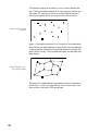
On the points list screen (see screen example opposite), check
the amount of residual for each control point involved in the
localization. The lower these values, the better the consisten-
cy of your control point network.
Should some residuals be abnormally high, the relevant
point(s) should be deleted using the Delete button, or removed
from the localization process using the On/Off button.
Warning! At least 3 points are required to compute residuals
in a horizontal system, and at least 4 points in a horizontal +
vertical system.
The On/Off button gives access to a menu allowing you to en-
able/disable the selected control point for the horizontal con-
trol process, for the vertical control process, or for both (see
screen opposite).
The localization parameters can be saved as a *.DAT file for
further use. Click on the Save button to do this.
To quit the localization function, click on the OK button.