
Specifications


234
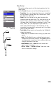
Select Map
This option is mainly used to choose the background maps
(vector map and/or raster map) that ProMark3 will display
on the Map screen. The following parameters can be set
on the Change Map screen:
- Basemap: Only the Default Map option can be selected
in this field. The default map – an American or Euro-
pean map – is always present in ProMark3.
- Detail Map: Select the desired vector map from the list
attached to this field.
Vector maps are IMI files downloaded into the unit
using GNSS Solutions (see Uploading a Vector Back-
ground Map on page 179) or MobileMapper Office
(see Uploading a Vector Background Map on
page 185). Only one vector map can be displayed at a
time.
The list attached to the Detail Map field includes IMI
files from both the internal memory and the SD card,
whatever the storage setting.
If you did not upload any vector map to ProMark3,
then Empty is the only option available for this field.
The extent of a vector map is usually limited to the
extent of the area you are working in.
- Raster Map: Select the desired raster map from the list
attached to this field.
Raster maps are TIF files downloaded into the unit
using GNSS Solutions (see
Uploading a Vector Back-
ground Map on page 179) or MobileMapper Office
(see Uploading a Vector Background Map on
page 185). Only one raster map can be displayed at a
time.
The list attached to the Raster Map field includes TIF
files from both the internal memory and the SD card,
whatever the storage setting.
If you did not upload any raster map to ProMark3, then
Empty is the only option available for this field.
After choosing the desired options for these parameters,
tap Save.
Maps are arranged as follows on the Map screen: raster
map at the front, basemap at the back, vector map in
between.