
Specifications


182
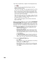
On the map screen, uploaded control points (Ctrl) will appear
as small yellow triangles whereas uploaded waypoints (Wpt),
as well as those created with the internal Mark function, will
appear as yellow squares (see opposite). Note that any upload
-
ed control point is also available as a waypoint and so can be
selected from the list of user waypoints.
NOTE: Control points logged during a post-processing survey
performed in Static or Stop&Go mode will be represented on
the map screen as black rhombs (see opposite).
The names of the uploaded points will be truncated to 4 char-
acters for control points and 8 characters for waypoints. Con-
sequently, make sure the points you select will keep different
names after truncation or rename those points that would oth
-
erwise have similar names after truncation.
Assuming the ProMark3 unit is connected to the PC via USB
(or RS232), it has been turned on and you have double-
tapped the Surveying icon, do the following on PC side:
- Launch GNSS Solutions and then open the project con-
taining the control, reference and target points you want
to upload to ProMark3.
- Select the points you want to upload (select them on the
Survey View or on the Points tab in the workbook).
- In the Command pane on the left, click the Export topic
bar and then the Upload Positions to External Device icon. In
the new dialog that opens (see below), select one of the
following two options:
• Points (as wpts & ctrl pts) if the uploaded points will be
used for RTK initialization, base position or stakeout
points (and possibly navigation).
• Points (as wpts only) if the uploaded points will be used
for navigation only.
Ctrl Wpt
Ctrl