
Specifications


179
Uploading a Vector Background Map
Background maps are imported into GNSS Solutions projects
either from DXF, SHP or MIF files (for vector maps) or BMP,
JPG, JPEG2000 or non-compressed TIFF files (for raster
maps).
You can upload a combination of several vector maps and sev-
eral raster maps through a single upload operation.
Raster maps will keep their original names (truncated to 8
characters if necessary) throughout the upload procedure.
Unlike raster maps, vector maps will need to be renamed be-
fore running the upload procedure. If you want to upload sev-
eral vector maps at the same time, then GNSS Solutions will
merge them into a single vector map and will name it with the
name you provide.
Before uploading background maps, choose the storage medi-
um on ProMark3 where you would like the background maps
to be stored.
Map files stored in the ProMark3 will be overwritten without
notice if you upload new maps with the same name.
Assuming the ProMark3 unit is connected to the PC via the
USB cable, it has been turned on and you have double-tapped
the Surveying icon, do the following on PC side:
- Launch GNSS Solutions and then open the project con-
taining the background maps you want to upload to
ProMark3.
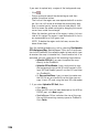
- In the Command pane on the left, click the Map topic bar
and then the Upload Maps to External Device icon. GNSS
Solutions then automatically detects the presence of the
ProMark3 on the USB port and also lists the project maps
present in the open GNSS Solutions project (see screen
below left).