
Specifications


86
For the same reason, GPS cannot be used in tunnels or under
water. Other objects such as trees will partially obstruct or re-
flect/refract the signal; reception of GPS signals is thus very
difficult in a heavily forested area.
In some cases, enough signal can be observed to compute a
rough position. But in virtually every case, the signal is not
clean enough to produce centimeter-level positions. There-
fore, GPS is not effective in the forest.
This is not to say that your ProMark3 surveying system can
only be used in areas with wide-open view of the sky. GPS can
be used effectively and accurately in partially obstructed ar
-
eas. The trick is to be able to observe, at any given time,
enough satellites to accurately and reliably compute a posi
-
tion.
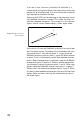
At any given time and location, 7-10 GPS satellites may be
visible and available for use. The GPS system does not require
this many satellites to function. Accurate and reliable posi-
tions can be determined with 5 satellites properly distributed
throughout the sky. Therefore, an obstructed location can be
surveyed if at least 5 satellites can be observed. This makes
GPS use possible along a tree line or against the face of a
building but only if that location leaves enough of the sky open
to allow the system to observe at least 5 satellites.
For the above reasons, make every effort to locate new points
to be established in areas where obstructions are at a mini-
mum. Unfortunately, the site location is not always flexible.