User Manual

Marine Systems
Aviation Recorders
Page 4--11
Initial Issue165M1161--00
Aug. 23/10
4.3.3. Set th e Latitud e and Longitude
The latitude/longitude feature tells the system where the AIS AtoN is supposed to be
located, according to international charts. The AIS AtoN compares the latitude and
longitude information with GPS data to determine whether or not the unit has drifted
from its charted position. When the unit is off -- position, Message 21 indicates an
“off-- position” status.
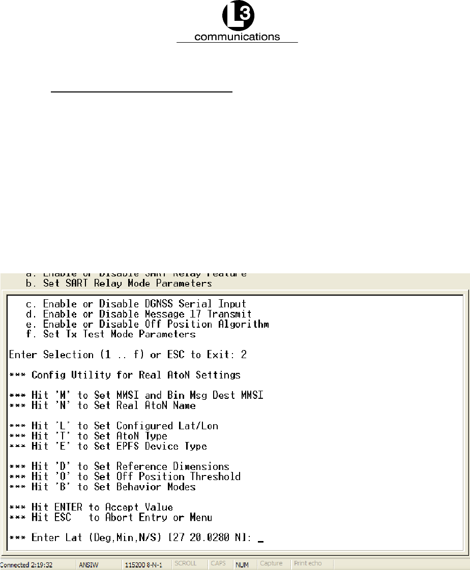
To set the latitude, enter “2” in the “System Configuration Menu,” followed by “L” in
the AtoN Configuration Menu, and the “Latitude” option appears, as shown in
Figure 4--7. Enter the “Degrees” and “Minutes” and press “Enter.” When the “Longit-
ude” option appears (Figure 4--8), type in the “Degrees” and “Minutes” and press
“Enter,” then press “ESC” to return to the System Configuration Menu.”
Figure 4--7. Set the Latitude


