
Operation Manual


16 User Manual
♦ Photos & Diagrams (high definition pictures of ports, piers, bridge
diagrams and nav-aids)
♦ Multilanguage Support (displays charts in the local character set)
♦ True-Type Font (improves text on chart for optimal reading)
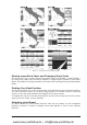
Presentation Features
♦ Clear View (advanced legibility techniques providing more chart data
on the screen)
♦ Clear Info (sophisticated "Human Dictionary" to translate Nav-Aid ab-
breviations found on paper charts)
♦ Dynamic Nav-Aids (an innovative and dynamic presentation mode)
♦ Flexi-Zoom (increased Under and Over Zoom between chart levels,
resulting in optimal scale display for any situation)
♦ Dynamic Elevation Data (optimized palettes including the NOAA color
palette)
♦ Perspective View ("Real World" perspective view of the chart, up-
dated real-time during navigation)
♦ Smooth-Zoom (smooth transition of cartographic levels)
♦ Enhanced Turbo-Zoom (extra fast cartography level change display-
ing the most important cartographic objects)
♦ Enhanced Mixing Levels (seamless data presentation)
♦ Off-line redraw (cartography level transition without image
construction)
Cartographic Data related Features
♦ Guardian Alarm (automatic control and alarm over obstacles on charts
in front of your boat)
♦ Safety Toolbar (interactive alarm system for situational awareness on
screen)
♦ Safety Route Check (sophisticated function checking dangerous ob-
jects along your navigation route)
MAX and NT/NT
+
C-CARD coexistence
♦ When NT
+
data and MAX data cover different areas, the chart plotter
gets data from both charts (depending on the current position).
♦ When NT
+
data and MAX data cover the same area, the chart plotter
gets data only from MAX chart.
1.3 GPS
For centuries, sailors have been searching for a reliable and precise method of
travelling the world's waterways. From celestial navigating to the modern naviga-
tion techniques as Loran, Decca Navigator, Omega or Transit Satnav, each system
has had its problems with weather, range and reliability. Without doubt, the "Glo-
bal Positioning System", or GPS for short, is the most significant advance in navi-
gation: it gives the navigator a position 24 hours a day, 365 days a year in any
weather condition.
GPS is a satellite based navigation system which provides suitably equipped users
with accurate position, velocity and time data.
Originally the GPS, developed by the U.S. Department of Defence, was conceived
for military purposes, but now it is used in a host of civilian applications. To
safeguard military operations, the U.S. Department of Defence introduced an
artificial error, "Selective Availability" (SA), which causes a random position error
www.busse-yachtshop.de | info@busse-yachtshop.de