
Operation Manual


65
4.2.4 Data Fields
Adjust how the software helps you navigate with different kinds of route related information on
the Map screen.
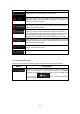
The data fields in the corner of the Map screen can be customised.
Tap this button and select the values you want to see. The values can
be different when you navigate a route from when you are just cruising
without a given destination. You can select general trip data like your
current speed or the altitude, or route data related to your final
destination or the next waypoint on your route.
4.2.5 Map settings
You can fine-tune the appearance of the Map screen. Adjust the map view to your needs,
choose suitable colour themes from the list for both daytime and night use, change the blue
arrow to a 3D car model, show or hide 3D buildings, turn track logging on or off, and manage
you Place visibility sets (which Places to show on the map).
The map is always shown on the screen so that you can see the effect when you change a
setting.
Button Description
Switch the map view between a 3D perspective view and a 2D top-
down view.
A
djust the basic zoom and tilt levels to your needs. Three levels are
available.
When selected, the map zooms out to show an overview of the
surrounding area if the next route event (manoeuvre) is far. When you
get close to the event, the normal map view returns.
Switch between daytime and night colour modes or let the software
switch between the two modes automatically a few minutes before
sunrise and a few minutes after sunset.
Select the colour scheme used in daytime mode.
Select the colour scheme used in night mode.