User Manual XZENT XT9026BT Navigation software for the XZENT XT9026BT UK English December 2011, ver. 1.2.
Thank you for choosing the XZENT XT9026BT as your navigator. Start using XZENT XT9026BT right away. This document is the detailed description of the navigation software. You can easily discover XZENT XT9026BT while you are using it; however, we still recommend that you read this manual to fully understand the screens and features.
Table of contents 1 Warnings and Safety information .........................................................................5 2 Getting started .........................................................................................................6 2.1 Buttons and other controls on the screen ....................................................................... 7 2.1.1 Using keyboards .................................................................................................................. 8 2.
3.1.5 Selecting one of the most likely destinations (Smart History) ........................................... 43 3.1.6 Selecting a recent destination from the History ................................................................. 44 3.1.7 Entering the coordinate of the destination ......................................................................... 45 3.1.8 Building a route from the list of destinations (Create Route) ............................................ 46 3.
1 Warnings and Safety information The navigation system helps you find your way to your destination with the built-in GPS receiver. XZENT XT9026BT does not transmit your GPS position; others cannot track you. It is important that you look at the display only when it is safe to do so. If you are the driver of the vehicle, we recommend that you operate XZENT XT9026BT before you start your journey. Plan the route before your departure and stop if you need to change the route.
2 Getting started XZENT XT9026BT is optimised for in-car use. You can use it easily by tapping the screen buttons and the map with your fingertips. When using the navigation software for the first time, an initial setup process starts automatically. Do as follows: 1. The language of the application is taken from the language settings of XZENT XT9026BT. You do not need to select the language. 2. Read the End User Licence Agreement. Tap 3. The Configuration wizard starts. Tap 4.
2.1 Buttons and other controls on the screen When you are using XZENT XT9026BT, you usually tap buttons on the touch screen. You only need to confirm selections or changes if the application needs to restart, it needs to perform a major reconfiguration, or you are about to lose some of your data or settings. Otherwise, XZENT XT9026BT saves your selections and applies the new settings without confirmation as soon as you use the controls.
When a feature can be set to different values in a range, XZENT XT9026BT shows an indicator on a gauge that displays and sets the value. Slider • Drag the handle to move the slider to its new position. • Tap the slider where you want the handle to appear; the thumb jumps there. Each key is a touch Alphabetic and alphanumeric keyboards screen button. to enter text and numbers. Virtual keyboard 2.1.1 Using keyboards You only need to enter letters or numbers when you cannot avoid it.
Finalising the keyboard entry (saving your input) Cancelling the keyboard entry (returning to the previous screen) Tap . Tap . 2.1.2 Beyond single screen tap You usually need to tap the screen only once. However, some useful features can be accessed with combined touch screen tapping. Those are the following: Action Tapping and holding the screen Details Tap and keep pressing the following buttons to reach extra functions: • Tap and hold the Map screen appears.
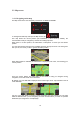
2.2 Map screen 2.2.1 Navigating on the map The Map screen is the most frequently used screen of XZENT XT9026BT. To enlarge this small map and open the Map screen, tap . This map shows the current position (the Vehimarker, a blue arrow by default), the recommended route (an orange line), and the surrounding map area. When there is no GPS position, the Vehimarker is transparent. It shows your last known position. You see coloured dots circling around a satellite symbol in the top left corner.
Default data fields when cruising without a destination (tap and hold any of the fields to change its value): Field Description Shows your current speed given by the GPS receiver. Shows the speed limit of the current road if the map contains it. Shows the current time corrected with time zone offset. The accurate time comes from the GPS satellites, and the time zone information comes from the map. (The current time is always displayed in the top left corner of menu screens.
2.2.2 Position markers 2.2.2.1 Vehimarker and Lock-on-Road When your GPS position is available, XZENT XT9026BT marks your current position with the Vehimarker. By default, this marker is a blue arrow, but you can change this icon in Settings. The Vehimarker may not show your exact GPS position and heading. If roads are near, it is aligned to the nearest road to suppress GPS position errors, and the direction of the icon is aligned to the direction of the road. 2.2.2.
There is a field in the top left corner that displays the next manoeuvre. Both the type of the event (turn, roundabout, exiting motorway, etc.) and its distance from the current position are displayed. A smaller icon shows the type of the second next manoeuvre if it is near the first one. Otherwise, only the next manoeuvre is displayed. Most of these icons are very intuitive. The following table lists some of the frequently shown route events.
2.2.3.3 Lane information and Signposts When navigating on multilane roads, it is important to take the appropriate lane in order to follow the recommended route. If lane information is available in the map data, XZENT XT9026BT displays the lanes and their directions using small arrows at the bottom of the map. Highlighted arrows represent the lanes you need to take. Where additional information is available, signposts substitute arrows. Signposts are displayed at the top of the map.
Tap any of them to display it on the map and add it as a waypoint to your route if needed. 2.2.3.6 3D object types XZENT XT9026BT supports the following 3D object types: Type Description 3D terrain 3D terrain map data shows changes in terrain, elevations or depressions in the land when you view the map in 2D, and use it to plot the route map in 3D when you navigate. Hills and mountains are shown in the background of the 3D map, and illustrated by colour and shading on the 2D map.
Streets and roads that are You can choose whether you want to use or avoid excluded from the navigation certain road types (page 1). However, when XZENT XT9026BT cannot avoid such roads, the route will include them and it will show them in a colour that is different from the route colour. Streets and roads that are affected by traffic events Road segments may be affected by traffic events received.
2.2.4 Manipulating the map Tap the map anywhere to browse it during navigation. The map stops following the current position (the Vehimarker, a blue arrow by default, is not locked in a fix position on the screen any more) and control buttons appear to help you modify the map view. Action Moving the map with drag&drop Button(s) No buttons Zooming in and out , Description You can move the map in any direction: tap and hold the map, and move your finger towards the direction you want to move the map.
Compass in 3D map view mode , The direction of the compass shows North. Tap the button to switch to North-up view, and then tap again to rotate the map in the previous direction. Location information Tap this button to open a new screen with information about the selected map point, the Cursor. Return to normal navigation Tap this button to move the map back to follow the current GPS position. Automatic map rotation is also re-enabled. The map manipulation buttons disappear and navigation continues.
This button opens the list of your Favourite destinations. This button opens the route editing function. This button opens the route related settings. This button opens the map related settings.
• button. Open the Quick menu and tap the Information on this screen: • , format). • : Altitude (elevation information coming from the GPS receiver - often inaccurate). : Latitude and Longitude (coordinate of the current position in WGS84 • : House number on the left. • : House number on the right. • In the middle of the screen you can see whether the position is current, or the time left since it was last updated.
2.3 Navigation menu You can reach all parts of XZENT XT9026BT from the Navigation menu. You have the following options: • Tap to select your destination by entering an address or selecting a place of interest, a location on the map or one of your Favourite destinations. You can also look up your recent destinations from the Smart History or enter a coordinate. • to display the route parameters and the route in its full length Tap on the map.
3 Navigating You can set up your route in different ways: • If you need a route for immediate navigation, you can select the destination and start navigating to it right away (normal navigation). • You can also plan a route independently of your current GPS position or even without GPS reception (to achieve this, you need to turn off the GPS receiver and set a new starting point in My Route / Edit Route by tapping the flag icon at the current position). You can plan routes with multiple destinations.
3.1.1.1 Entering an address To enter an address as the destination, do as follows: 1. If you are on the Map screen, tap menu. 2. In the Navigation menu, tap the following buttons: to return to the Navigation , . 3. By default, XZENT XT9026BT proposes the country and city/town where you are. If needed, tap , enter the first few letters of the country name on the keyboard, and select one country from the list of results. 4. If needed, select a new city/town: a. Tap b.
• The most likely street name is always shown in the input field. To accept it, tap • . If the desired name does not show up, the names that match the string appear in a list after entering a couple of characters (to open the list of results before it appears automatically, tap the street from the list. 6. 7. ). Select Enter the house number: a. Tap b. Enter the house number on the keyboard. (To enter letters, tap c. Tap to finish entering the address.
Tip! If you know that you will use this destination frequently, before tapping to confirm the destination, put it on the list of your Favourites first: tap then , give a name for the new Favourite, and tap to save the location. The map with the destination returns automatically. Now you can start your journey. 3.1.1.2 Entering the midpoint of a street as the destination You can navigate to the midpoint of a street if the house number is not available: 1. If you are on the Map screen, tap menu. 2.
. The midpoint of the 5. Instead of entering the house number, tap street is selected as the destination. 6. A full screen map appears with the selected point in the middle. If necessary, tap the map somewhere else to modify the destination. The Cursor ( new location. Tap ) appears at the to confirm the destination, or tap to select a different destination. 7. After a short summary of the route parameters, the map appears showing the entire route. The route is automatically calculated.
• The most likely street name is always shown in the input field. To accept it, tap • . If the desired name does not show up, the names that match the string appear in a list after entering a couple of characters (to open the list of results before it appears automatically, tap the street from the list. 5. Enter the intersecting street name: 1. 6. ). Select Tap . • If only a few intersecting streets exist, their list appears immediately.
3.1.1.4 Selecting a city/town centre as the destination The city/town centre is not the geometric centre of the city/town but an arbitrary point the map creators have chosen. In towns and villages, it is usually the most important intersection; in larger cities, it is one of the important intersections. to return to the Navigation 1. If you are on the Map screen, tap menu. 2. In the Navigation menu, tap the following buttons: , . 3. If necessary, modify the country as described earlier (page 25). 4.
to confirm the destination, or tap new location. Tap to select a different destination. 7. After a short summary of the route parameters, the map appears showing the entire route. The route is automatically calculated. Tap parameters, or tap to modify route and start your journey. 3.1.1.5 Entering an address with a postal code All of the above address searching possibilities can be performed with entering the postal code instead of the city/town name.
5. Enter the street name: a. Tap b. Start entering the street name on the keyboard. c. Find the street you need: • . The most likely street name is always shown in the input field. To accept it, tap • . If the desired name does not show up, the names that match the string appear in a list after entering a couple of characters (to open the list of results before it appears automatically, tap the street from the list. 6. 7. ). Select Enter the house number: a. Tap b.
to confirm the destination, or tap new location. Tap to select a different destination. 8. After a short summary of the route parameters, the map appears showing the entire route. The route is automatically calculated. Tap parameters, or tap to modify route and start your journey. 3.1.1.6 Tips on entering addresses quickly • When you are entering the name of a city/town or a street: • Only those letters are offered on the keyboard that appear in possible search results.
3.1.2 Selecting the destination from the Places of Interest You can select your destination from the Places of Interest included with XZENT XT9026BT.
4. (optional) The Places in the list are ordered by the length of the necessary detour (when navigating a route) or by their distance from the current position (when no . destination is given). If you need to reorder the list, tap 5. Browse the list if necessary and tap one of the list items. A full screen map appears with the selected point in the middle. The name and address of the Place is displayed at the top of the screen. 6. (optional) Tap to see the details of the selected Place.
• If an active route exists, petrol stations are searched along the route. • If there is no active route (destination is not selected), they are searched around the current position. • If the current position is not available either (no GPS signal), they are searched around the last known position. • : • If an active route exists, parking lots are searched around the destination of the route.
8. If necessary, tap the map somewhere else to modify the destination. The Cursor ( ) appears at the new location. Tap destination, or tap 9. to confirm the to select a different destination. After a short summary of the route parameters, the map appears showing the entire route. The route is automatically calculated. Tap parameters, or tap to modify route and start your journey. 3.1.2.
restaurants. (The result list will be ordered by the length of the necessary detour.) 5. (optional) If you have selected 6. Select one of the main Place categories (e.g. Accommodation) or tap , select the city/town to search in. to list all Places around the selected location or along the route. 7. Select one of the Place subcategories (e.g. Hotel or Motel) or tap to list all Places in the selected main category around the selected location or along the route. 8.
10. (optional) The Places in the list are ordered by their distance from the current or last known position, from the selected city/town, from the destination or by the length of the necessary detour. If you need to reorder the list, tap . 11. Browse the list if necessary and tap one of the list items. A full screen map appears with the selected point in the middle. The name and address of the Place is displayed at the top of the screen. 12. (optional) Tap to see the details of the selected Place.
4. Select the area around which the Place should be searched for: • to search around the current position or if it is not Tap available, around the last know position. (The result list will be ordered by the distance from this position.) • to search for a place within a selected city/town. (The Tap result list will be ordered by the distance from the centre of the selected city/town.) • to search for a place around the destination of the Tap active route.
8. Tap 9. Using the keyboard, start entering the name of the Place. if you have not done it before. 10. After entering a few letters, tap to open the list of Places with names containing the entered character sequence. 11. (optional) The Places in the list are ordered by their distance from the current or last known position, from the selected city/town, from the destination or by the length of the necessary detour. If you need to reorder the list, tap . 12.
15. After a short summary of the route parameters, the map appears showing the entire route. The route is automatically calculated. Tap parameters, or tap to modify route and start your journey. 3.1.2.5 Selecting nearby assistance from 'Where Am I?' You can quickly search for nearby assistance from the 'Where Am I?' screen. 1. On the Map screen, tap 2. Tap 3.
5. (optional) The Places in the list are ordered by their distance from the current or last known position, from the selected city/town, from the destination or by the length of the necessary detour. If you need to reorder the list, tap . 6. Browse the list if necessary and tap one of the list items. A full screen map appears with the selected point in the middle. The name and address of the Place is displayed at the top of the screen. 7. (optional) Tap to see the details of the selected Place.
4. Tap the location that you want to select as your destination. The Cursor ( appears. 5. Tap 6. After a short summary of the route parameters, the map appears showing the entire ) to select the Cursor as the destination. route. The route is automatically calculated. Tap parameters, or tap to modify route and start your journey. 3.1.4 Selecting the destination from your Favourites You can select a location that you have already saved as a Favourite to be your destination.
3. Tap the Favourite that you want to set as your destination. If necessary, browse down to see more of the list or tap name of the Favourite destination. 4. and enter a few letters from the A full screen map appears with the selected point in the middle. If necessary, tap the map somewhere else to modify the destination. The Cursor ( new location. Tap ) appears at the to confirm the destination, or tap to select a different destination. 5.
to confirm the destination, or tap new location. Tap to select a different destination. 5. After a short summary of the route parameters, the map appears showing the entire route. The route is automatically calculated. Tap parameters, or tap to modify route and start your journey. 3.1.6 Selecting a recent destination from the History The destinations that you have set earlier appear in the History. 1. Access the History: • If you are in the Navigation menu, tap and then tap . 2.
5. After a short summary of the route parameters, the map appears showing the entire route. The route is automatically calculated. Tap parameters, or tap to modify route and start your journey. 3.1.7 Entering the coordinate of the destination You can also select a destination by entering its coordinate. Do as follows: 1. If you are on the Map screen, tap menu. 2. In the Navigation menu, tap 3. Tap 4.
to confirm the destination, or tap new location. Tap to select a different destination. 8. After a short summary of the route parameters, the map appears showing the entire route. The route is automatically calculated. Tap parameters, or tap to modify route and start your journey. 3.1.8 Building a route from the list of destinations (Create Route) You can also build your route destination by destination from the My Route menu. 1. If you are on the Map screen, tap menu. 2.
8. To add more destinations, tap where you want to insert the new route point in the list, and repeat the above procedure. 3.2 Viewing the entire route on the map It is easy to get a map overview of the active route. Do as follows: 1. If you are on the Map screen, tap menu. 2. In the Navigation menu, tap 3. Tap . The active route is displayed in its full length on the map together with additional information and controls. to return to the Navigation . 3.
• Tap to display the entire route on the map. • Tap to bypass a part of the route. • Tap to delete the active route. • Tap to open a list with more options like selecting from route alternatives, changing route parameters. • Tap to return to the Navigation menu. 3.4 Modifying the route When navigation is already started, there are several ways to modify the active route. The following sections show some of those options. 3.4.
3.4.2 Setting a new starting position for the route For normal navigation, all routes are planned from the current position. In order to check future routes, simulate them or see their length in time and distance, you can turn off the GPS receiver. Then you can set the starting point of the route to a different location than the current GPS position. 1. If you are on the Map screen, tap menu. 2. In the Navigation menu, tap 3. If you already have a route, tap tap to return to the Navigation . .
3.4.3 Editing the list of destinations (Edit Route) You can edit the route by modifying the list of destinations. You can add or remove destinations, modify the start position or reorder the list. 1. If you are on the Map screen, tap menu. 2. In the Navigation menu, tap 3. Tap 4. You have the following options: to return to the Navigation . . • Tap to add a new destination. • Tap to delete a destination. • Tap to reorder the list.
3.4.4 Pausing the active route You do not need to pause the active route: when you start driving again, XZENT XT9026BT restarts the voice instructions from your position. 3.4.5 Cancelling the active route To cancel the navigated route, do one of the following: • If you are on the Map screen, tap with waypoints, you need to tap • and then tap . (If you have a route until all waypoints are deleted.) In the Navigation menu, tap and then tap The active route is deleted with all its waypoints. .. 3.4.
5. Or if you cannot find a good alternative, tap routes with different routing methods. 6. Select one of the route alternatives and tap to return to the previous screen. XZENT XT9026BT recalculates the route. The orange line now shows the new recommended route. and scroll down for 3.4.7 Checking route alternatives for an existing route To recalculate the active route with a different route planning method, you can modify the Route settings (page 61).
5. You see the basic details of three route alternatives with the selected route planning method. Tap any of them to see it on the map. 6. Or if you cannot find a good alternative, tap routes with different routing methods. 7. Select one of the route alternatives then tap and hold for a few seconds to return to the Map screen. XZENT XT9026BT recalculates the route. The orange line now shows the new recommended route. and scroll down for 3.4.
3. • - XZENT XT9026BT includes toll roads (pay roads where there is a per-use charge) in the routes by default. If you disable toll roads, XZENT XT9026BT plans the best toll-free route. • - XZENT XT9026BT includes ferries in a planned route by default. However, a map does not necessarily contain information about the accessibility of temporary ferries. You might also need to pay a fare on ferries.
4 Reference Guide On the following pages you will find the description of the different concepts and menu screens of XZENT XT9026BT. 4.1 Concepts 4.1.1 Smart Zoom Smart Zoom provides much more than just a usual automatic zoom feature: • While following a route: when approaching a turn, it will zoom in and raise the view angle to let you easily recognise your manoeuvre at the next junction.
emission calculations are estimations only. They cannot take elevations, curves and traffic conditions into account. • • : Results in a route with fewer turns and no difficult manoeuvres. With this option, you can make XZENT XT9026BT to take, for example, the motorway instead of a series of smaller roads or streets. Road types used or avoided in route calculation: • • • • • Real-time Traffic events are also taken into account and sometimes greatly modify the route.
If the selected route planning method is not Green, and you have allowed the application to show the green alternative, the price, fuel consumption and CO2 emission differences between your selected route and the Green route are also shown on this screen: Tap the field with these details to switch the route to Green immediately. 4.1.
4.1.6 Speed limit warning Maps may contain information about the speed limits of the road segments. XZENT XT9026BT is able to warn you if you exceed the current limit. This information may not be available for your region (ask your local dealer), or may not be fully correct for all roads in the map. Speed warning can be fine-tuned in Sound and Warning settings (page 61). You can set the relative speed above which the application initiates the warning.
4.1.8 Traffic information in route planning The recommended route is not always the same between two points. Real-time traffic information can help you avoid current traffic events like temporary road closures or a traffic jam caused by an accident. The function is subject to data availability. You can display the live traffic information on the map if you browse the map and select this option from the More menu. A 2D map is displayed with road segments coloured by the severity of traffic events.
to open the Traffic Summary screen: Tap to open the list of traffic events: Tap Now tap any of the list items to see its details, and to display the affected road segment in its full length on the map: Note! If there are traffic events on the recommended route that the application has not bypassed, the icon will open the list of significant traffic events to let you quickly check them. 4.2 Settings menu You can configure the program settings, and modify the behaviour of XZENT XT9026BT.
Button Description Enable different sounds and alerts in the application. The recommended route is not always the same between two points. Whenever suitable data exists, traffic information can be taken into account in the route calculation. These settings determine how routes will be calculated. Select the type of vehicle you are driving, the road types used in route planning, and the route planning method. You can fine-tune the appearance of the Map screen.
Maps may contain information about the speed limits of the road segments. XZENT XT9026BT is able to warn you if you exceed the current limit. This information may not be available for your region (ask your local dealer), or may not be fully correct for all roads in the map. This setting lets you decide whether you wish to receive visible and/or audible warnings. Adjust the slider to set the relative speed above which the application initiates the warning.
4.2.2 Traffic settings The recommended route is not always the same between two points. Whenever suitable data exists, traffic information can be taken into account in the route calculation. Button Description Use this switch to enable or disable the TMC receiver that can receive real-time traffic information. The rest of the buttons below are all related to the TMC function and are available only if the receiver is enabled.
Button Description You might need to avoid motorways when you are driving a slow car or you are towing another vehicle. Charge roads are pay roads where you can purchase a pass or vignette to use the road for a longer period of time. They can be enabled or disabled separately from toll roads. XZENT XT9026BT includes toll roads (pay roads where there is a per-use charge) in the routes by default. If you disable toll roads, XZENT XT9026BT plans the best toll-free route.
4.2.4 Data Fields Adjust how the software helps you navigate with different kinds of route related information on the Map screen. The data fields in the corner of the Map screen can be customised. Tap this button and select the values you want to see. The values can be different when you navigate a route from when you are just cruising without a given destination.
Replace the default position marker to one of the 3D vehicle models. You can select separate icons for different vehicle types selected for route planning. Separate icons can be used for car, pedestrian and the other vehicles. Show or suppress 3D landmarks, 3D artistic or block representations of prominent or well-known objects. Show or suppress 3D city models, 3D artistic or block representation of full city building data containing actual building size and position on the map.
5 Glossary 2D/3D GPS reception The GPS receiver uses satellite signals to calculate its (your) position and needs at least four signals to give a three-dimensional position, including elevation. Because the satellites are moving and because objects can block the signals, your GPS device might not receive four signals.
North-up map orientation In North-up mode the map is rotated so its top always faces North. This is the orientation for example in Find on Map. Road Safety Camera Special alert points for speed, red light or bus lane cameras. Different data sources are available. You can configure XZENT XT9026BT to warn you when you approach one of these cameras. Detecting the location of Road Safety Cameras is prohibited in certain countries.
6 Copyright note The product and the information contained herein are subject to change without prior notification. This manual may not, in whole or in part, be reproduced or transmitted in any form either electronically or mechanically, including photocopying and recording, without the express written consent of ZENEC. © 2011 - ZENEC Data Source © 2006-2010 Tele Atlas. All rights reserved.