
User Manual
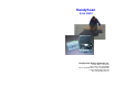
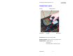
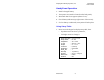

Table Of Contents
Geophysical Survey Systems, Inc. HandyScan
User's Guide
MN70-416 1
Introduction
HandyScan is a small-size, fully functional ground penetrating
radar. It can instantly find the position and depth of metal and non-
metal bars, pipes and cables. It works in natural and man-made
non-conductive materials (concrete, rock, sand, brick, water, and
ice). It can also locate voids and measure the thickness floors and
other structural elements.
HandyScan allows the user to:
•
Collect
single lines of data (page 4) or grid data for
plan viewing (page 8).
•
Review
data on screen, determine position and depth of
features (page 5).
•
Print
data on the Seiko DPU-3445-20 printer supplied with the
system (page 6).
•
Transfer
data to a PC in GSSI (*.dzt) format for storage and
processing in RADAN software (page 7).
•
Display
plan views (Depth Slices) of grid data on a PC screen
(page 9).
Specifications
Survey depth
20-30 cm
Max survey length
15 m
Size
21 x 15 x 14.5 cm
Weight
2.4 lbs
Display
LCD, B&W w/back lighting
Battery
life
2 hours