
User Manual

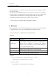
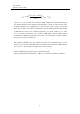
Table Of Contents

User’s Manual
Version 1.0, Nov. 2022
7
7.2 GeoTIFF conversion with the external tool
The output HDF5 files of this tool can be converted into GeoTIFF format files with the
external tool "Map projection & GeoTIFF conversion Tool."
A sample shell script in the Bash at Linux OS that implements the procedure is as
follows:
#------------------------------------------------------------
#!/bin/bash
#set the input file and output directory
file="GC1SG1_20220627D01D_T0427_L2SG_LTOAQ_2012.h5"
outdir="./output"
#run the "RSP Path Detection in L2 Tile Tool"
/(exedir)/SGLI_t2p_linux.exe $file -o $outdir
#omit the extension of the input filename
file1=`basename $file .h5`
#run the "Map projection & GeoTIFF conversion Tool"
#for all output files from the "RSP Path Detection in L2 Tile Tool"
for f in ${outdir}/${file1}_???.h5; do
/(exedir)/SGLI_geo_map_linux.exe $f -d "Image_data/Lt_VN01" -o $outdir
done
#------------------------------------------------------------
For Windows OS, the procedure can be implemented in the standard scripting
language such as the PowerShell.