
User manual
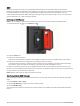
Table Of Contents
- Table of Contents
- Introduction
- inReach Features
- Viewing the Main Pages
- Connected Features
- Navigation
- Where To? Page
- Waypoints
- Saving Your Current Location as a Waypoint
- Saving a Location on the Map as a Waypoint
- Navigating to a Waypoint
- Finding a Waypoint
- Editing a Waypoint
- Deleting a Waypoint
- Changing the Photo for a Waypoint
- Increasing the Accuracy of a Waypoint Location
- Projecting a Waypoint from a Saved Waypoint
- Moving a Waypoint on the Map
- Finding a Location Near a Waypoint
- Setting a Waypoint Proximity Alarm
- Adding a Waypoint to a Route
- Repositioning a Waypoint to Your Current Location
- Routes
- Recordings
- Courses
- Weather
- Main Menu Applications
- Customizing the Main Menu
- Garmin Adventures
- Setting an Alarm
- Calculating the Size of an Area
- BirdsEye Imagery
- Camera and Photos
- Dog Tracking
- Using the Flashlight
- Geocaches
- Using the inReach Remote
- Marking and Starting Navigation to a Man Overboard Location
- Selecting a Profile
- Setting a Proximity Alarm
- Satellite Page
- Sending and Receiving Data Wirelessly
- Using the VIRB Remote
- Customizing the Device
- Custom Data Fields and Dashboards
- Rotating the Screen
- Setup Menu
- System Settings
- Display Settings
- Bluetooth Settings
- Wi‑Fi Settings
- Routing Settings
- Turning On Expedition Mode
- Setting the Device Tones
- Camera Settings
- Geocaching Settings
- Wireless Sensors
- Fitness Settings
- Marine Settings
- Menu Settings
- Position Format Settings
- Changing the Units of Measure
- Time Settings
- Accessibility Settings
- Profiles
- Resetting Data and Settings
- Device Information
- Appendix
- Index

Activating the Device
WARNING
Before you can use the inReach features of your Montana 700i/750i device, you must activate it (inReach
Features, page 7).
1 Create an account, and select a satellite subscription at explore.garmin.com.
2 Turn on the device.
3 Select Next.
4 Follow the on-screen instructions.
NOTE: You must enter the device IMEI number and authorization code to complete the online portion of
activation before you go outdoors.
5 Go outdoors to an open area with a clear view of the sky, and point the antenna on the device toward the sky
for optimal performance.
6 Wait while the device communicates with the Iridium satellite network.
NOTE: It may take up to 20 minutes to activate your device. The device must send and receive several
messages, which takes longer than sending a single message during regular use. You should remain
outdoors until activation completes.
Iridium Satellite Network
Your device requires a clear view of the sky to transmit messages and track points over the Iridium satellite
network. Without a clear view of the sky, your device attempts to send the information until it acquires satellite
signals.
TIP: For the best connection with satellites, hold the device with the antenna pointed toward the sky.
Acquiring Satellite Signals
It may take 30 to 60 seconds to acquire satellite signals.
1 Go outdoors to an open area.
2 If necessary, turn on the device.
3 Wait while the device searches for satellites.
flashes while the device determines your GNSS location.
in the status bar shows the satellite signal strength.
When the device acquires satellite signals, it automatically starts recording your path as an activity.
6 Introduction