
Cockpit Reference Guide


Garmin G1000 Cockpit Reference Guide for the Beechcraft 200/B200 Series
190-00929-03 Rev. A 47
Hazard Avoidance
Flight
Instruments
Nav/Com/
XPDR/Audio AFCS GPS Nav
Flight
Planning Procedures
Hazard
Avoidance
Additional
Features Annun/Alerts Appendix Index
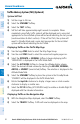
Displaying precipitation Weather information
1)
Select the MAP Softkey (for the PFD Inset Map, select the INSET Softkey).
This step is not necessary on the GFDS Weather Data Link Page.
2)
Select the PRECIP Softkey.
Radar data shown represents lowest level, base reflectivity, of radar returns. The
display of the information is color-coded to indicate the weather severity level. All
weather product legends can be viewed on the GFDS Weather Data Link Page. For
the Precipitation legend, select the LEGEND Softkey when Precipitation is selected
for display.
precipitation limitations
Radar images may have certain limitations:
• Radarbasereectivitydoesnotprovidesufcientinformationtodeterminecloud
layers or precipitation characteristics (wet hail vs. rain). For example, it is not
possible to distinguish between wet snow, wet hail, and rain.
• Radarbasereectivityissampledattheminimumantennaelevationangle.An
individual radar site cannot depict high altitude storms at close ranges. It has
no information about storms directly over the site.
• Whenzoomedintoarangeof30nm,eachsquareblockonthedisplayrepresents
an area of four square kilometers.
The following may cause abnormalities in displayed radar images:
• Groundclutter
• Strobesandspuriousradardata
• Sunstrobes(whentheradarantennapointsdirectlyatthesun)
• Interferencefrombuildingsormountains,whichmaycauseshadows
• Metallicdustfrommilitaryaircraft,whichcancausealterationsinradarscans
Infrared Satellite
Infrared Satellite (IR SAT) data depicts cloud top temperatures from satellite imagery.
Brighter cloud top colors indicate cooler temperatures occurring at higher altitudes.
Displaying clouD tops information
1)
Select the GFDS Weather Data Link Page.
2)
Select the IR SAT Softkey.
To display the Infrared Satellite legend, select the LEGEND Softkey when Infrared
Satellite data is selected for display.